The last few years a few of us have made a fun habit of heading to what I like to call The Great North (north of…Vancouver!?) for June packrafting trips and they have all worked out well: bouncing around the Talkeetna and Susitna rivers north of Anchorage, the South Fork Nahanni/Broken Skull zone north and east of Whitehorse, Yukon, and last year the “Extra Happy” trip on the Keskowin and Happy Rivers in the “hills” (decent mountains) of the Alaska Range (a big comparison). I was fortunate enough to be introduced to Great North packrafting by the inimitable Brad Mickeljohn and Roman Dial on an incredible trip to the Arctic National Wildlife Refuge (not “Anwar” – it’s better known to the likes of “us” as “The Refuge”) and doing the Alsek River in packrafts that enabled a portage of the fearsome Turnback Canyon and a cheap exit from the mouth walking back up the coast to Yakutat to avoid a flight (and have a nice walk!). This last trip was spearheaded by Tim Kelley, who has become not only a great resource for fun adventures but a great pard for me, when I can get onto his busy schedule (most recently a trip in the North Cascades).
Tim’s zest for great trips took him to the Mountain River zone a few years ago, and since we have had good luck repeating Tim’s adventures in the past and the Mountain – being the next major drainage “down” (downriver, but up on the map) the Mackenzie river from the Nahanni, we decided to give the mighty Mountain a go.
Here’s Tim’s trip report, which was a lot longer than ours; we were only doing a good chunk of the 2nd half of what for him was a monthlong trip.
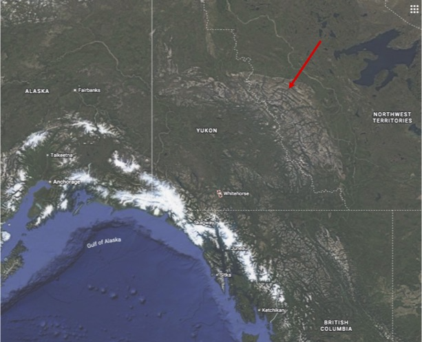
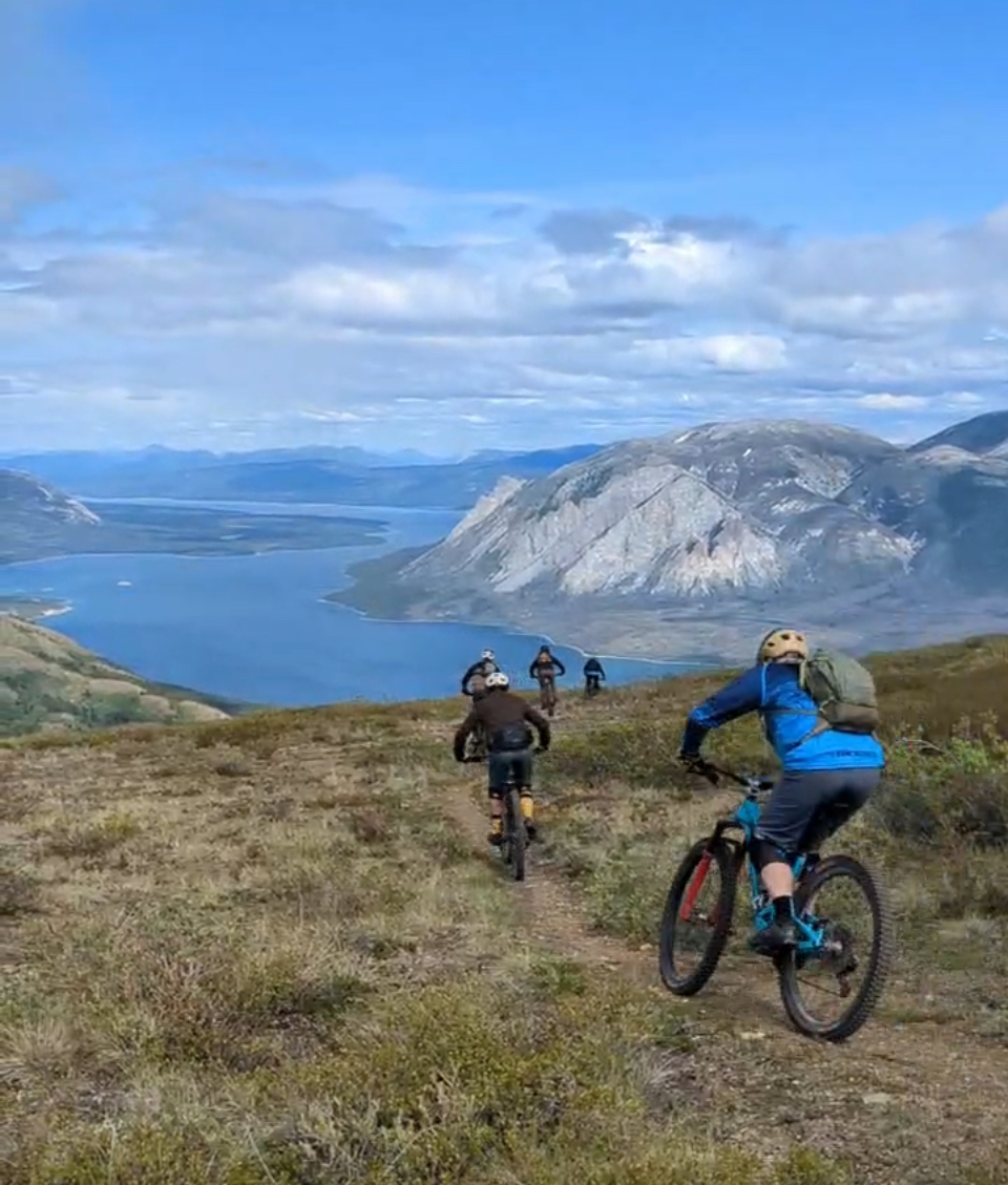
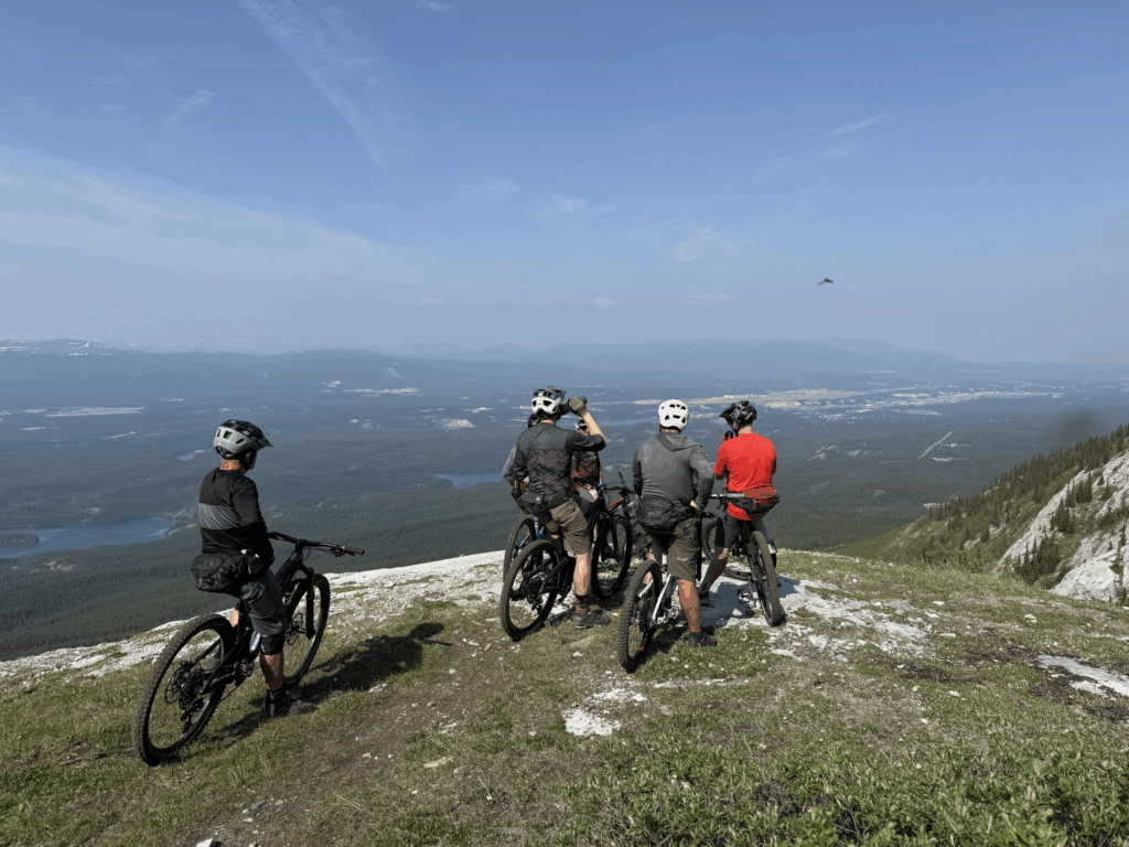
It seems that most great Great Northern adventures launch from either Anchorage or Whitehorse, and having spent some time there en route to the Nahanni we were keen to get back; Whitehorse is a great place. Whitehorse is nicknamed “The Wilderness City”, which sounds like a bit of an oxymoron, but the interesting truth is that while Canada has bazillions of square miles (kilometers, I s’pose) of wilderness with a lower case W, Canada doesn’t have Wilderness with a big W; that is, lands designated by Congress (Parliament) with formalized protections. Probably because Canada’s wilderness is indeed so vast and wild that it doesn’t need designation, it just is wilderness. They do have 46 national parks, which engage in formalized protection (and development, ala Banff and Jasper parks) but there is a lot of very wild lands that are wildernessy enough, and indeed there’s a lot around Whitehorse. But since this isn’t a big W, mountain biking is not only allowed in the outskirts of the Wilderness City, it’s renowned, so a few of us used a half of our first day of our trip noodling around on amazing singletrack just above town. Our pal Joe Hazel happened to be in town at the same time for a mountain bike trip, and I’m poaching a coupla pics from him (thanks Joe!)
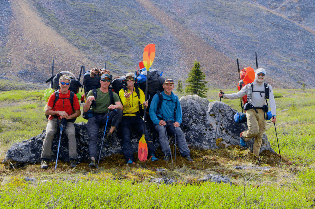
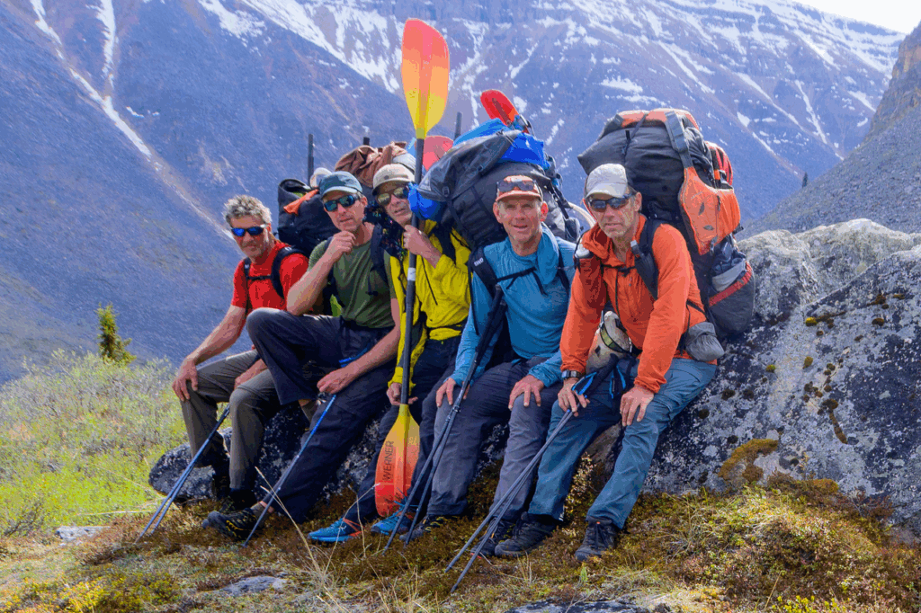
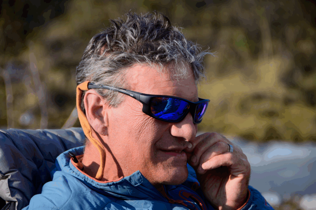
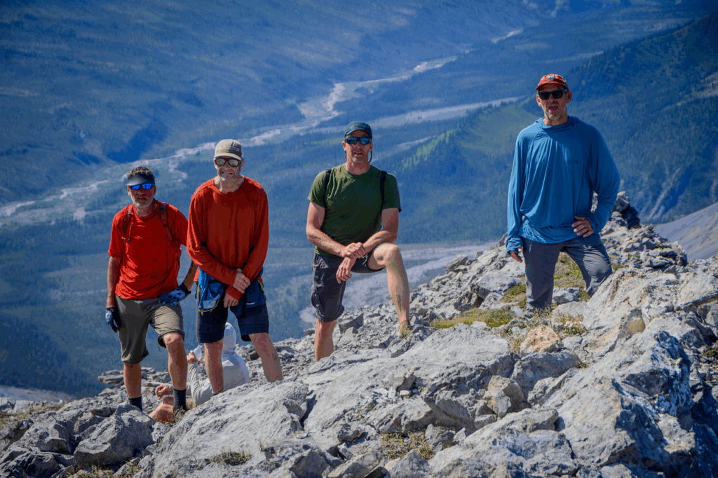
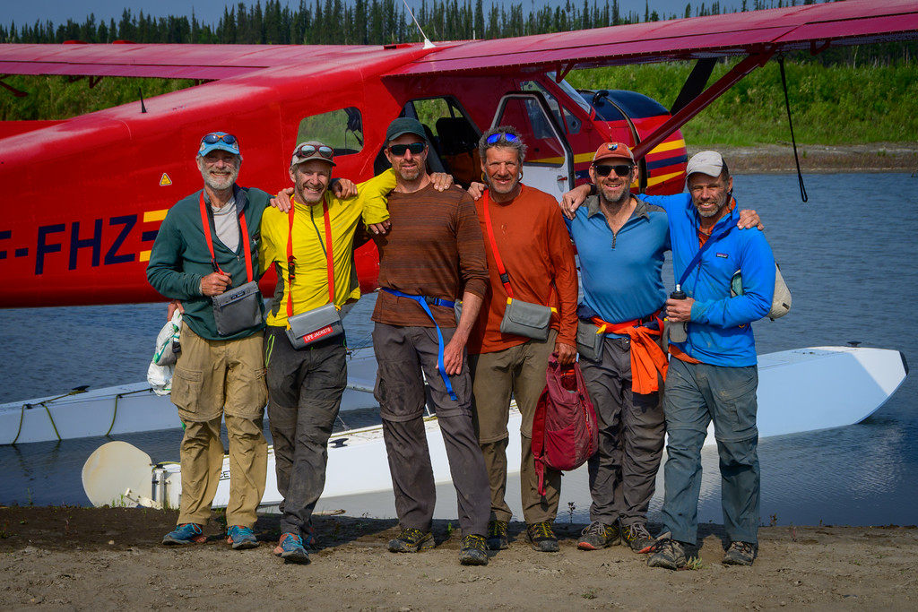
Our crew was familiar: brother Paul, the captains of the New England Packraft team Greg Hanlon, the former captain of the Cincinnati Packrafting Team Mike Elovitz (now a humble new member of the Teton Packrafting Team), Bryan Godlewski, another Tetoner and Utah expat who joined our merry band last year in Alaska to much acclaim, and Benj Wadsworth, whose photography skills are only eclipsed by his outdoor experience and great expedition disposition.
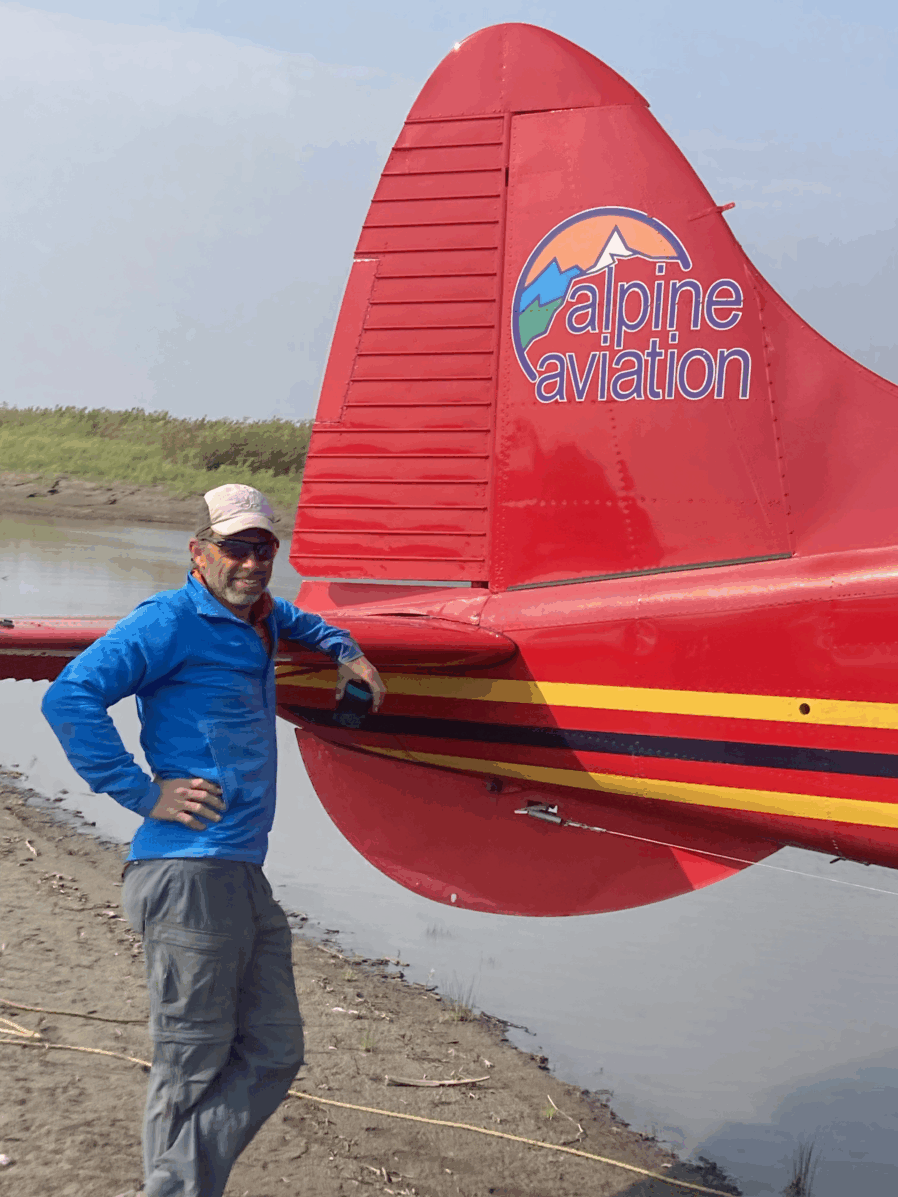
Soon enough we found ourselves at the “airport” for Alpine Aviation; on the Yukon river where it drifts lazily through town.
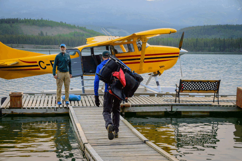
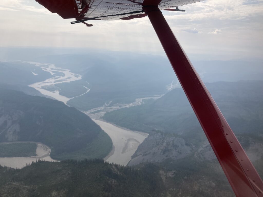
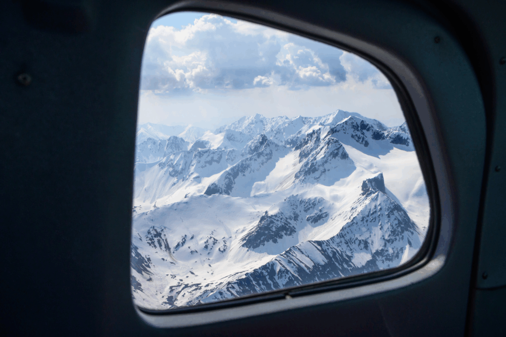
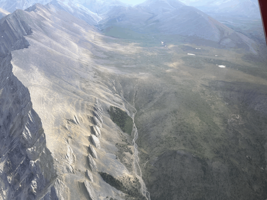
After weighing ourselves and our too-heavy packs we loaded into two Cessna 206’s for the 2.5 hour flight into the Northwest Territories (the NWT is almost twice as big as Texas, with 41,000 people in the province, mostly in Yellowknife). As per the above, we started flying over wilderness immediately after takeoff, and all we saw for the next coupla hours were mountains and rivers:
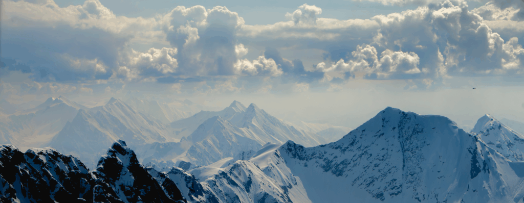
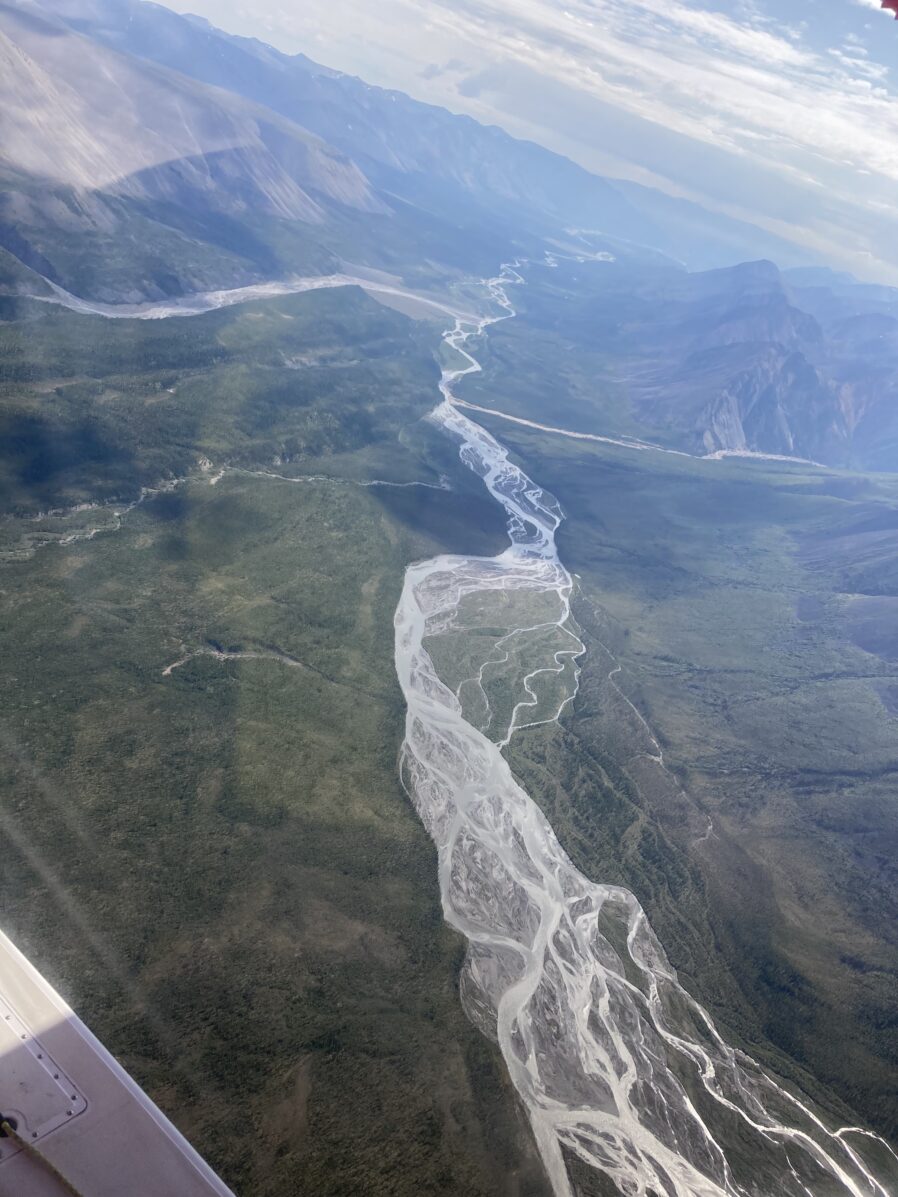
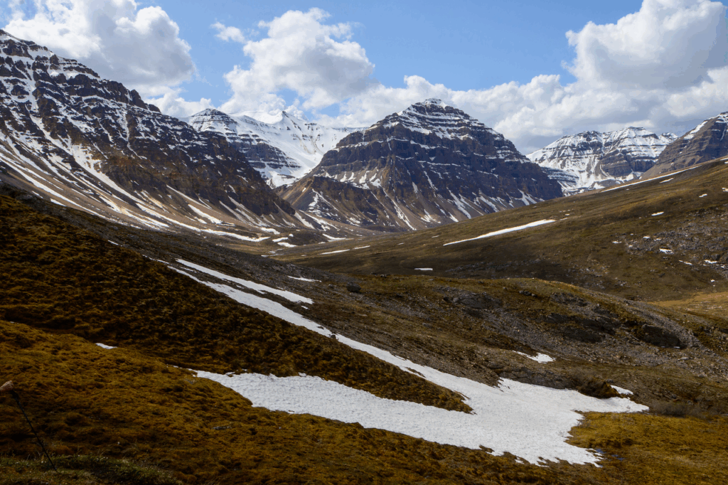
As happened last year flying into the Happy River area, I was a bit alarmed at how much snow was still in the high country. Over 6000 feet it was still mostly snow, and through the headset the pilot explained to us that while the snowpack overall this past winter was pretty lean – which was our general impression with casual online glances at the weather and snowpack periodically – the spring was quite cold, so there hadn’t been much in the way of meltoff. Last year we were worried both about the potential for hiking in the snow – which did not happen – and high water levels, which did. Oh well, we see how we go.
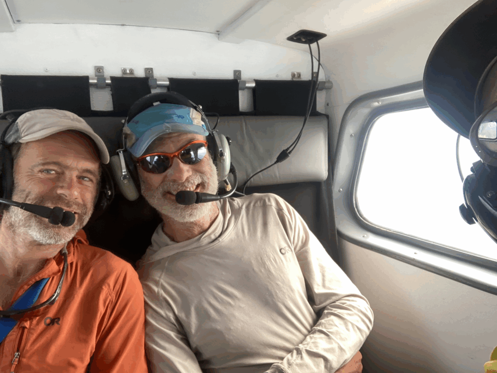
I honestly didn’t know that these little planes could fly for 2.5 hours with a buncha doods and gear in them, and what I found out is that they can….barely! But Gerd and his sidekick Tom both also brought a few jerry cans with them to refuel at the end of our flight to get them home.
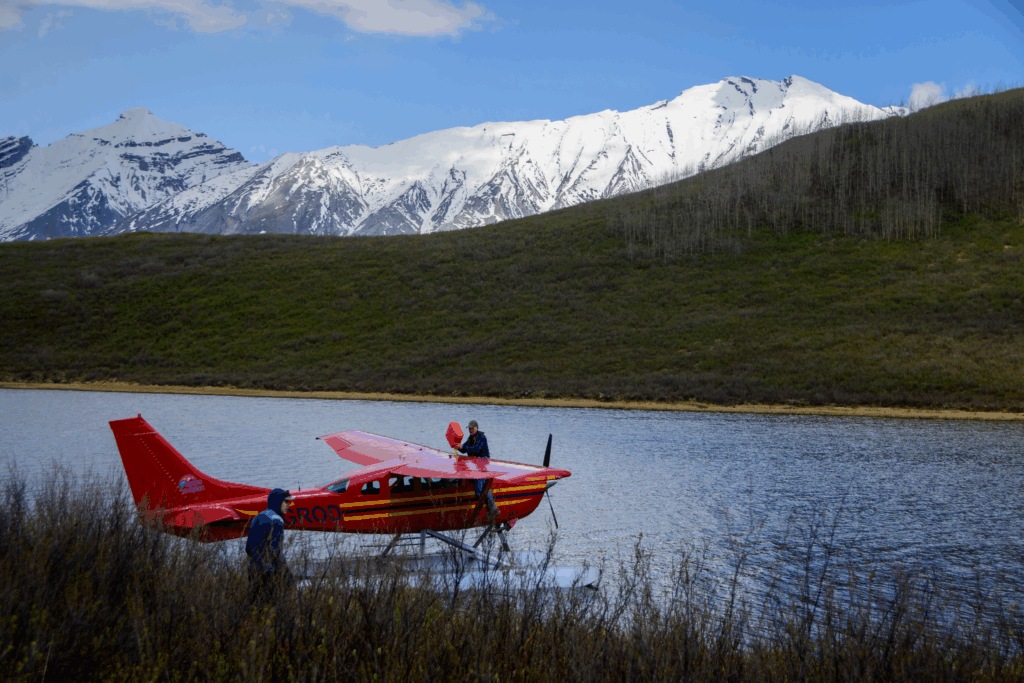
Now that I’ve done a few of these trips I’ve gotten a bit accustomed to the concept of “Drop Shock” (a new term for me) but…..when the pilot hops in with a cheery “see you in a coupla weeks!”, fires up his plane, takes off with a roar, zooms back overhead with a goodbye wing-waggle, and the sound quickly fades…..you look around and think “holy shit; we are really, really out here!” and then hope that it all goes well.
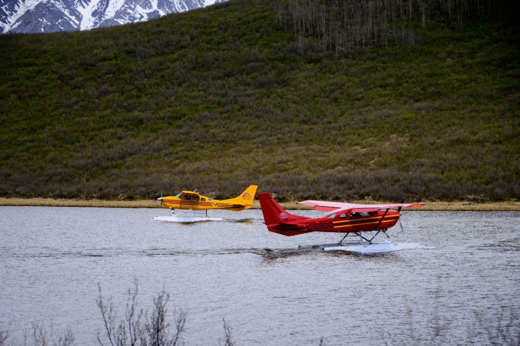
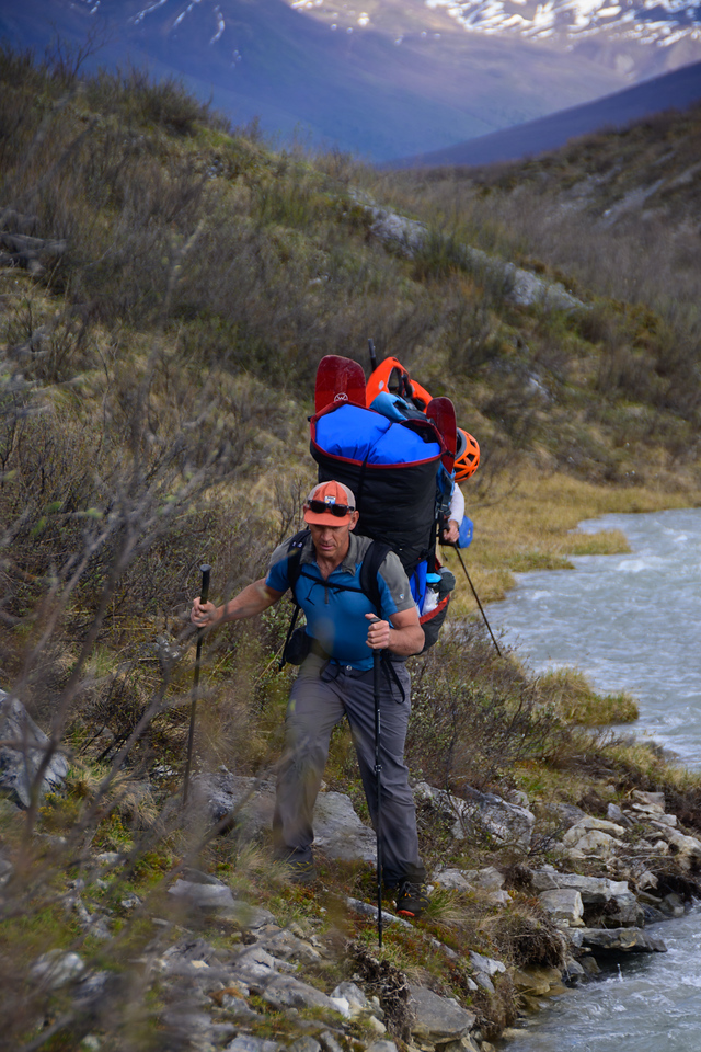
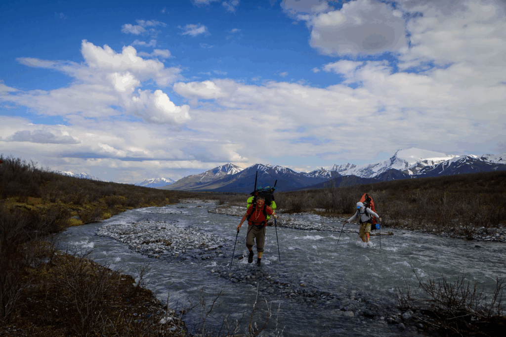
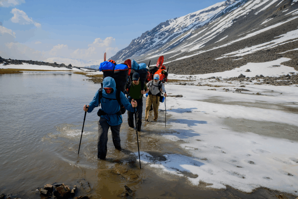
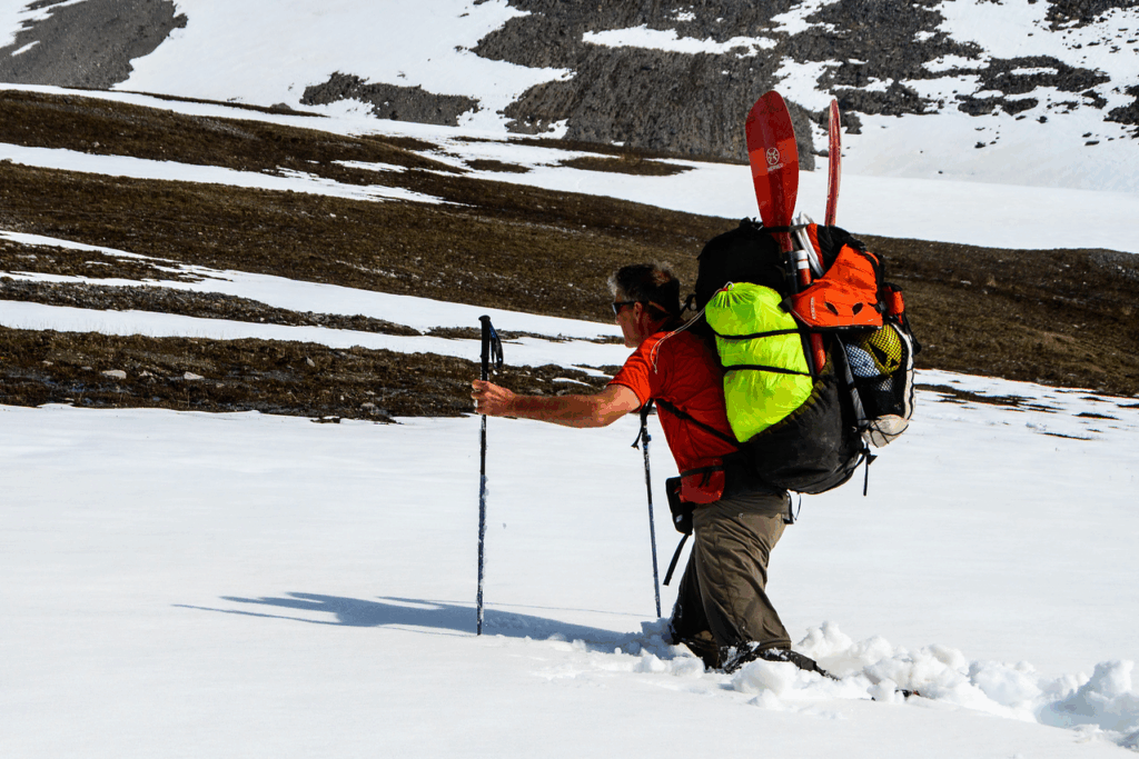
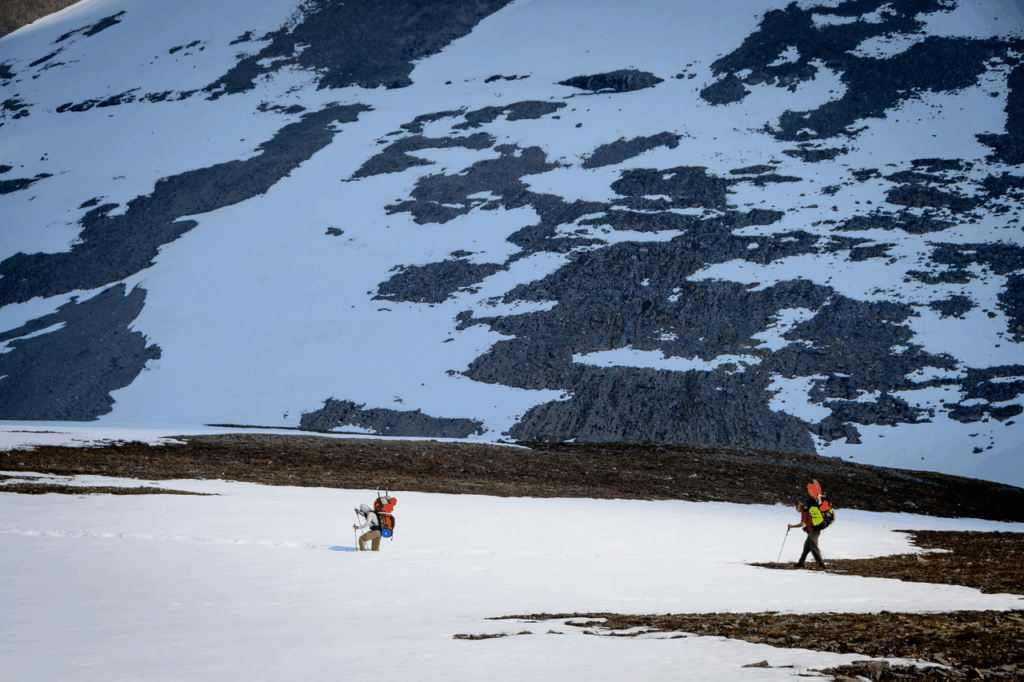
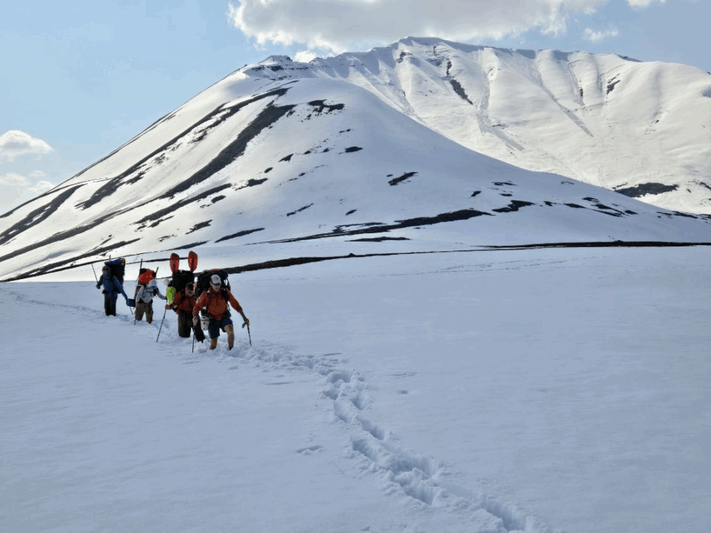
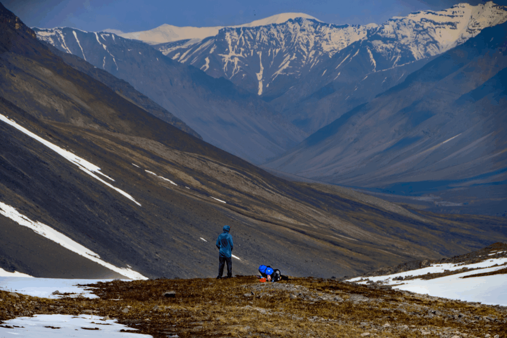
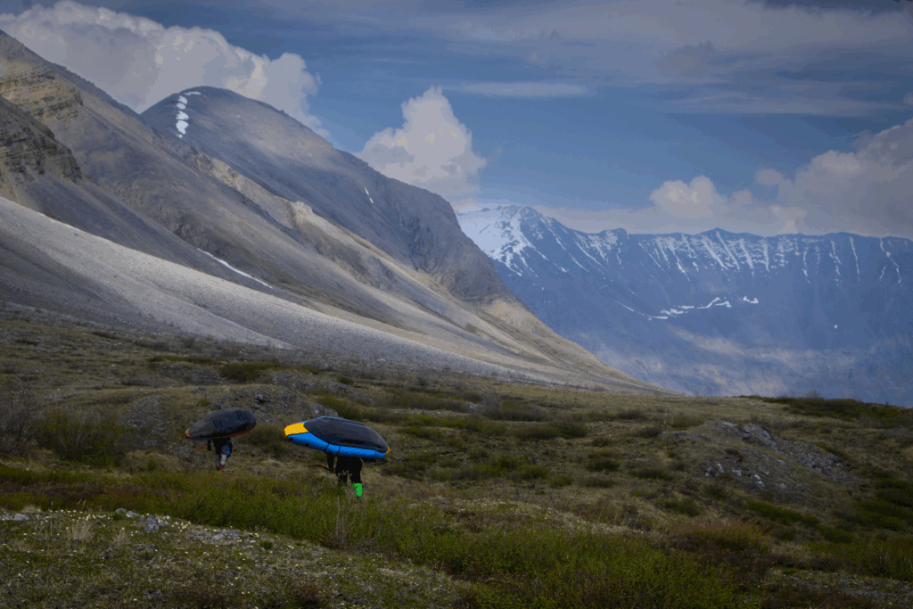
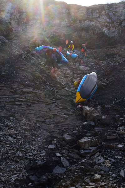
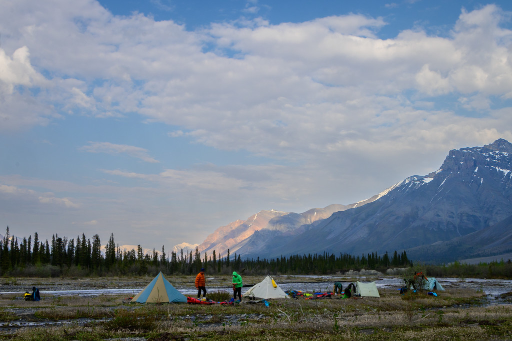
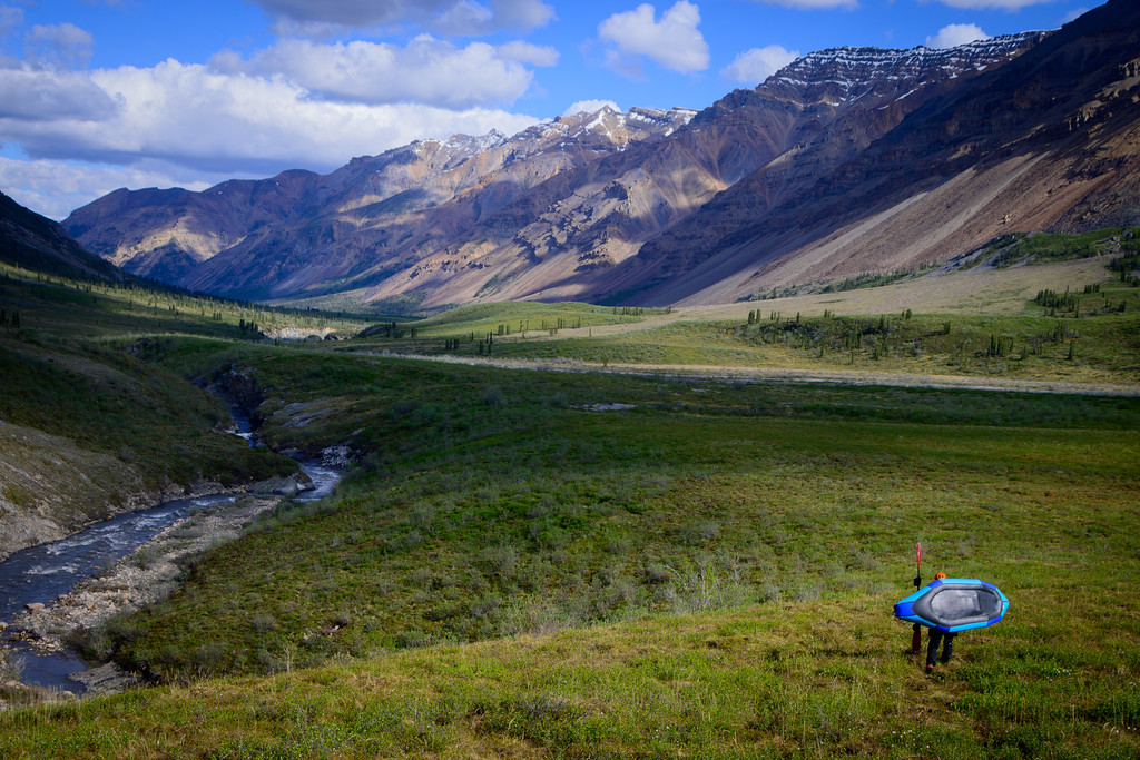
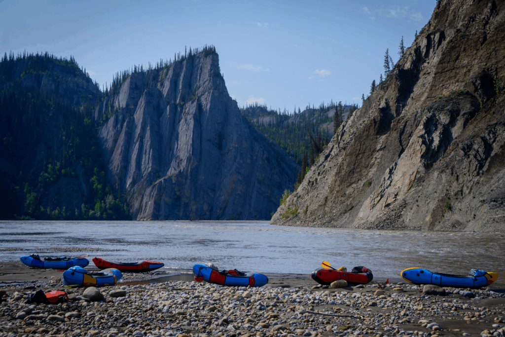
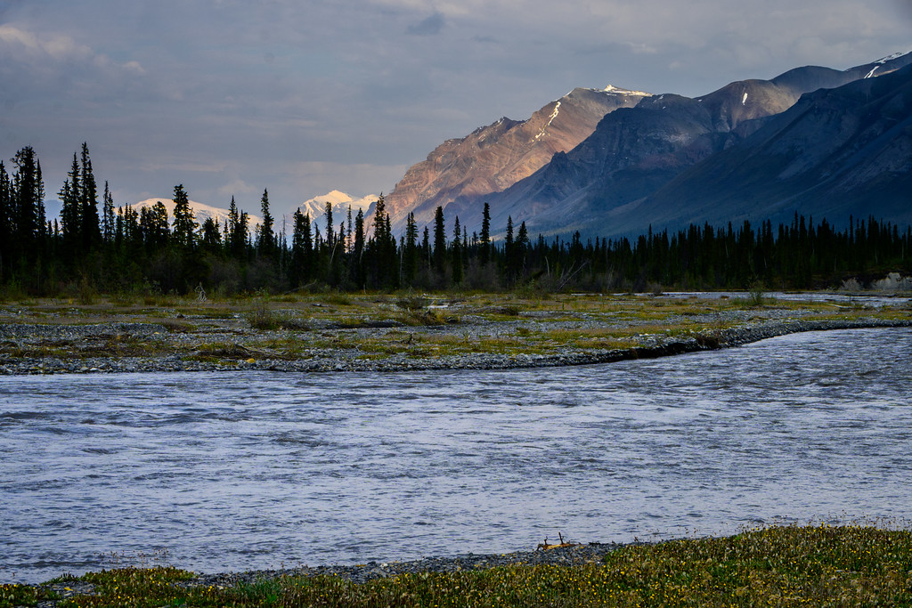
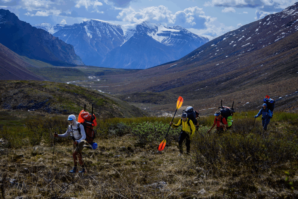
In this case we were dropped at Norseman Lake, which rests above the Mountain River within sight (a long sight) of the headwaters. When we did the Nahanni – a comparably-long trip – we also landed on a lake, but that time we floated out of the lake and had the opportunity to float down the river for a coupla of days to eat down a few pounds of food. This time we hiked down to the river, blew up our boats, got in, floated across, deflated, and started hiking up and out of the river! We all were a bit intimidated; our packs were really heavy. Two full weeks-worth of food is a lot of bulk and weight to add to our camping and paddling gear, even in our 100 liter Superior Wilderness Designs packs, and for the first hour or so I think all of us were wondering how we were going to do this. But like every trip, we just kept tromping:
and took a goodly number of rests:
to get up and over a pass to drop us into another river.
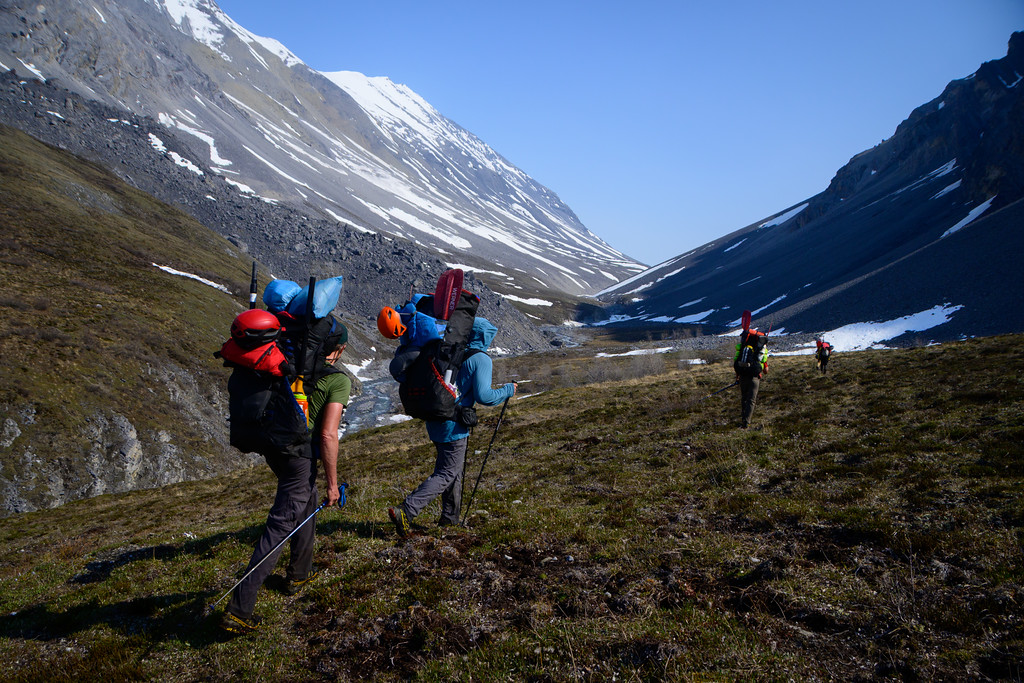
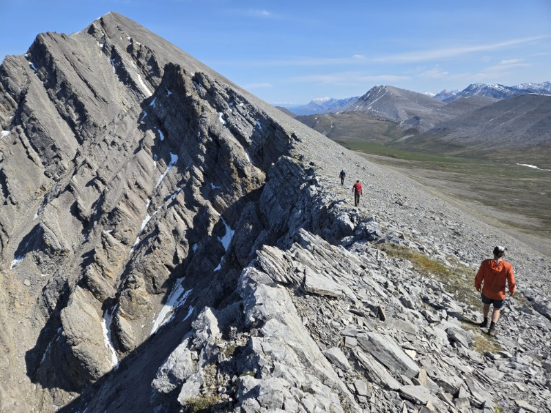
While the Mountain River is great – and done periodically as a trip by itself – Tim Kelley had done this hike to get over to the Stone Knife river, which as a tributary of the Mountain was longer, started higher, had some better whitewater, and had two different forks to explore, which is why we chose to leave the floatable comfort of the Mountain itself.
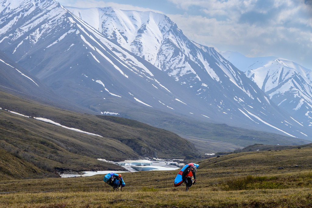
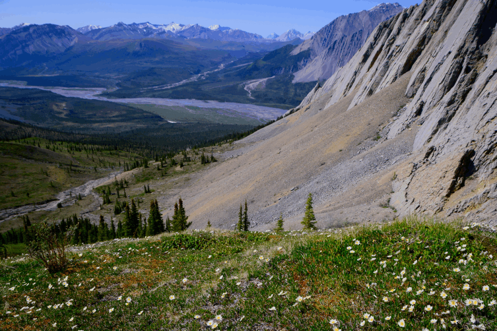
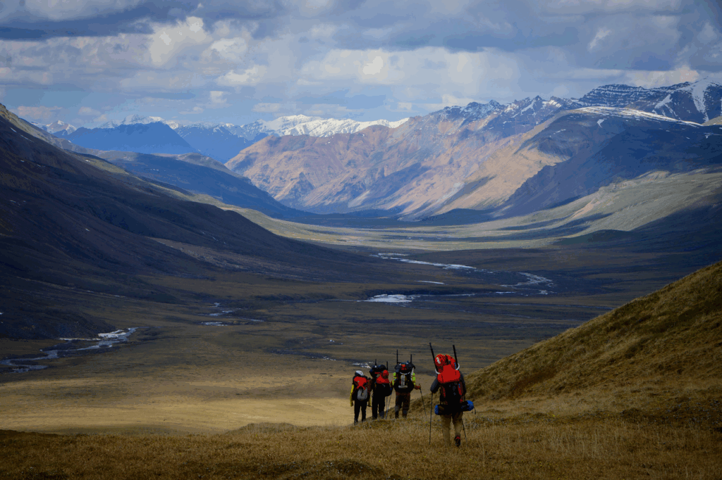
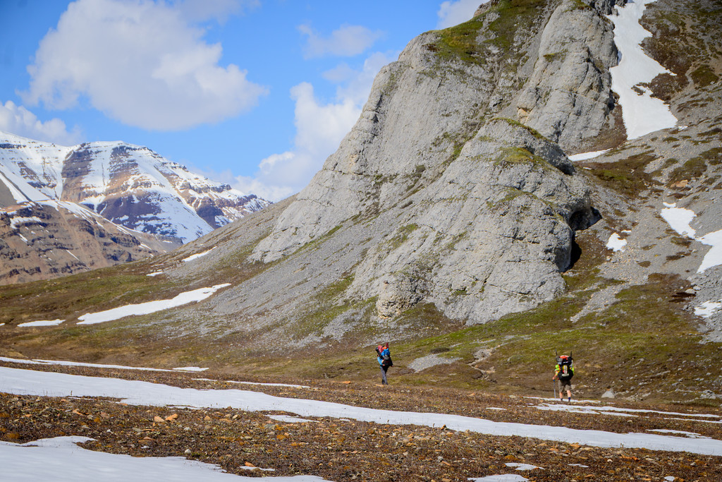
Despite our heavy loads, we made good time up towards the pass between the drainages since at that latitude and elevation there’s very little schwacking that needs to be done. However, we didn’t quite count on the impact of the snow, which due to the (very nice!) mild weather – and very long days at that latitude – was pretty goopy, which made for some challenging travel:
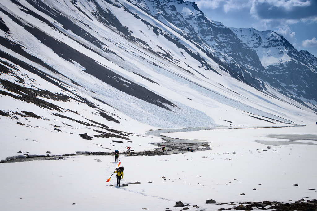
but we persevered, even as we were concerned about going down the back (north) side, which might have more snow that wasn’t conducive to glissading
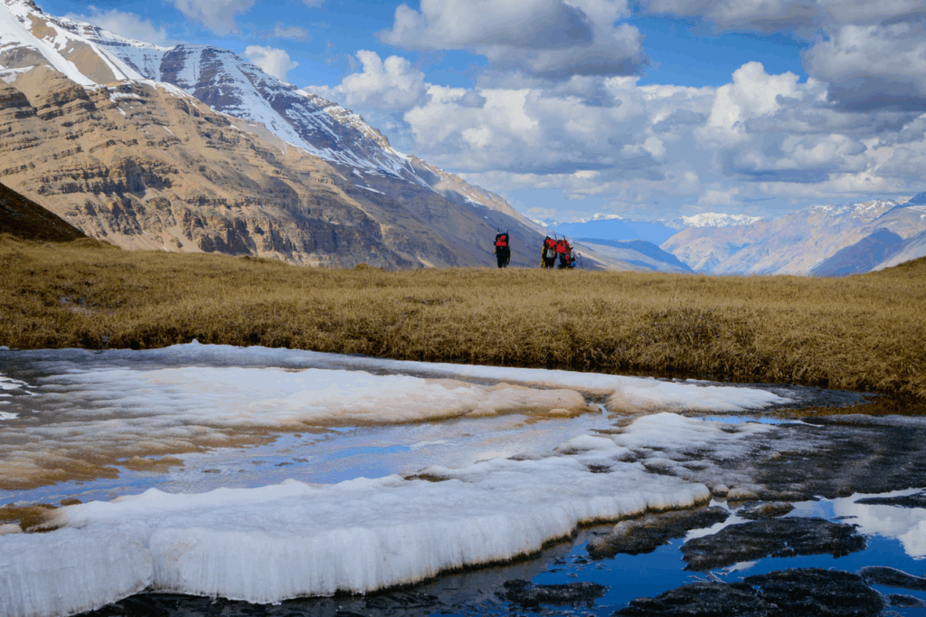
But fortunately – probably because the sun is indeed almost always out in June a coupla hundred miles from the Arctic Circle – we found a pretty easy route down into our first float.
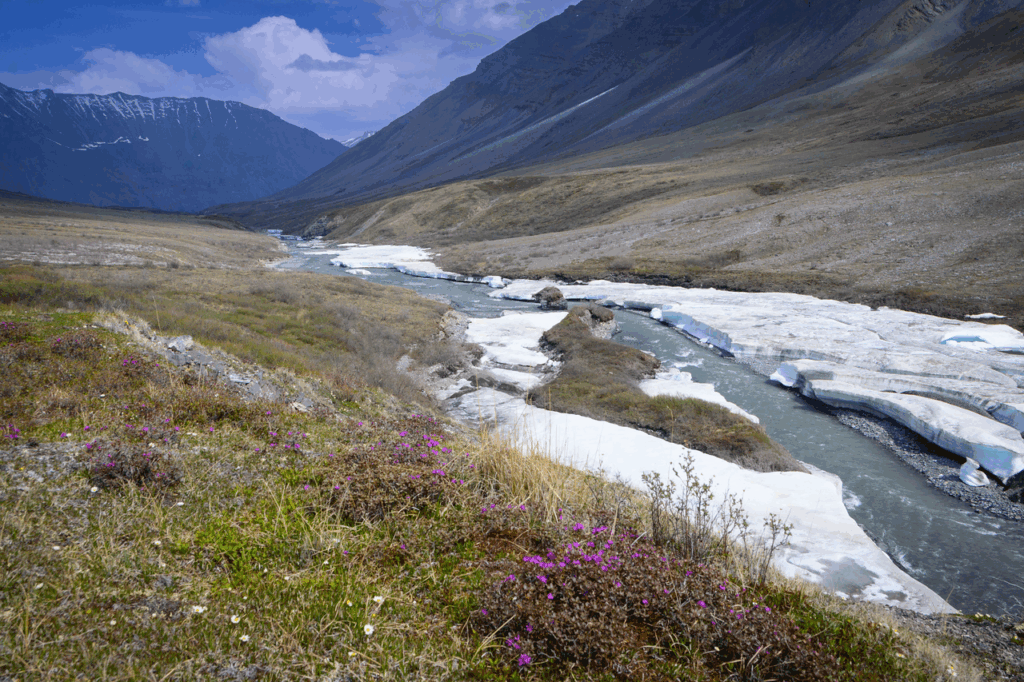
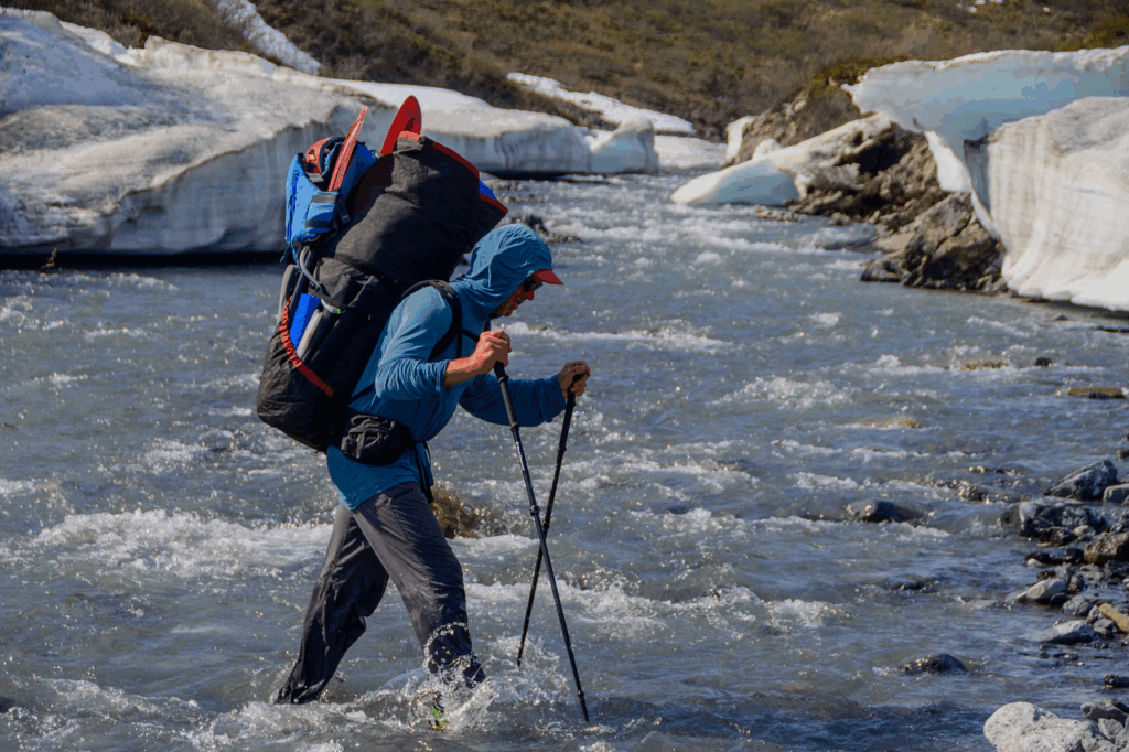
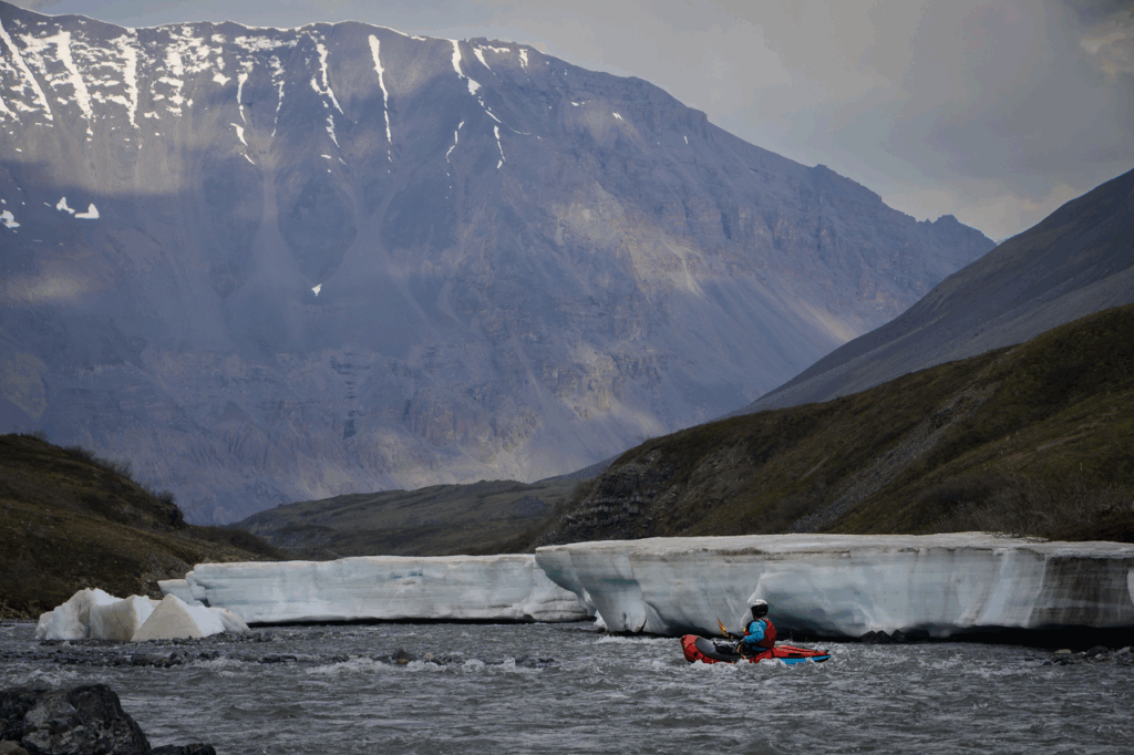
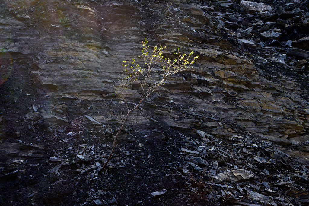
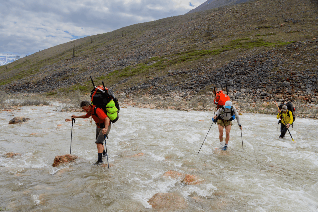
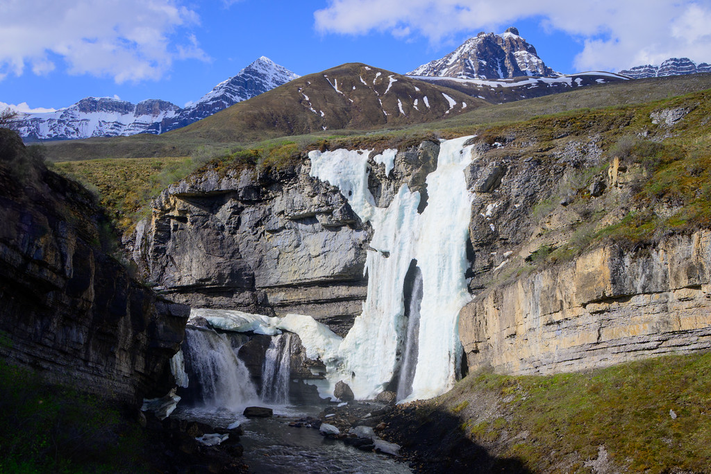
An element of packrafting that I never experience while kayaking is that there are times when you enter a drainage and you pretty much start walking downstream until there’s enough water to – hopefully! – float a boat. And in a snowmelt situation the diurnal flow fluctuations mean that when you see it may not be when it’s good to float, or what looks good in the evening may be a trickle in the morning. That was the case on this first (unnamed) creek; even with a lot of daylight the temps dropped as the sun neared the horizon and starting circling the horizon, so we’d have enough water, which also isn’t a gimme depending on how far you from where the melt is happening. And that far north we realized that there was âufeis; an interesting phenomenon where near-permanent ice forms on the banks of rivers and many times bridges over rivers, which is suboptimal.
So to get enough flow, avoid getting stuffed into an ice tunnel not far downstream, avoiding rigging/blowing up boats or rigged-boat portaging is kind of a multi-faceted decision making process. But we figured it out and were very happy to have the water carrying us down the river instead of us carrying huge packs!
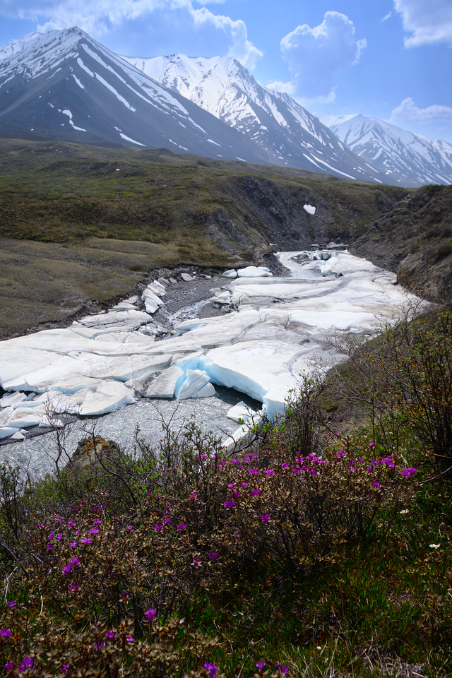
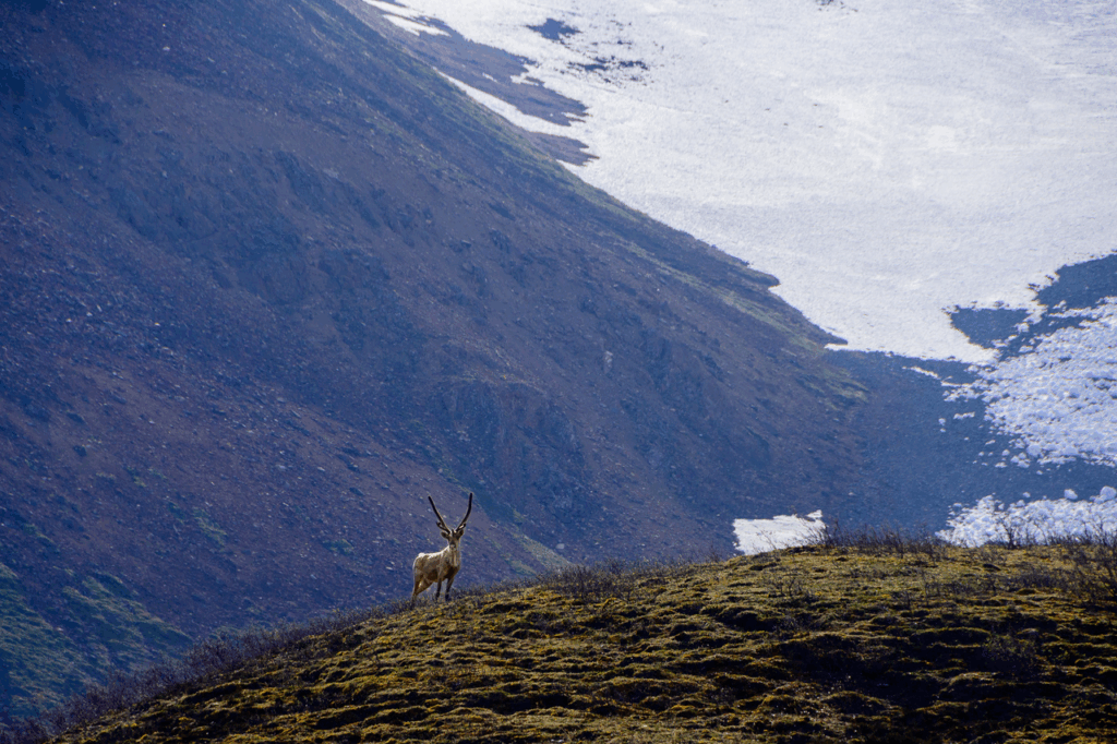
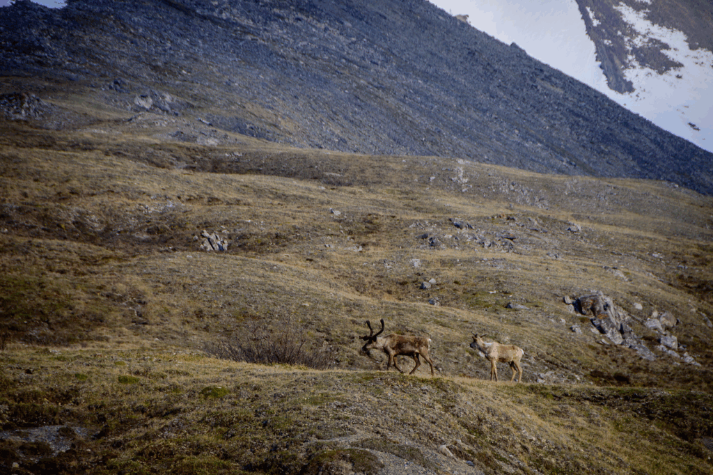
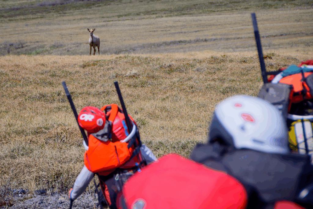
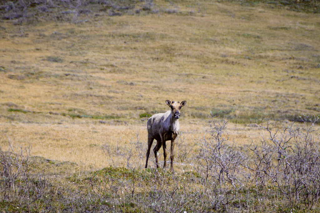
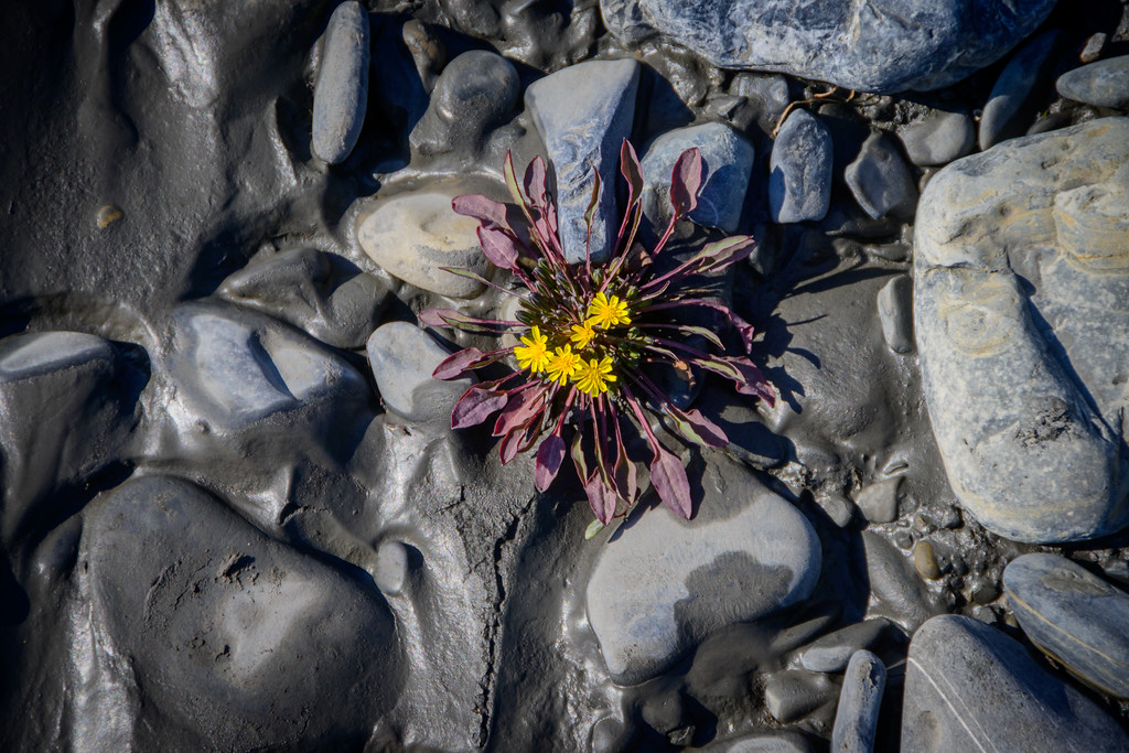
We dubbed this previously unnamed tributary of the Stone Knife Caribou Creek, named for the curious ungulates that hung out up there:
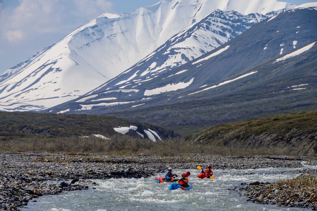
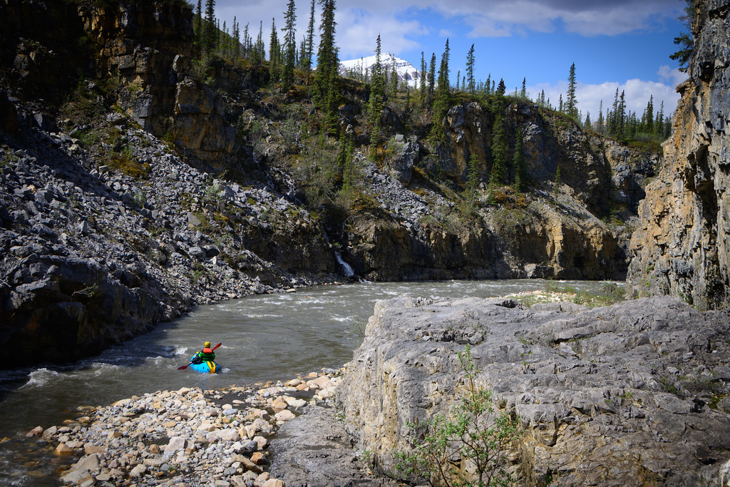
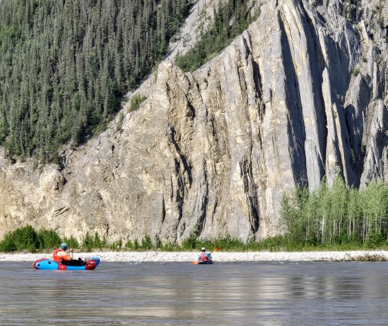
and it had its share of gnarly gorges that we had to portage:
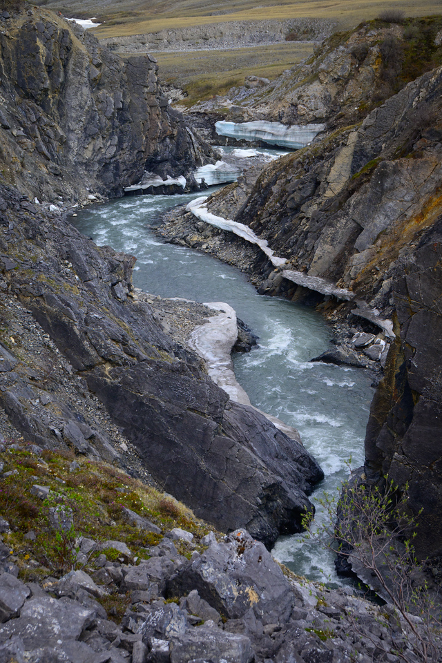
and some that we could run (after extensive scouting).
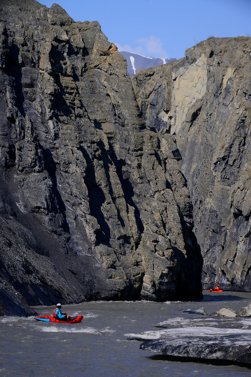
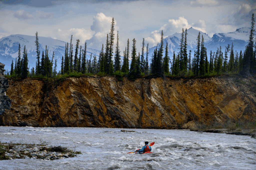
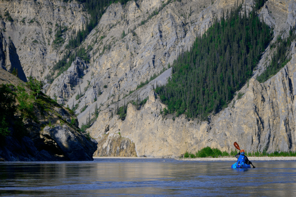
The base rock layer of the Stone Knife is – appropriately enough – super sharp limestone, so we had be be really careful not to cut the boats either in the rivers or on portages.
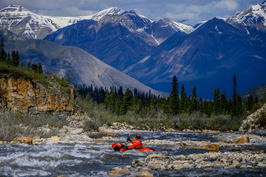
And soon enough we found ourselves on the Stone Knife itself:
where we did a kinda-layover day of hiking upstream a few miles and floating back down to camp.
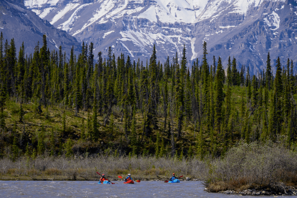
We floated the south fork of the Stone Knife for some number of miles, with a great 3000-foot day hike to get out of the boats and scramble without packs.
But of course we got tired of floating and missed our huge packs, so we loaded up again to hike up and over to the North Fork of the Stone Knife:
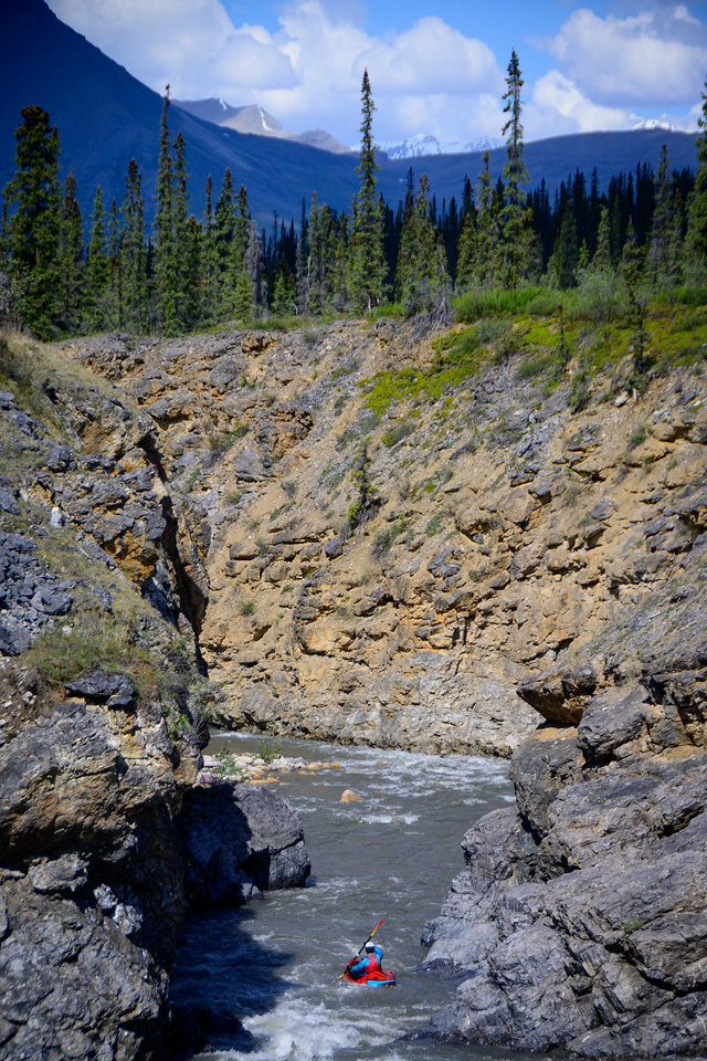
where once again we found ourselves on an unnamed tributary and had to gauge if/when there’d be enough water to float a boat
And this creek was a bit steeper, so we had to be pretty attentive to not get swept into anything too sketchy, especially it went in and out of a couple of tight gorges.
When the gorges form and the river races into them, whoever is leading needs to be very attentive to the eddies: do they exist? how big? can you see downstream from the eddy? and most importantly: can you escape to the shore and get up/out to portage if it doesn’t “go”? And you have to evaluate these factors from a ways upstream, while your pards watch expectantly. A challenging but fun aspect of exploring new, info-less rivers.
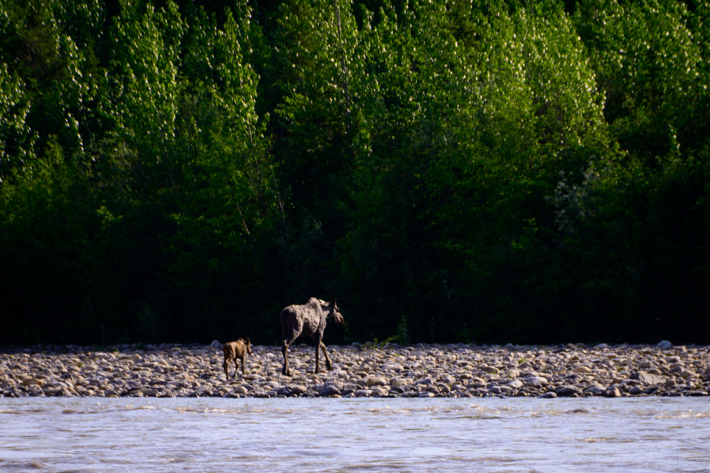
It was on this creek that we had our only bear sighting. At least a quarter mile away Paul (I think) spotted a grizz up on a hillside, and while we thought at first perhaps it wasn’t aware of us since we were far off, him (or her, but no cubs) stood up, looked at us, then ran away. Not too fast, nor too far, and he may have been in a good spot for grubbin’, because he just moved slowly through that area and didn’t pay us any more mind. Where we saw him was actually a really nice campsite and there hadn’t been many in that area, so despite Yogi’s proximity, we decided to camp, and we (including more curious caribou) all got along well for the evening.
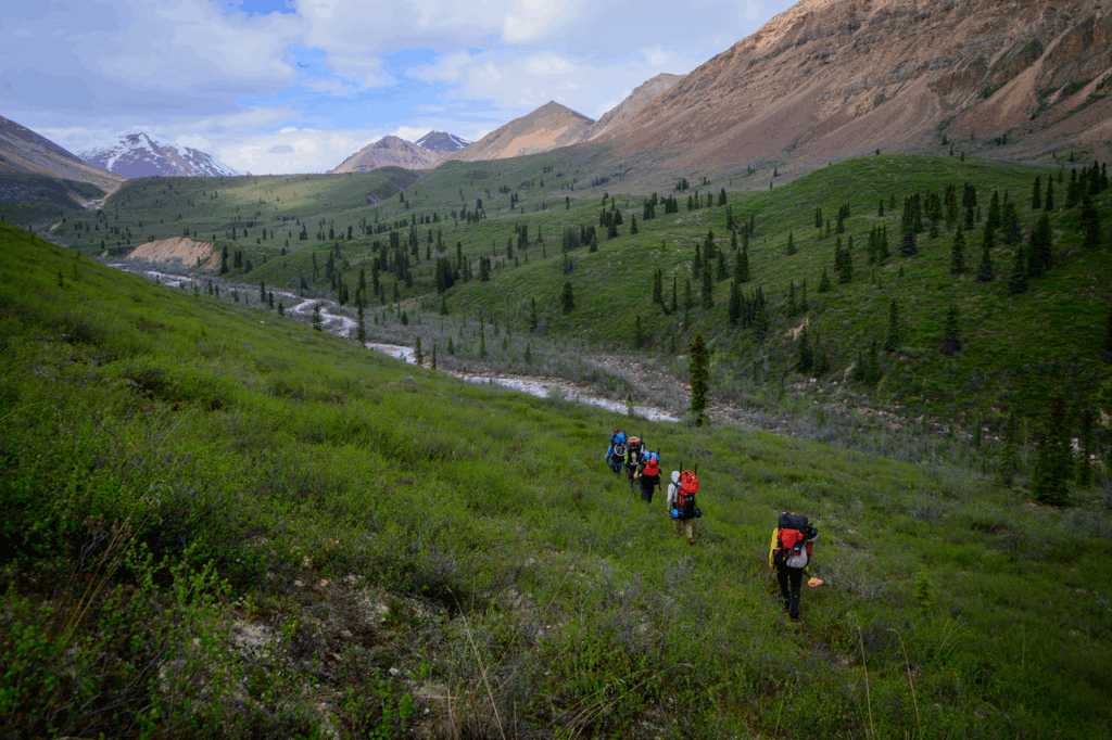
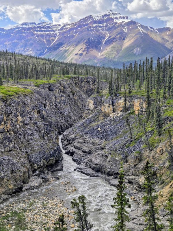
We made our way down the north fork Stone Knife to the confluence with the south fork (that we had been on earlier) and a day after that we hit the Mountain river, which we had crossed at the very beginning of the trip, now much bigger. As it winds its way towards the Mackenzie the river flattens out a bit as does the surrounding terrain, and the low elevation means thicker bush off the rivers – and more mosquitoes -so we just paddled along for a couple of days, though we were able to go through a couple of cool gorges and camp in one of them:
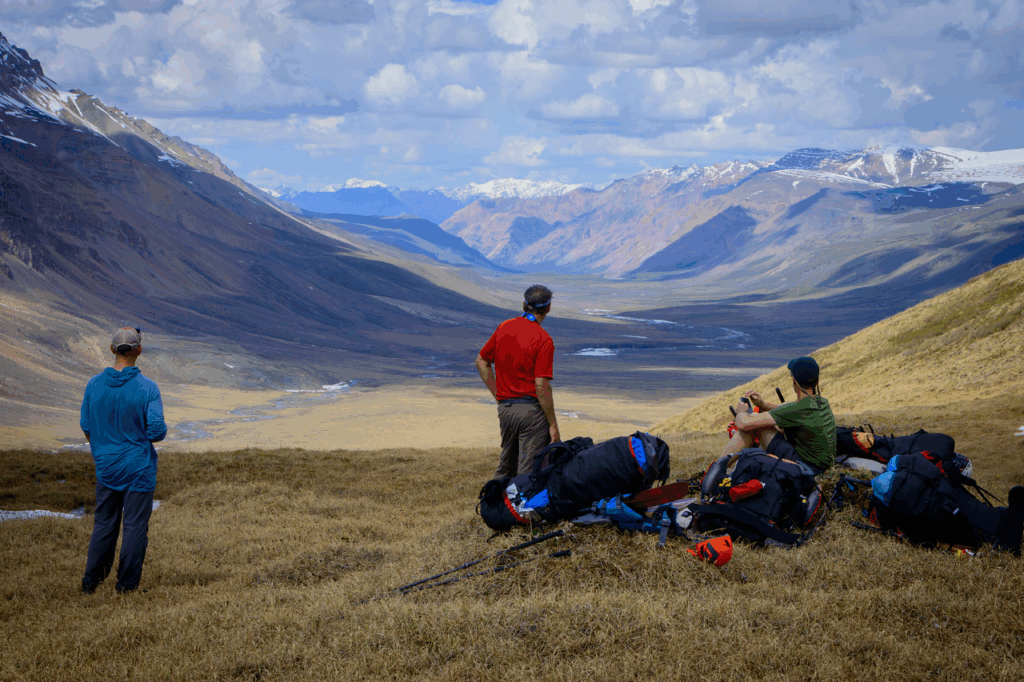
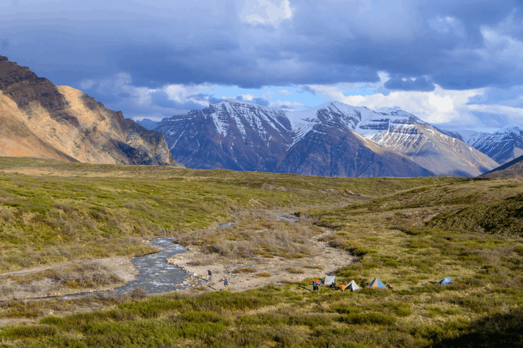
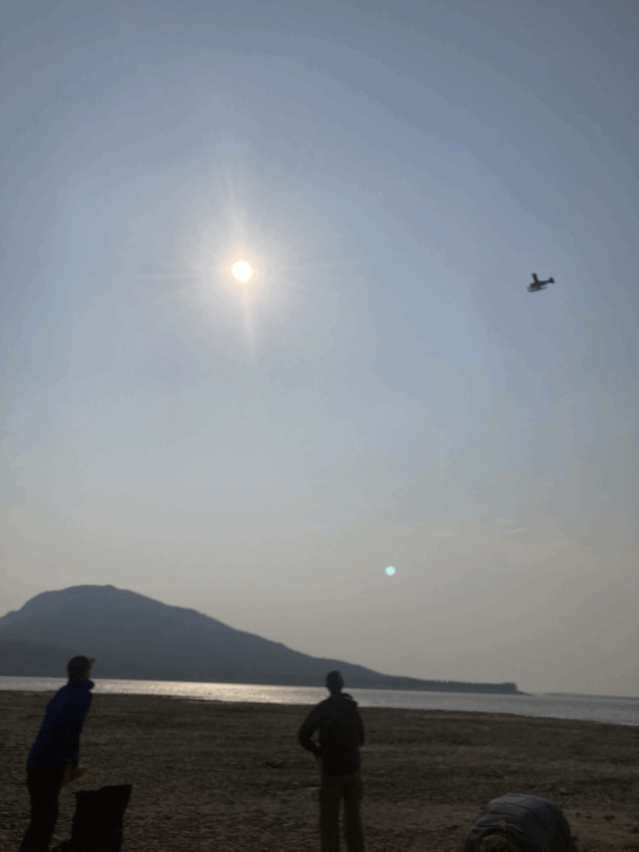
We realized as a result of swifter water that we were ahead of schedule by a day or even two, and we started pondering what to do with our days. The prospect of getting onto the Mackenzie proper loomed large; what looked at first glance like 40 miles of river would take us to the remote, fly-only village of Fort Good Hope, which had some appeal: maybe a night in a bed, possibly a cute little remote village (??), probably some interesting characters who are always pretty easy to meet in such a remote outpost. We were a bit concerned about the “40 miles” of flatwater; our elevation was something like 175 feet above sea level and we felt very far from the sea, and packrafts aren’t known for their flatwater speed. But we got word from our trusted weatherman Larry Dunn on the InReach that the wind would likely be blowing downstream, and with a lot of volume (almost half a million cfs) maybe we could make it. However, when we got to the mighty Mackenzie we were a bit daunted: it was ginormous. like 3-4 miles across, and the ability to follow currents and river bends meant that the 40 miles would almost certainly be longer. And the wind was indeed blowing downwind, but at least where we were it was kinda down and across, and it looked like we’d be fighting to stay off the left shoreline. I was pretty dubious, and we decided to sleep on it and decide in the morning, which is always a good strategy.
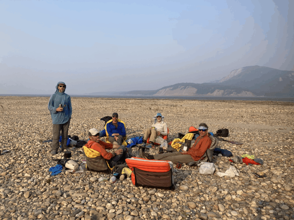
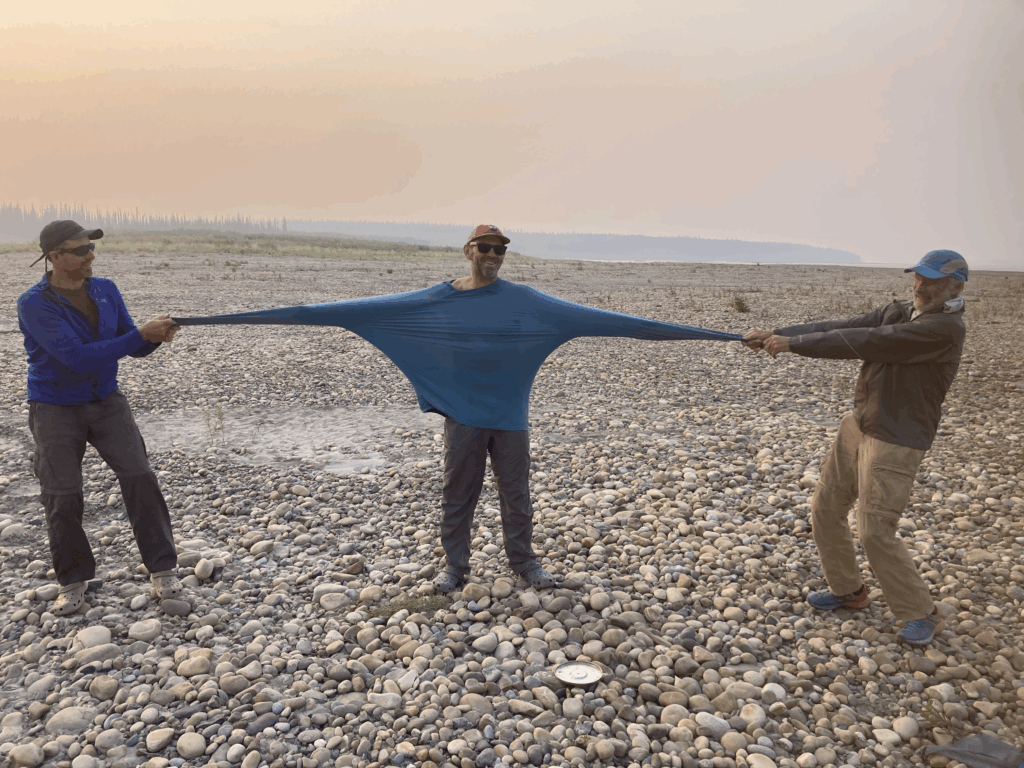
The wind blew hard all night across the dust and sand of our exposed bar, and by morning it had shifted a bit so it was coming even harder across the river, so we sent a message to our pilot: “Okay, we’re ready! Come get us!” However, we also had noticed that the wind had brought in a lot of smoke from distant forest fires, which hadn’t escaped the pilot’s attention, and he replied: “Hopefully tomorrow!” Eek. None of us are very good at just hanging out, but hang out we did, keeping ourselves entertained:
And sure enough, our pilot showed up the next morning.
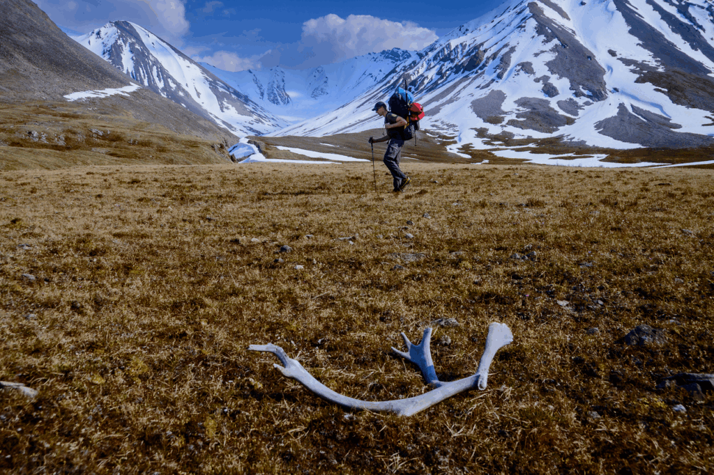
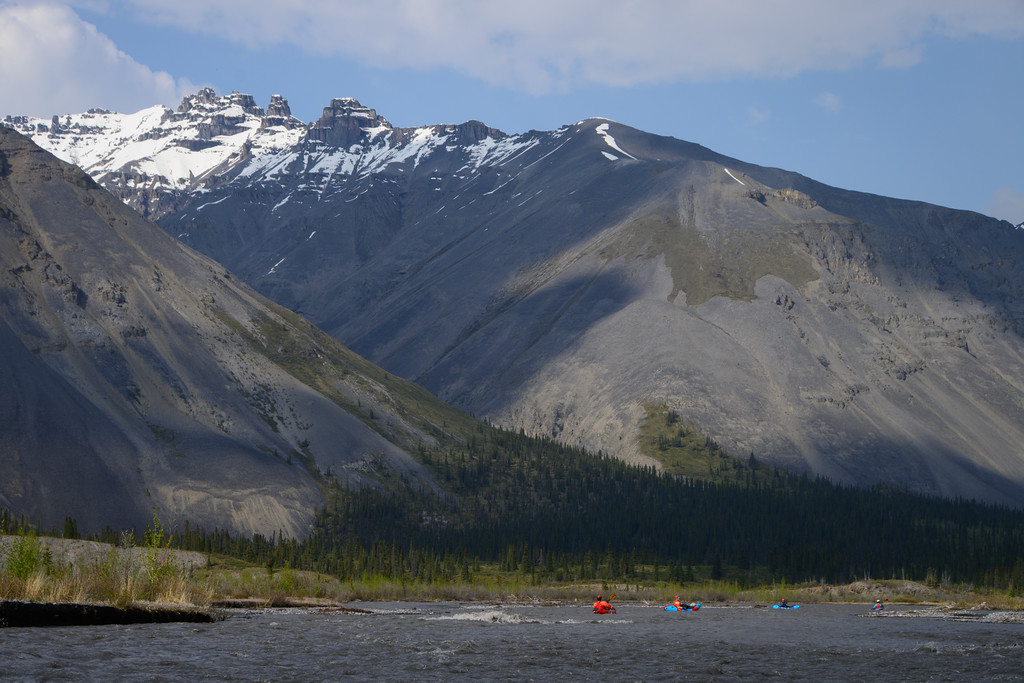
I have had the good fortune to see a lot of beautiful places, and with convenient ADD I am usually able to think that the latest place I’ve been is The Most Beautiful. 5 of the 6 of us did the Nahanni two years ago and we all agreed it was one of the most spectacular places we’d ever been. But we all kinda agreed – and to be sure, all of us are as ADD as the other – that the combination of big mountains and big river valleys of the Mountain/Stone Knife zone probably stepped it up a bit.
An incredible trip with some great pards
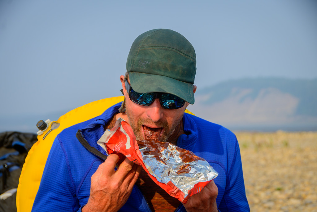
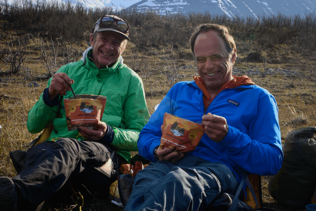
As a quick follow up, a big thanks to Gerd at Alpine Aviation for his great flying and flexibility in our scheduling, Derrick Law for his great Air BnB in Whitehorse, and Foundation Outdoors: a new player in the freeze dried food field that supplied most of us with their great meals that are lighter, have a slightly higher-caloric density, and have sensibly-smaller packaging so you can take more and you don’t get food all over your fingers as you try to get the last scraps out of your foil envelope!
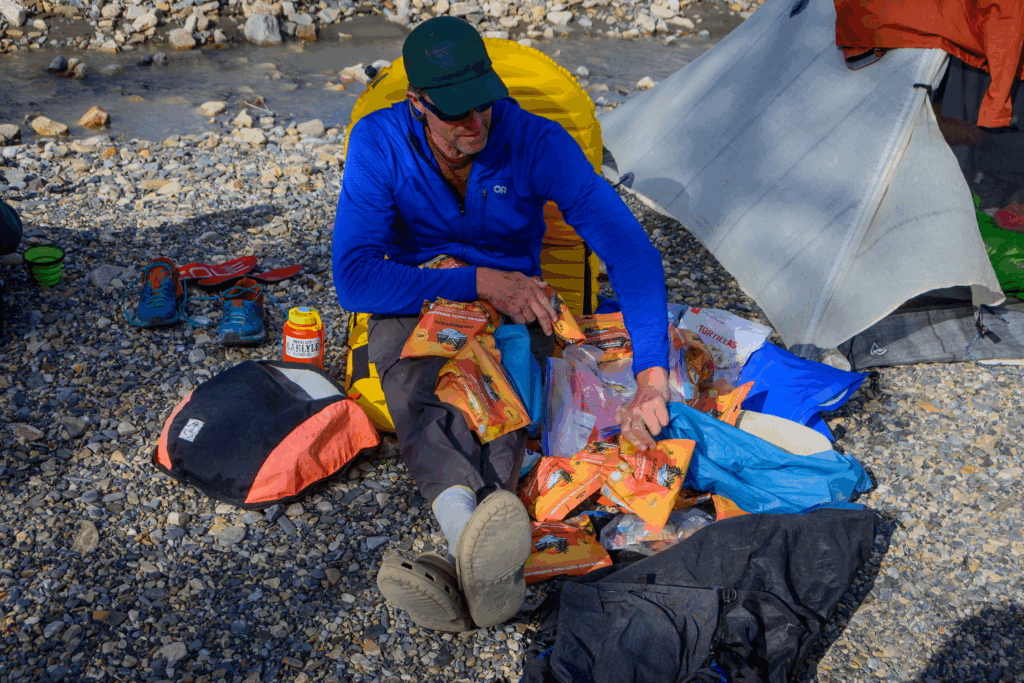
and they’re good!
Speaking of Benj, thanks much to him for lugging around that big camera in addition to all the other packraft gear and being such a great photographer, documenting both the beauty (Benj’s pics are almost better than what’s there!) and the personal aspects of our trips. His pics make writing a half-decent blog post come across much better!
Thanks for sharing the report and these beautiful shots. Love the fact this is so remote it needs less protection!
an interesting concept for sure. Though arguably the Arctic Refuge is not that far away and is pretty dang remote, but it’s cursed with exploitable natural resources….
Wow….. Tom and Paul. Incredible trip. Stunning landscapes hidden from the many. Great there are a few places left like this in the world. You have awesome endurance.
What an expedition .
As I fly from London to Portland over the NWT, I’m going to gaze closely…looking for the Diegel boys!!
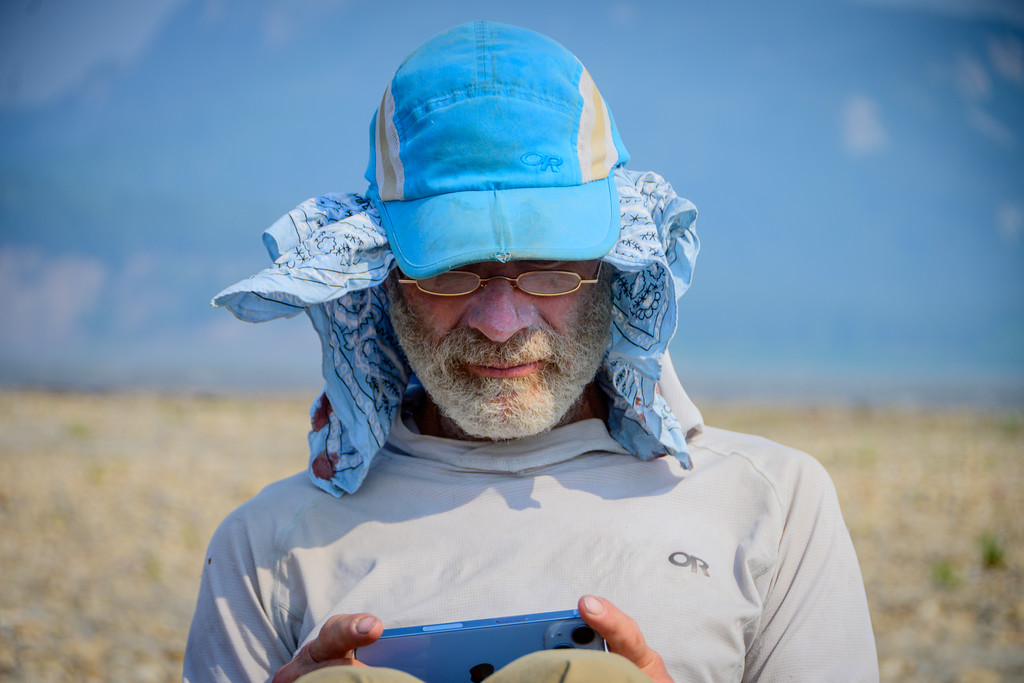
It seems to get more challenging to “get away from it all” but the thrill and comfort of that still exists! For clarification, the apparent phone use in a couple of the pics was just reading books on the phones….tho as noted, we did do a little as-necessary comms via inReach.
Gawd! That is all so vast and bee-yoo-tee-full!! You all seem so tiny in the landscape but you were mighty in fortitude. Tell me….2 planes in and 1 out or is that just misinterpretation on my part? So impressive a trip. Testament to your collective planning skills and experience. How many days hiking vs how many rafting?
Good observation on the planes there Dave! Because there were 6 of us and all of us had at least 30# of food that put us over the weight limit. They returned with one plane and as it was the pilot sorta muttered: “okay, honey, lets see if we can get off the water here!” as we taxied on the river for takeoff; we kinda chuckled…kinda nervously….
I think we were about 2/3 paddle 1/3 hike. a good ratio.
Aaah, living vicariously through your beautiful adventures. Hopefully a lot more to come and maybe a couple I can enjoy live. Thanks, Tom, Paul, and crew.
Thank you Tom! Love it.