
If you like to paddle rivers, there are fortunately a lot of choices (something that’s sometimes difficult to remember in the great Southwest desert!) and even if you’re into rivers, it’s hard to keep track of all of them! So I didn’t feel too bad a few years ago when my old pal Greg Hanlon said “we gotta go do the Nahanni!” huh? Where’s that? “In the Yukon, or maybe the NW Territories. We gotta go!” Turns out it is the South Nahanni, and a quick glimpse at Wikipedia described it as “one of the prime wilderness rivers in Canada, frequented as a whitewater destination by adventure seekers around the world.” Well, that’s encouraging; what’s it like? “We would start on the Little Nahanni, go to the South Nahanni, hike to the an unnamed river that is a tributary of the Broken Skull, hike up the Broken skull then paddle down it, then hike to the Black Wolf, paddle that back down to the Broken Skull and back to the South Nahanni!” This makes me a little dizzy trying to create a mental map, but it doesn’t matter; sounds like a good adventure. I’m in.
However, turns out I wasn’t in. For a variety of reasons I wasn’t able to commit to the original spring of 2019, spring of 2020 was obviously a no-go, 2021 still had full national park closures even if we could get into Canada, which was dodgy, and in 2022 I was out of the country. I told Greg to just put together a trip without me, but for a variety of reasons he couldn’t get the appropriate group together. But sometime around the holidays Greg sent out a message to a small handful of folks that was pretty simple: “2023 is the year of the Nahanni!” With no firm plans past ski season, this time I was indeed in.
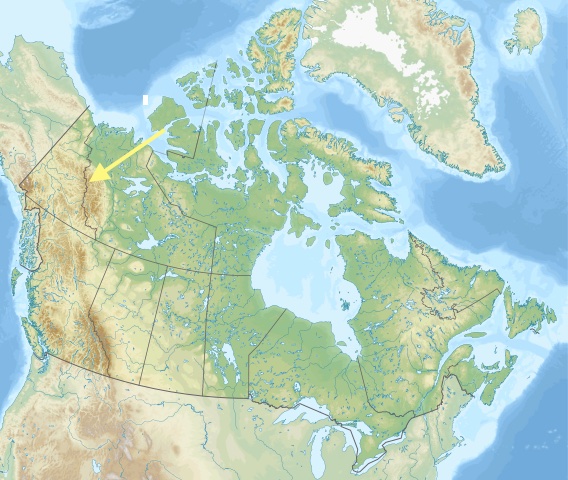
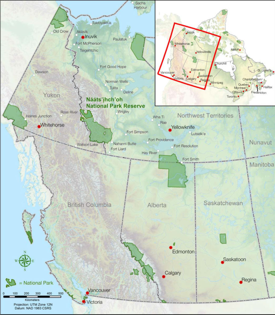
As someone who feels like he’s spent a lot of time in the mountains, I felt a little sheepish in that I basically had never heard of the mighty Mackenzie Mountains. They are over 500 miles going both north/south and east/west; for reference, the Sierras are 430 miles long and 60ish miles wide, the huge Brooks range is 700 miles long but only 150 miles wide, and even the Himalayas are two-thirds the size of the Mackenzie Mountains. But they are demure; even with all them craggy mountains, the highest peak doesn’t even crack the 10k mark; we can see “bigger” mountains from our porch! But a big difference between the Wasatch and the Mackenzies – beyond the square mileage – is the wildness. There are virtually no people in the Mackenzies; the only “town” is Tungsten at 230 residents who travel one of the two roads in the range to work the mine (tungsten is somewhat akin to titanium) and when the mine has closed – as it did for most of the 90’s – so too goes the town (it’s open now). For adventurers, however, Canada has created two nearby national parks: Nahanni and Nááts’ihch’oh (we had to have a bit of help with this one: the best we got to was Nah-cheat-sho). Even though they are adjacent to one another, like Banff and Jasper national parks they were/are intended to be managed separately; perhaps because they are so big: Nááts’ihch’oh is almost 1900 square miles and Nahanni is almost 12,000 square miles. For reference, Yellowstone is 3500 square miles; a quarter of the size. Everything is big up there!
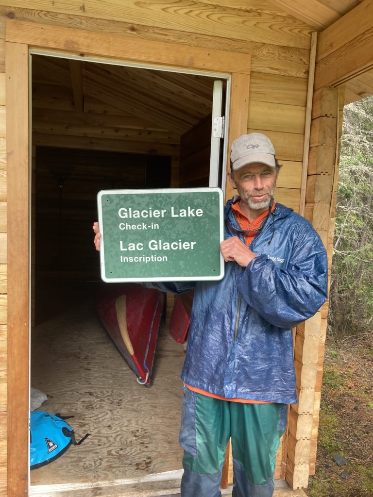
It’s worth a bit of space to talk about our experience with the national park folks there. Contrary to US parks, which have become infamous for being overrun with people, these parks are so under-visited that the park system actively markets them. Their very comprehensive pdf on this page is super helpful, and when Greg reached out to them about our trip they got so excited that someone was actually going to come and do what they thought was the ultimate river adventure in their area. Perhaps it’s the famously good nature of Canadians or perhaps the wildness of the region, but regardless of the reason, the park folks up there were great (to be sure, for the thousand dollar permit fee, we did expect…something?!”).
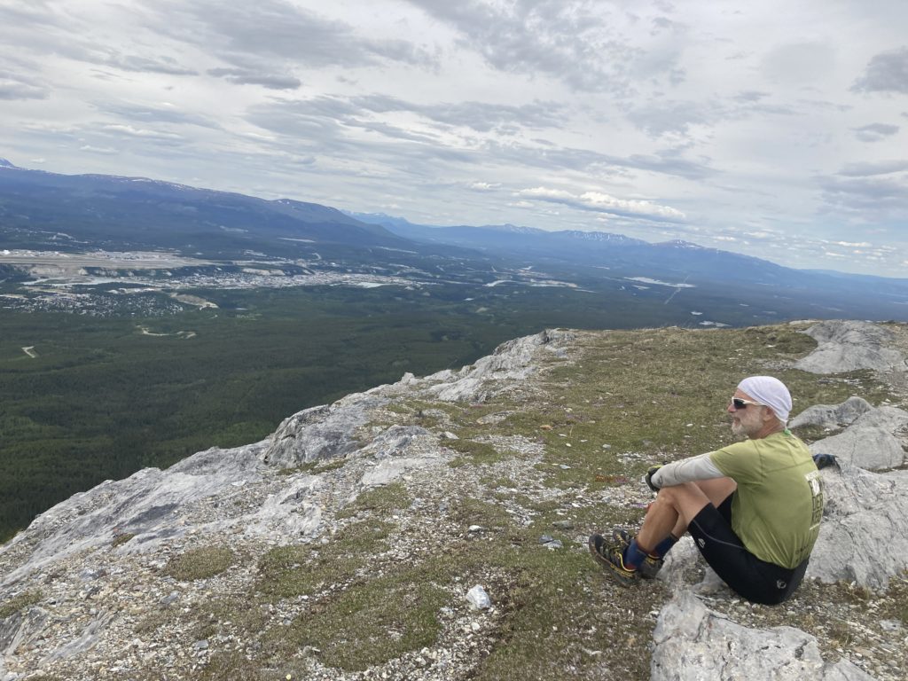
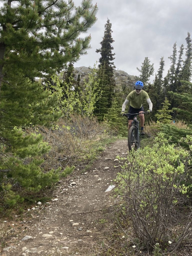
Brother Paul and I decided to travel up to Whitehorse -our jumpoff point – a couple of days early to check out this interesting town. I had been told that Whitehorse is a big mountain bike destination, so we reserved a couple of nice rental bikes and for two days we slayed great singletrack that we accessed right from town.
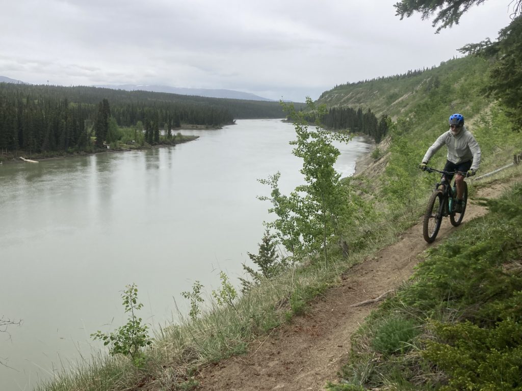
Whitehorse itself is a busy place; it’s the capital of the Yukon province and has something along the lines of 35,000 people, many of whom, we were told, work for “the government.” We weren’t sure if that meant the Yukon government or the Canadian government; if the former, then most folks are practically self-employed, because there are only 42,000 people in the entire province, which is 2.5 times the size of Utah! Regardless, Whitehorse is a nice place right on the banks of the Yukon river with the requisite number of brewpubs, bike shops, bakeries, restaurants, and grocery stores, with a blessedly-small airport. No Uber or Lyft to get around, but the taxi service is cheap and mellow and we were able to walk and ride everywhere anyway.
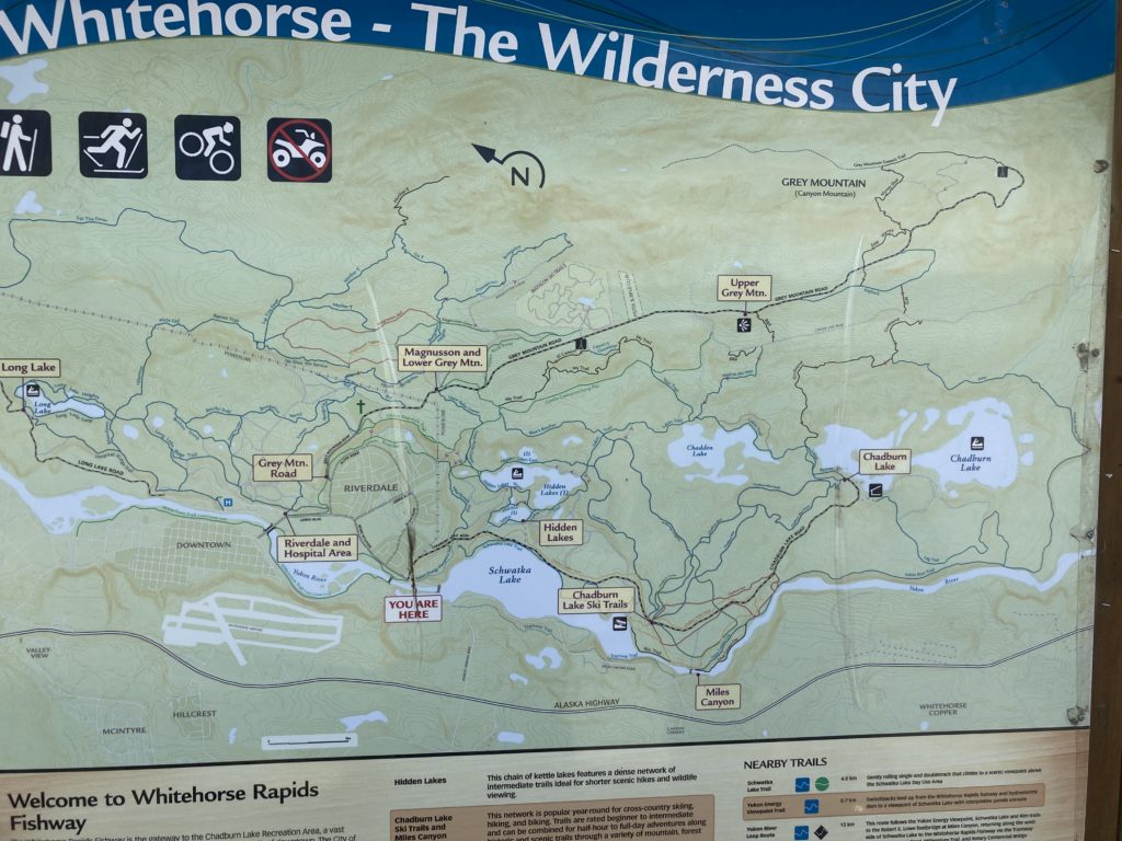
We were able to connect with Theresa, the owner of Tatsenshini Expeditions, whom I met a few years prior on an Alsek river trip; she and her late husband plied our small packraft crew with a full on turkey dinner pretty much made us throw some of our dumb freeze dried meals into the river! Theresa and her friends love Whitehorse; just big enough to be exciting but small enough to be friendly and tight, and the recreation opportunities abound from tons of trails (at our air BnB I realized that a trailhead leading into a pretty vast network was right across the street) and a commensurate nordic ski trail system to decent backcountry skiing and good access to rivers. And it only gets to minus 40 a coupla times a winter!
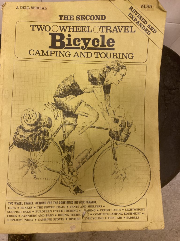
At the shop that rented us the bikes (Cadence; a good place) they had a book that they refused to sell me, even though I offered more than the $4.95 list price:
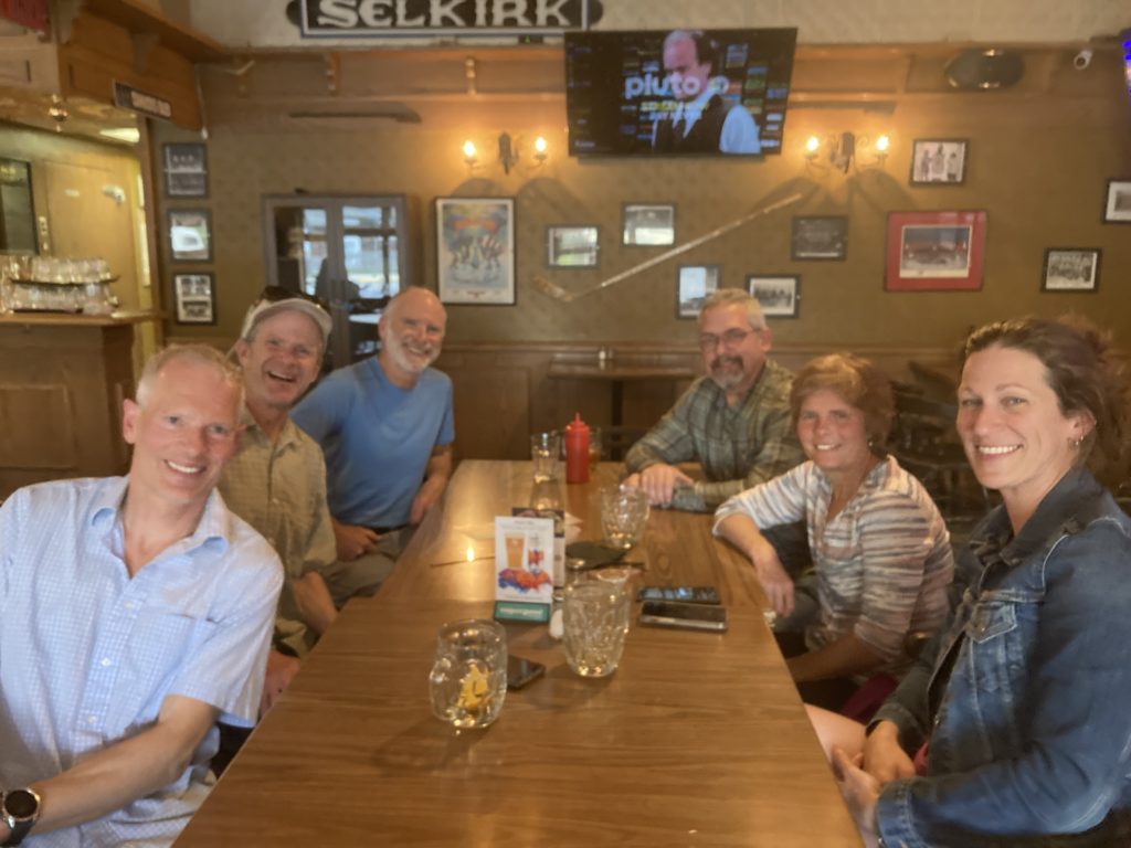
After a coupla days in Whitehorse the rest of our crew – and their gear, fortunately, after a couple of close connections – arrived.
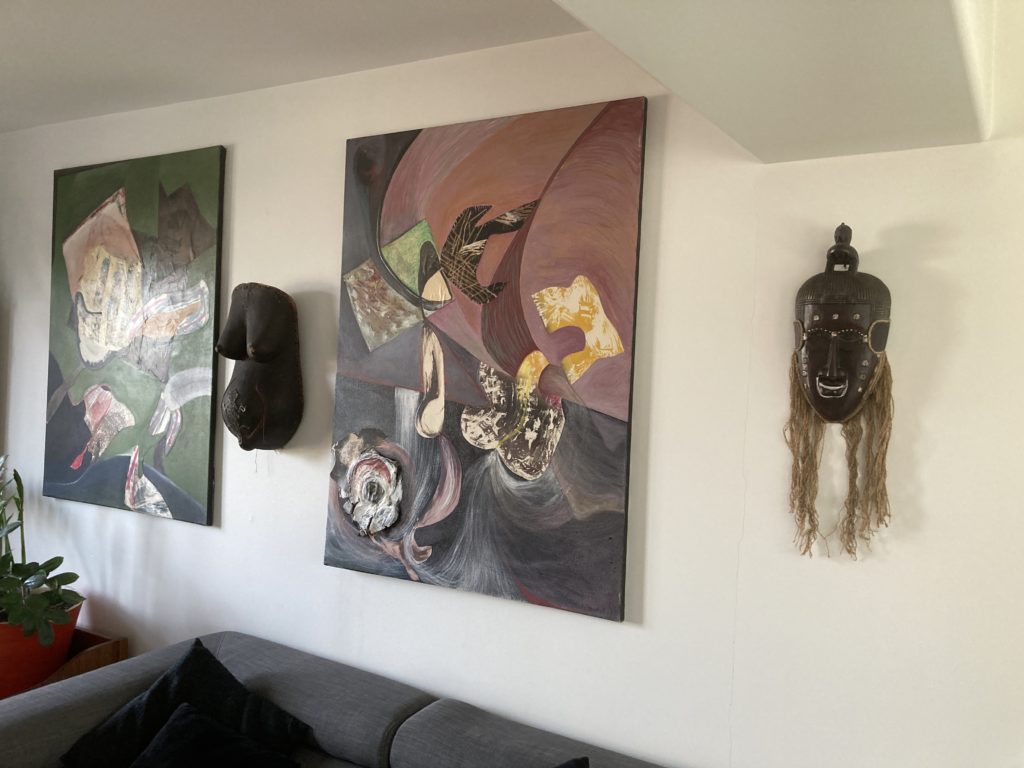
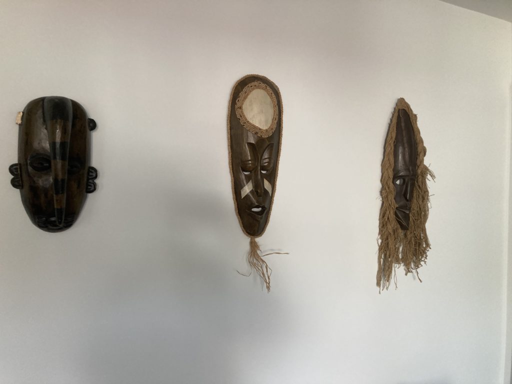
As if to prove that any stereotypes of Canadians are indeed just stereotypes, the owners of our Air BnB were a coupla characters (whom I forgot to take pics of) who had a pretty funky space with cool art:
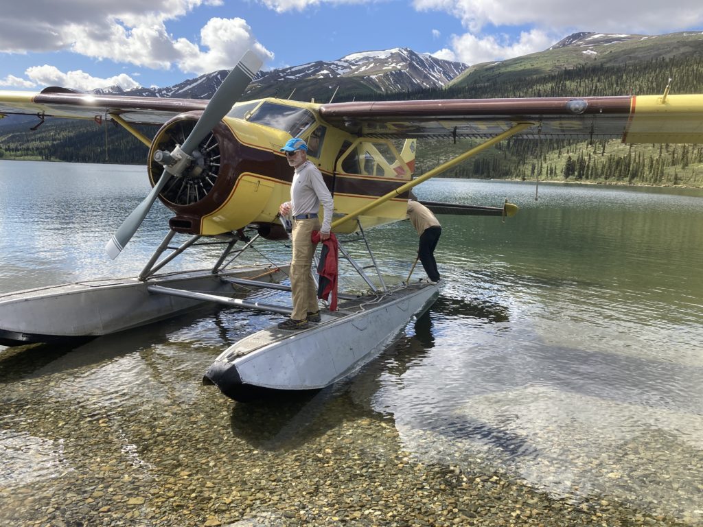
After a bit more nosing around Whitehorse and some shopping and some meals we were off. The first leg of the trip involved driving a van most of a day to a lake seemingly in the middle of nowhere, where Warren, proprietor of Kluane Airways, picked us up in his Beaver:
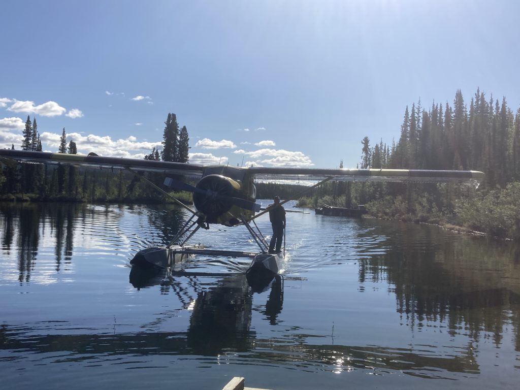
Warren asked where we were from: Salt Lake City was okay, New Hampshire seemed to be fine, as was Cincinnati, but….Seattle! “You must be one of them Biden Lovers!” Ohboy, here we go. Fortunately Warren’s less-opinionated son Sean was our pilot, so we were spared too much conservative diatribes (though he made up for that later!).
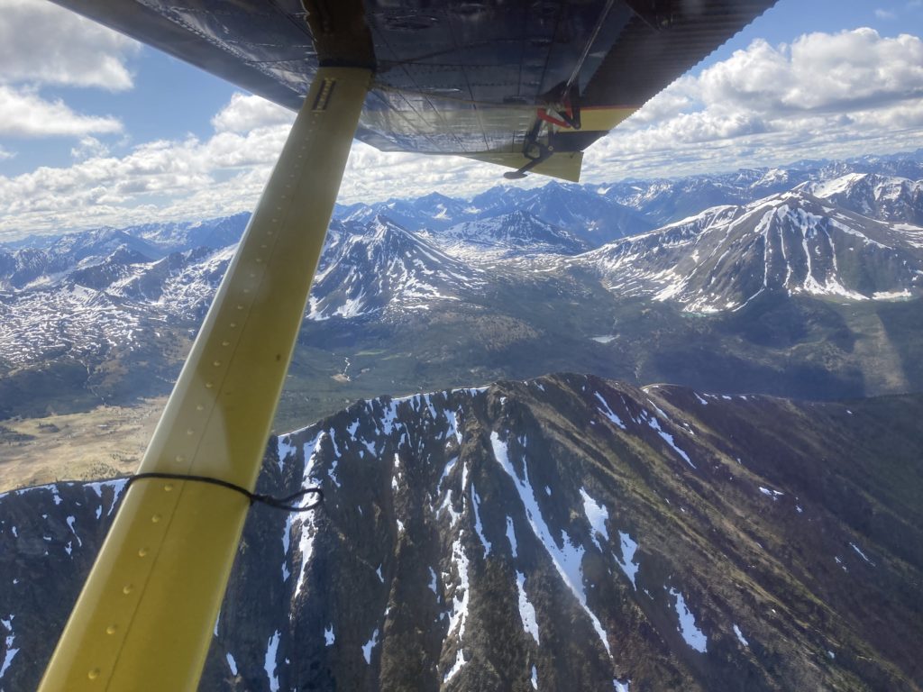
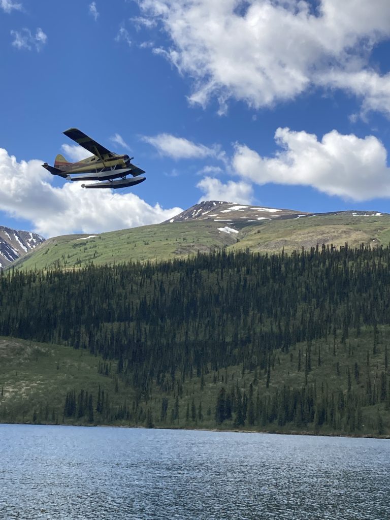
Getting up to a couple thousand feet over the peaks we finally got a sense of the vastness of the parks and the Mackenzie Mountains; while not high, the peaks still laced with ribbons of snow and the deep river valleys in between seemed endless, and we flew over scads of beautiful alpine lakes.
Warren has tenure and boats on 30 different lakes that he flies his clients into for fishing for lake trout; according to him they are pretty good – usually in the 12-15 range. I thought that sounded fine; a 1-1.5 foot trout was indeed impressive, but….”no, 12-15 pounds!” eek. I didn’t know they came that big!
Finally we came to one of the bigger lakes and Sean eased it down onto the water and hit shore at one end, and we threw our gear onto the beach. He waited a bit for us to confirm that we had everything, bid us bon voyage and said “you’re not likely to see many folks” and flew off. I’ve had that sensation a couple of times before when the plane leaves and that’s the last of civilization we’ll see for a while, and that’s when Greg remembered what the Park Service folks told him when he did the final check in with them before we left: “you boys will be the only people in the parks!” Yowza. A zone four times the size of Yellowstone, and we are the ONLY people there! As much as I am a wilderness/backcountry misanthrope, that was both exciting and a little daunting!
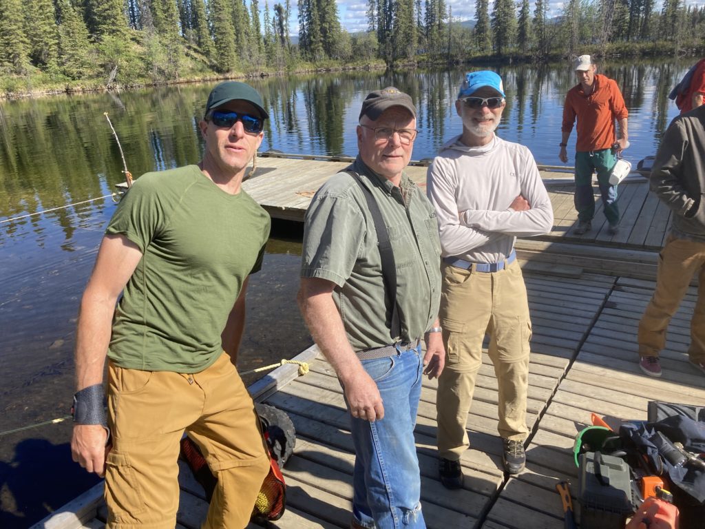
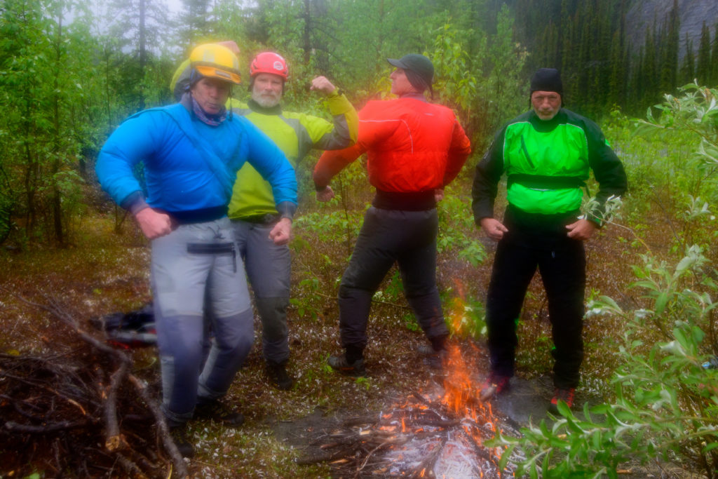
Now it was just us, in this vast expanse of mountains and rivers. But despite the remoteness, we were all quite confident, because we had a great crew:
the trip mastermind and general house of fire outdoor enthusiast Greg Hanlon:
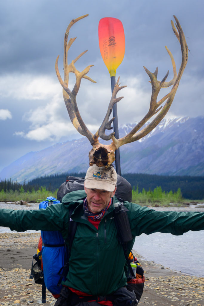
The captain, president and grand poobah of the Cincinnati Packrafting (and canyoneering, and backcountry skiing) societies, Mike Elovitz:
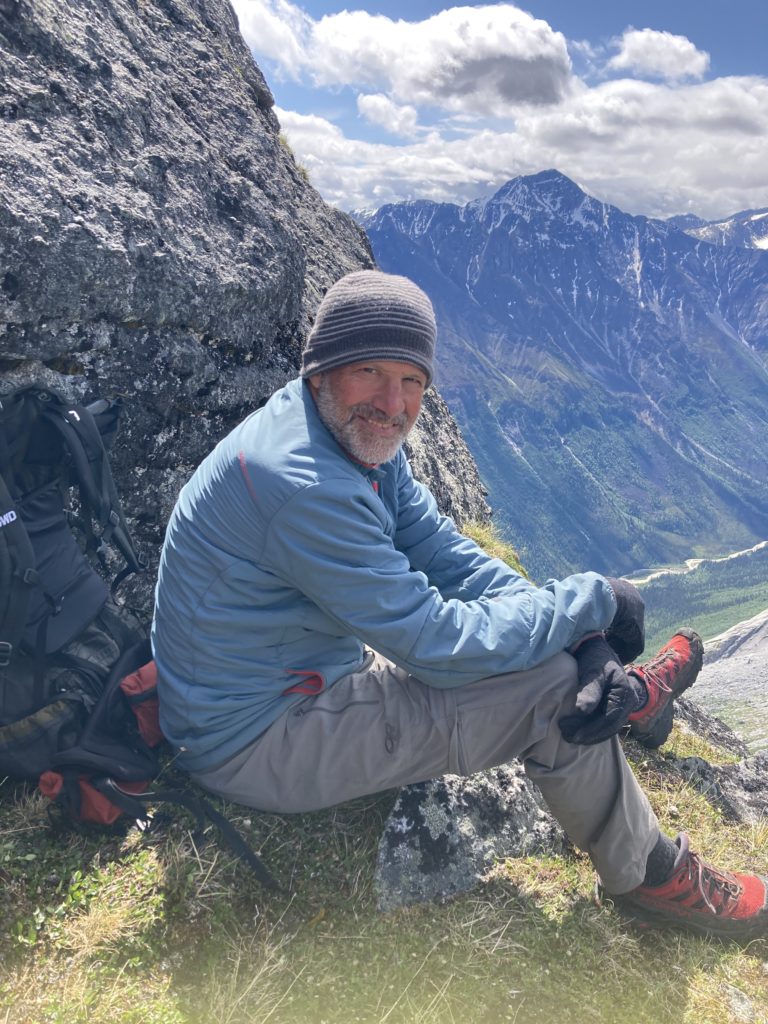
Brother Paul, veteran of many such silly adventures:
And Benj, who is a relatively new addition to this longtime posse, but Benj famously fits in anywhere:
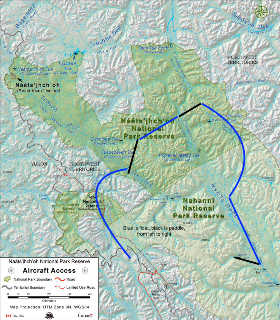
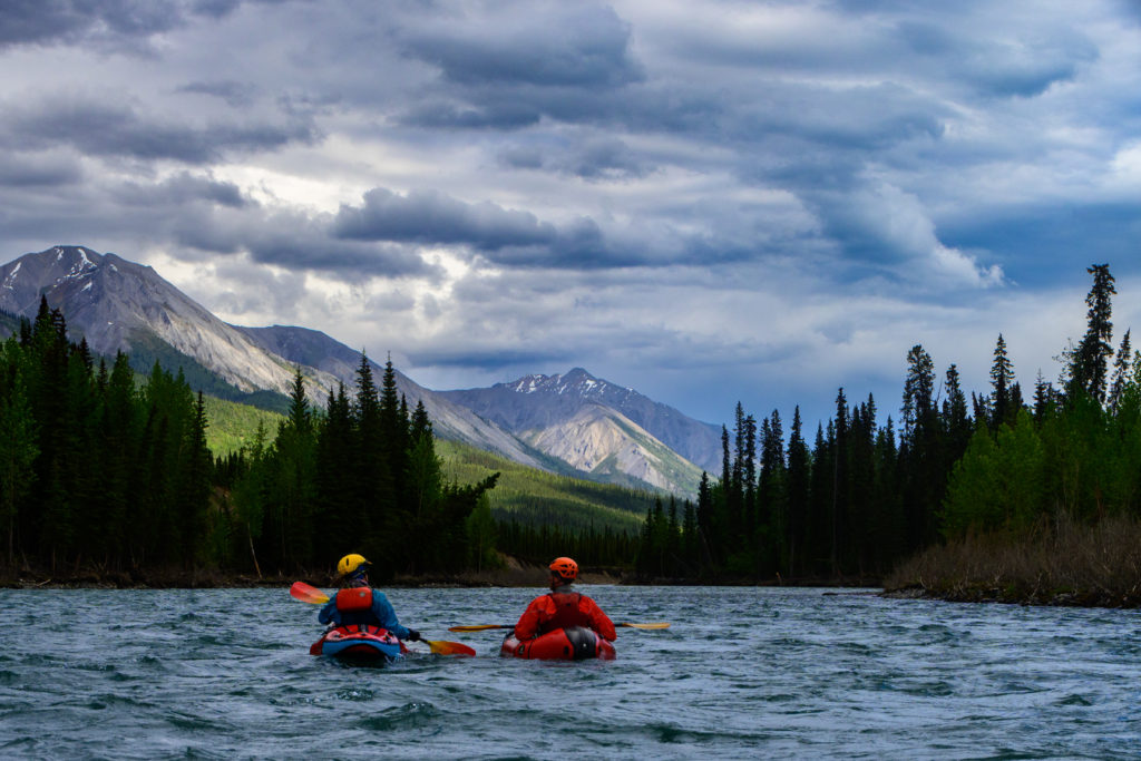
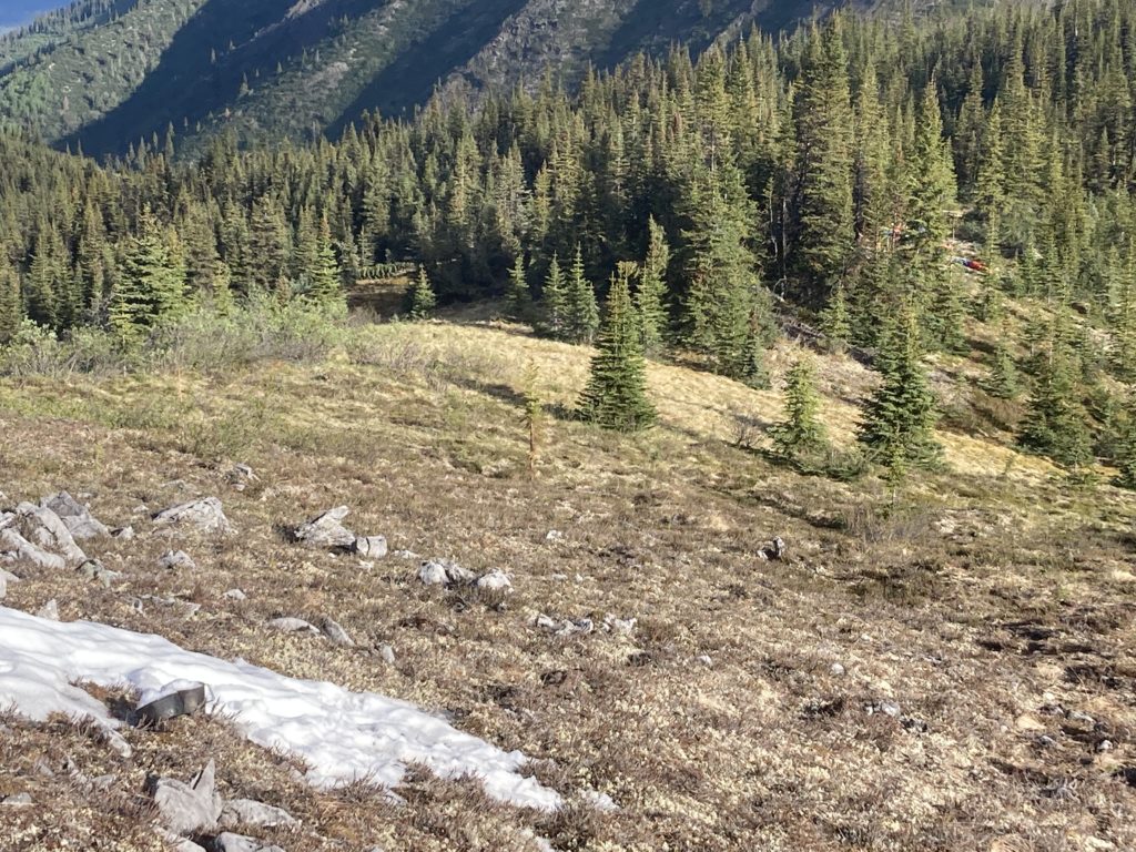
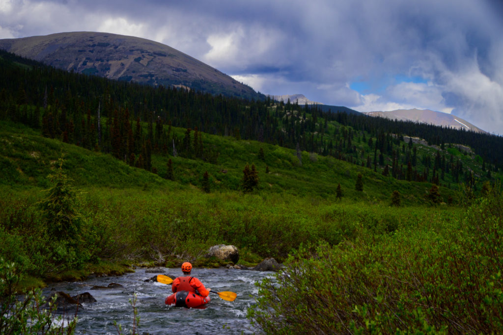
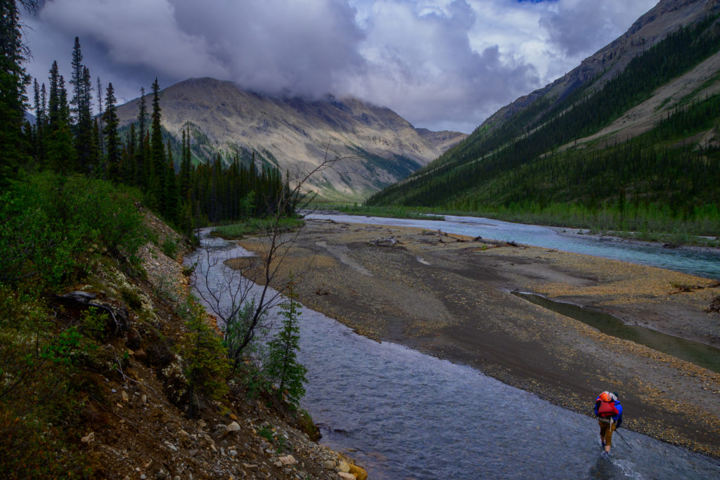
And finally – after at least Greg waited about four years, we are floating. Flat Lake is the source of our first river, the Little Nahanni. Paddling out of the lake was a bit anticlimatic for such a long-anticipated big trip; low flow and very little gradient had us bumping and grinding and even doing a little walking downstream:
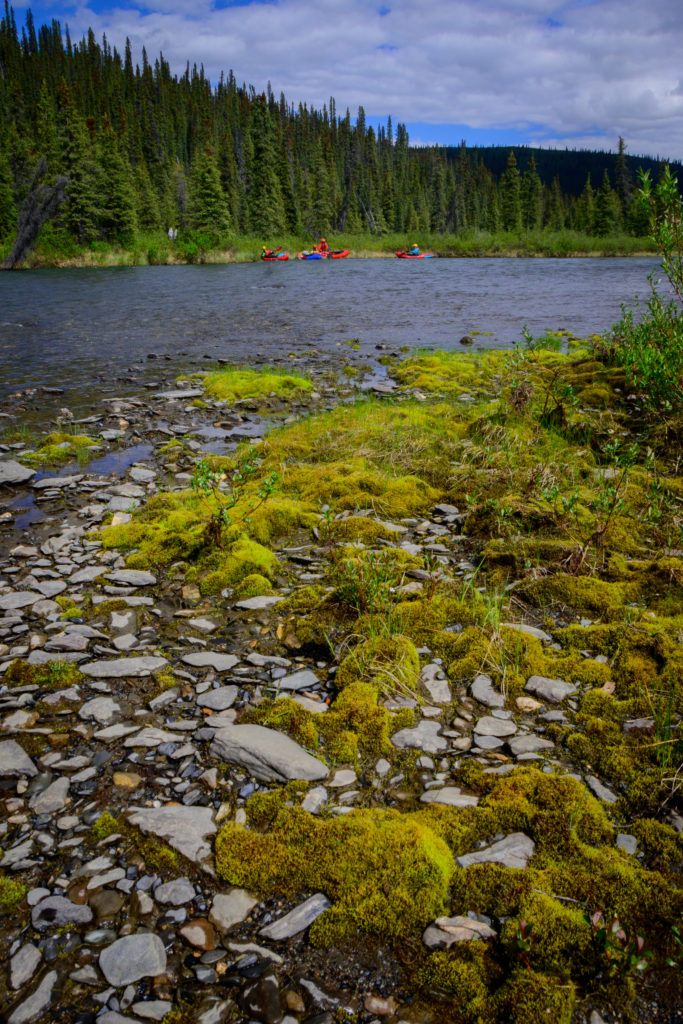
but soon enough a bit o’ gradient and channelizing and we were floating just fine, and as we came to realize, all those mountains and valleys we saw from the plane had water and all of the rivers grow very quickly as you head downriver.
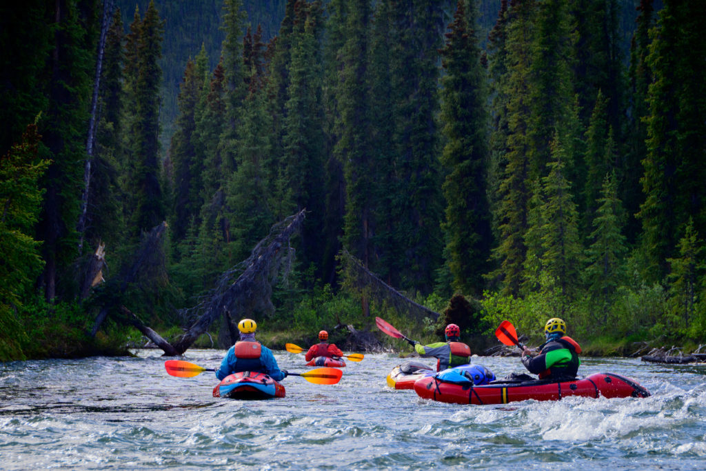
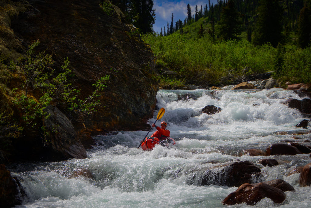
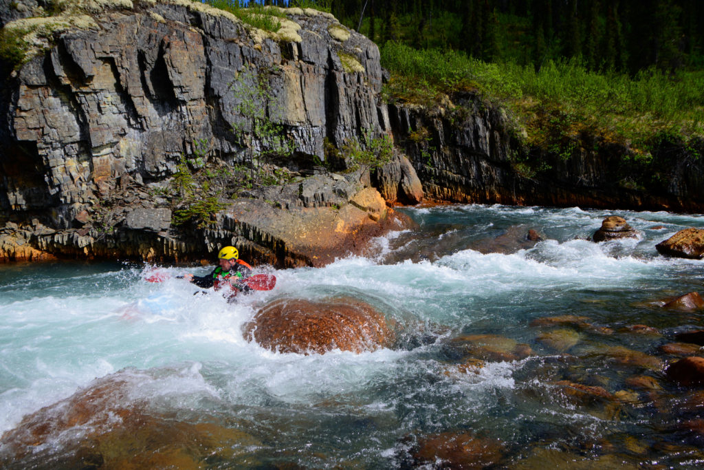
This first river was about 50 miles long and was mostly class 2/3, with one class 4ish drop and another – The Step – that is a fairly straightforward short move, but at the flow we had the move went past a ledge that appeared to be a pretty effective drowning machine, so we took the 30 second portage option.
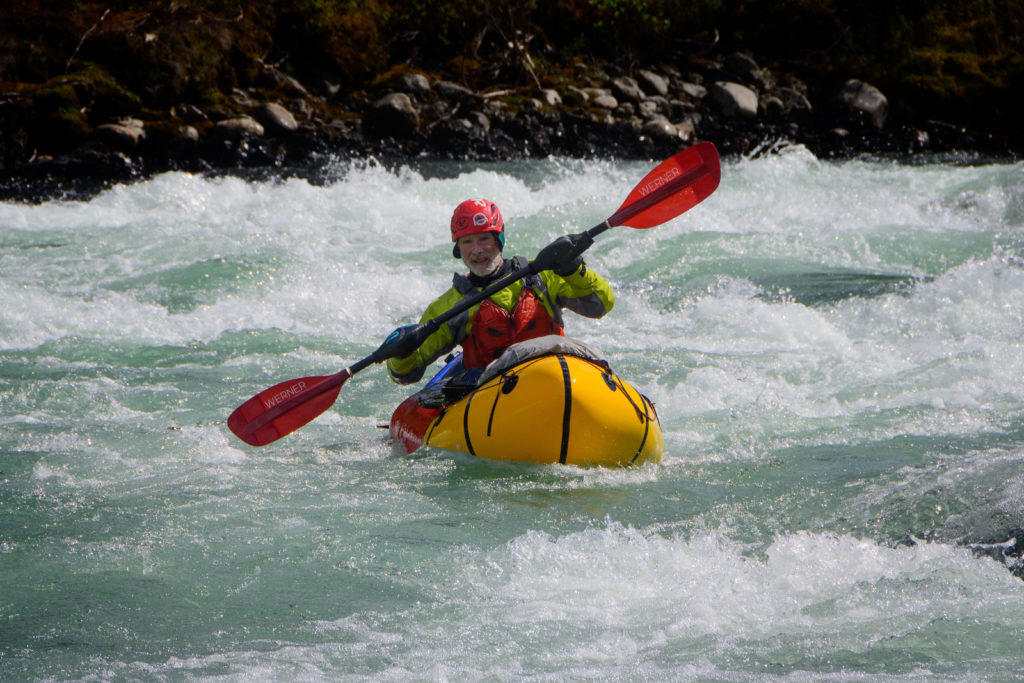
Beyond this the river zipped along, was beautiful, and quite easy:
and as we anticipated we were able to cover the 50 miles in two days. Then came our reckoning….
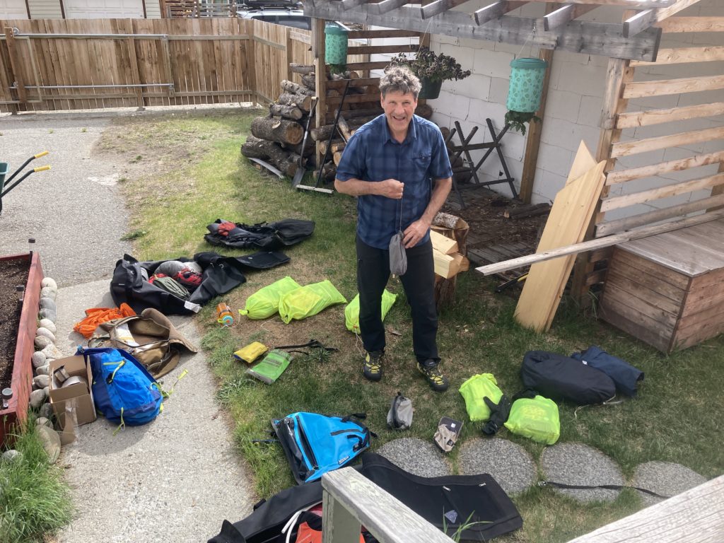
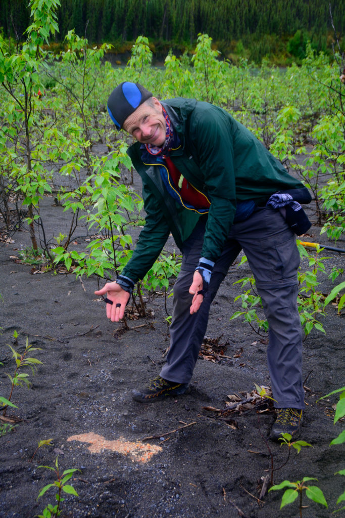
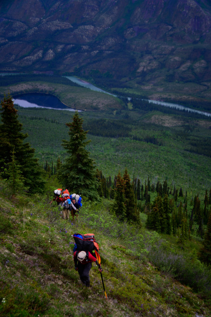
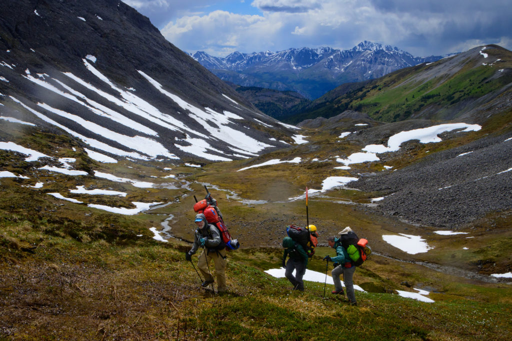
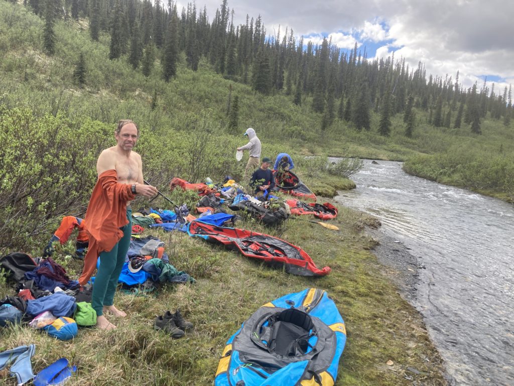
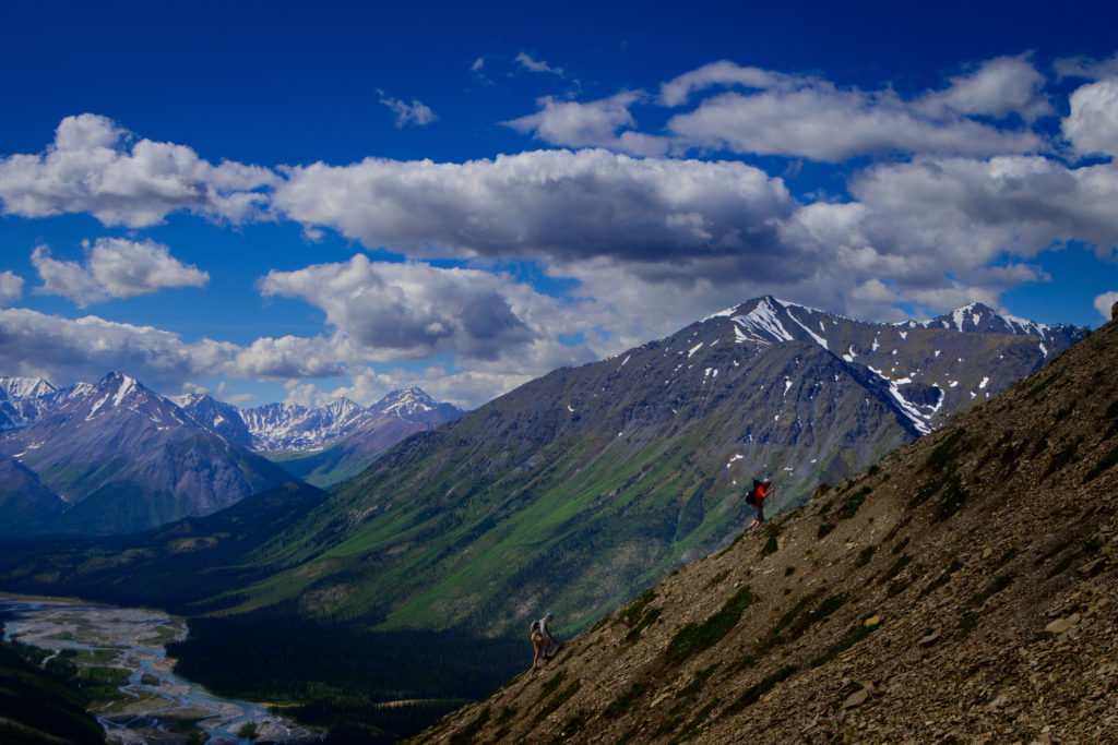
The beauty of wild places is getting deep into them. But getting into them deeply means bringing a lot of food, and while food is good, food is also…heavy. Our total trip was 17 or 18 days, and we were able to give Warren and Sean a couple of bags of food to stash for us for our last 2-3 days, and for our first two days we floated so the boats happily carried us and our food. But once we reached the South Nahanni our route took us off the river and into the mountains over to our next float, so we had a daunting task; carry our camping gear, our boats and all the assorted boating gear, and 25-30 pounds of food up about 4000 feet to a ridge that we were fairly certain would be dry, so we had to carry a day/night’s worth of water as well. And at least we were going to have plenty of solid bushwacking up the first couple of thousand feet until we cleared the treeline. As if to reiterate that point, that morning we had a pretty solid rain that we tried in vain to wait out, talking between tents, but ultimately our itch to move on won out so we packed a fair bit of wet gear into our packs. We helped each other hoist our packs on, and slowly started off through the woods and up the steep hillside that challenged every slow step. Mine felt particularly slow; the night prior I had a meal enhanced by a raw chanterelle mushroom and a tin of oysters; one of those two (likely the one oyster that didn’t quite look like the others) didn’t agree with me and I woke in the midnight twilight scrabbling for the tent zipper before dramatically hurling up my expensive freeze dried dinner; those were useful calories goin’ to waste!
As we labored steeply upward through the alders we didn’t really intend to take turns leading through the bush, but invariably the leader would make a fateful zig and find himself trapped in a green jail, which necessitated a turnabout while the next person who was able to would take the alternate behind would zag to find another less-dense way onward and upward. And when there was a brief opening a glance back down towards the river provided a very clear view of our riverside camp, despite having left it hours before.
Our short term goal was an opening in the alders that was a limestone scree field (to pass the time we debated the difference between a “scree field” and a “talus slope”) that was blessedly alder-free but littered with unstable limestone boulders that were nice and sticky, but also razor sharp. I debated pulling on my warm gloves to save my palms from the inevitable stumble and slash.
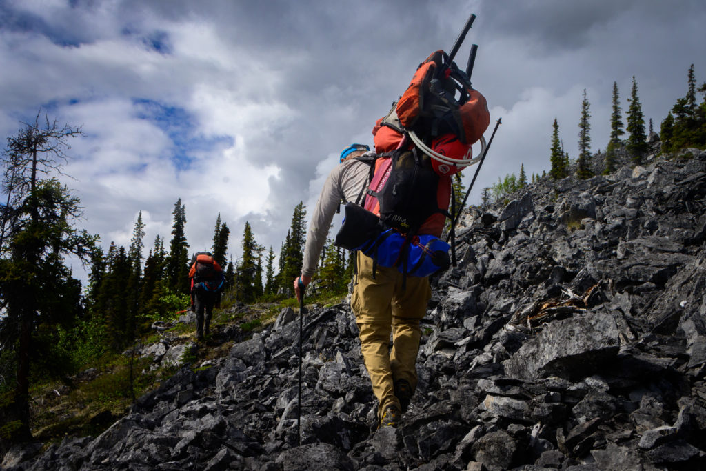
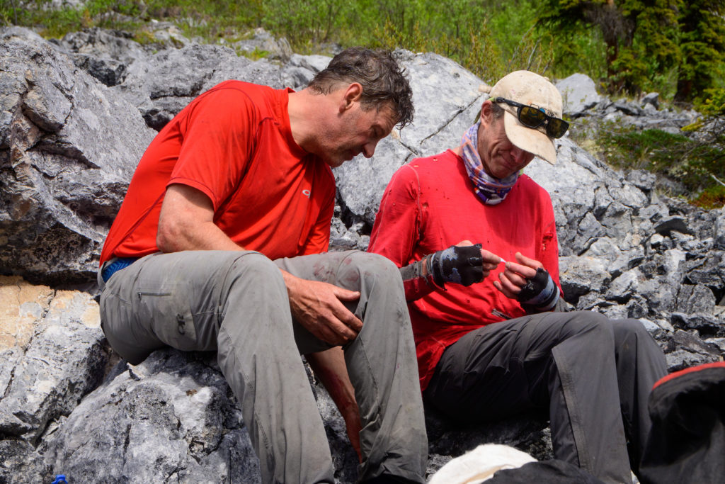
At one point we stopped for a rest, and Mike did a half-sit, half-stand with his pack still on but supported on a big boulder. But supported on a relatively small point of the bottom of the pack wasn’t quite fully supported, and without the pressure on the straps on his shoulders the heavy pack succumbed to gravity and rolled off the boulder, taking Mike with it. Suddenly Mike went from a comfy rest to diving downhill into another boulder and was trapped upside down, yowling in pain and fright. We quickly wrestled him out of the pack straps and were able to get him up, and though he remarkably was not slashed by the spiked limestone, his shoulder was in a bad way. Mike has played a lotta hockey and a lotta ultimate and broken more than a couple of bones, and he was in pain, and having experienced the extraordinary pain of both a shoulder separation and a dislocation myself I knew this could be a bad deal. However, fortunately neither of those injuries were evident, so it was likely a “sprain” of this extraordinarily sensitive and complex joint. But how bad? Could he carry a pack? Could he paddle? But after a bit of rest to quell the nausea and a bit of Mike’s standard self-flagellation, we helped him get his pack on, which seemed to be tolerable, and onward and upward we climbed, again over the sharp, unstable rocks, hoping that it would work. Being Mike – and having plenty of ibuprofen and Tylenol – it did.
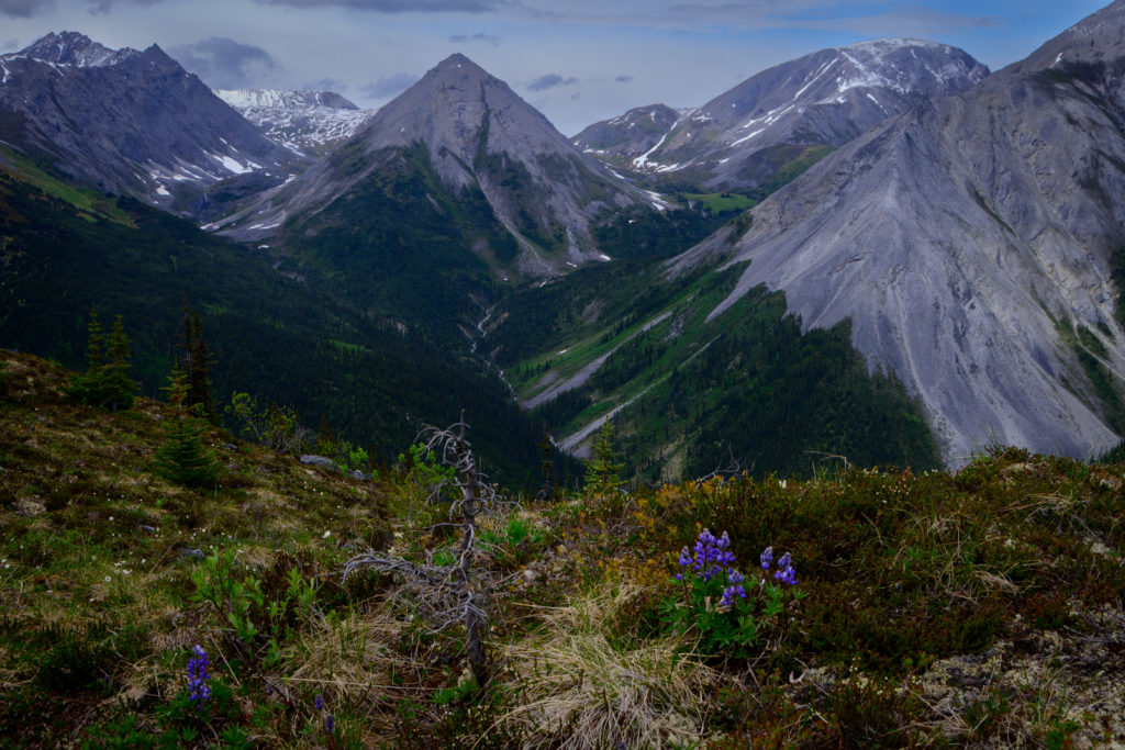
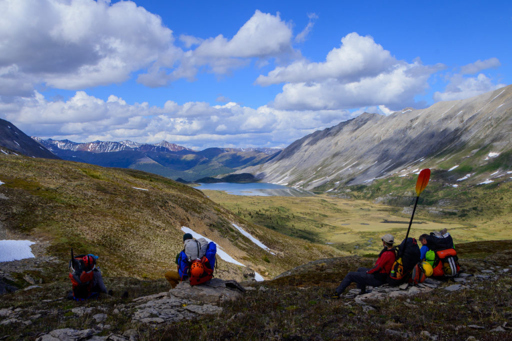
We finally gained the ridge and were able to gaze into the valleys beyond.
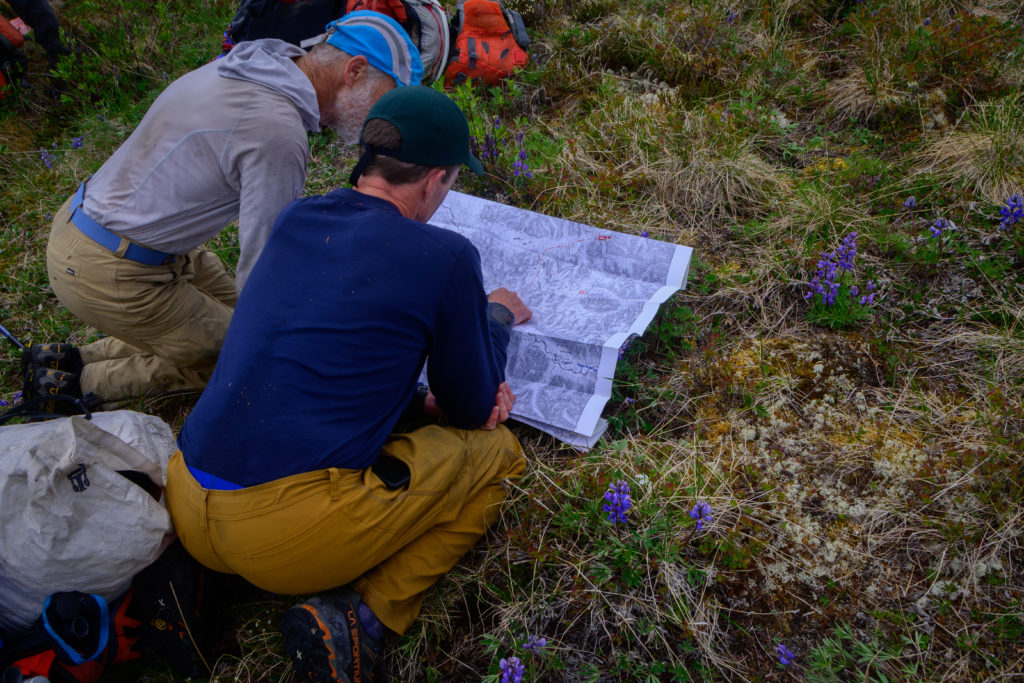
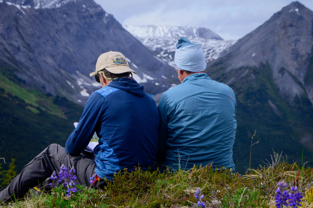
A long session with maps ensued trying to figure out where go:
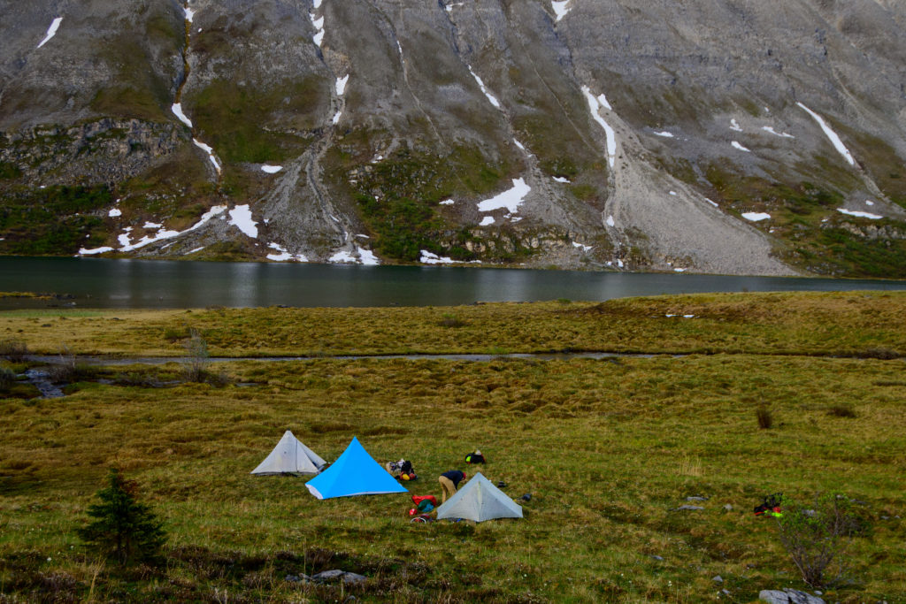
and while the gang did that I sniffed around a bit on the ridge looking for one of those rare mountain/ridge top springs or even a flat place to camp, and found neither. We had taken so long to attain the ridge and were so blown that covering enough ground to get to water seemed unrealistic, but after agreeing on a direction and shrugging, struggling to get the packs back on, and traversing the ridge for a few minutes we came upon not only a nice flat zone for camp but also a nearby 20×30 foot patch of snow. Camp!
The next morning we continued traversing until we grew wearing of ankle-tweaking side-hilling with our great loads, and mercifully started zigzagging down into the drainage to just walk up it, heading for the obvious pass we had to attain.
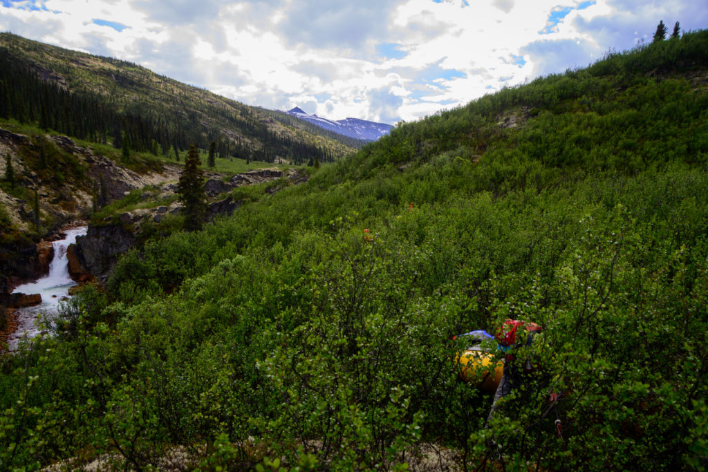
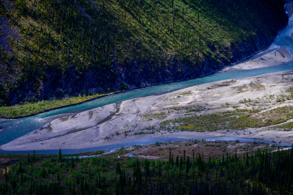
From that lake drained a steep creek, which in turn ultimately met another and became our unnamed river (or was it named “Unnamed River?” Another good one to debate as we marched). We found a nice camp in the ‘tweener zone between tussocks and swamp near the lakeshore and the rocky lower slopes of the mountain looming above
and looked forward to a relatively short hike the next morning before blessedly putting our loads back into our boats and letting air and water “shoulder” the weight!
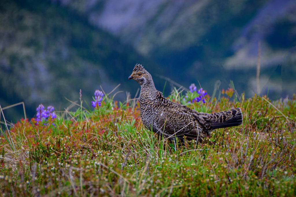
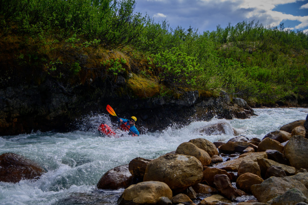
It was yet again another example of the wildness of the area that a river that had a fairly large drainage area and ultimately had probably 1000 cfs – more than almost any river in Utah except the Green and the Colorado -was never so recognized as to even deserve being named! But it was a nice little river that whisked us down through fun class 2-3 rapids and provided a habitat for our first wildlife sightings; a couple of monstrous bull mooses. They trotted away as we approached, and even though we Utahns and New Hampshirites get to see a fair number of moose, in keeping with the scale of the landscape the moose up there seem extraordinarily huge! Must be something in the grass or lichen in those swamps.
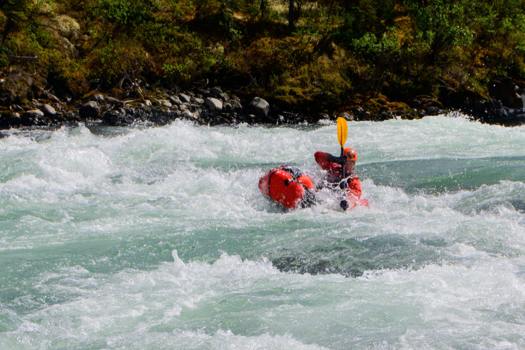
We had some fun whitewater:
And had a good reunion with our pals the alder thickets on a healthy portage:

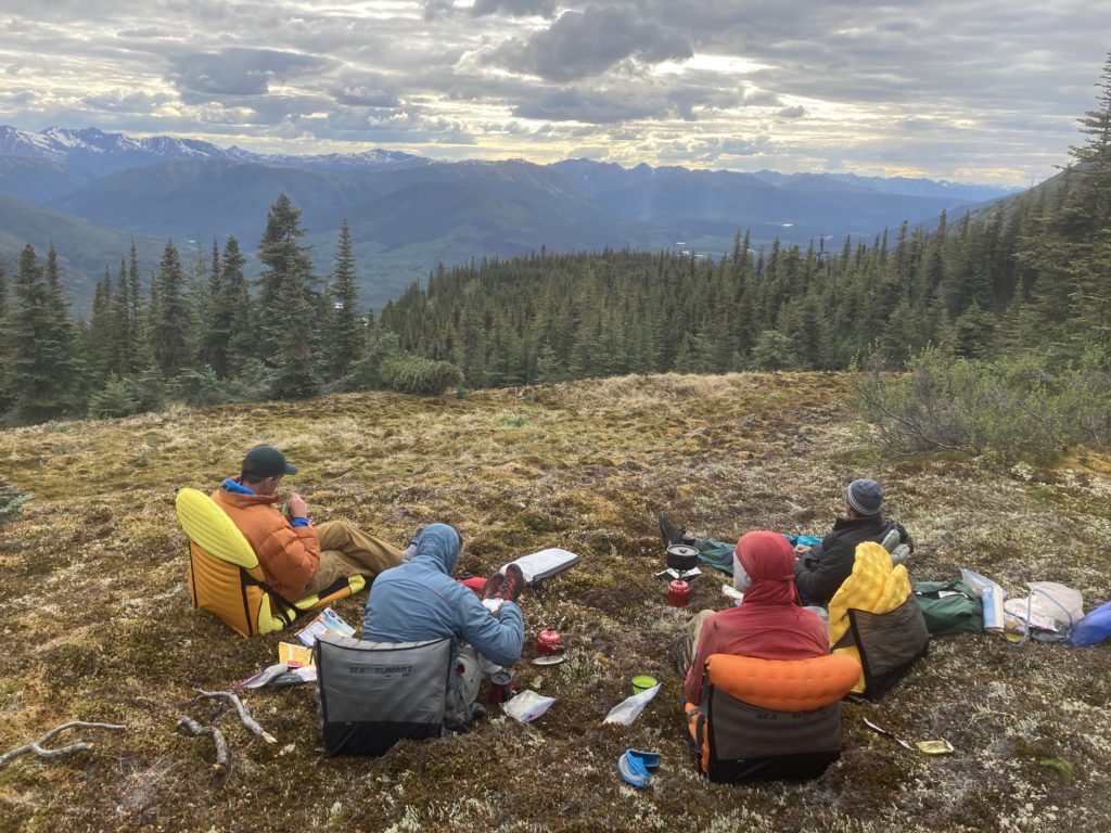
Thanks to the modern power of technology, we had checked in via our InReach gizmo with our old pal, weatherman Larry Dunn about our weather, and he had been remarkably accurate. As we approached the Broken Skull there was apparently a large storm passing mostly to the south of us and we were on the edge of it, which meant we were still going to get hit somewhat by a “relatively short-lived, but well-organized and quite cool” system. Sure enough, as we floated down to the Broken Skull a mild mist became a steady rain, and “cool” it was. At the confluence we were all quite cold and the prospect of rigging for hiking in the cold steady rain was disheartening at best, so we rallied up a big fire, gave our dry suits plenty of air volume to both dry our damp clothes underneath and in turn warm us up, we did a civilized hot lunch, and sure enough, shivering turned to smile, which in turn made the rain stop, and we had a nice transition back to hike mode.
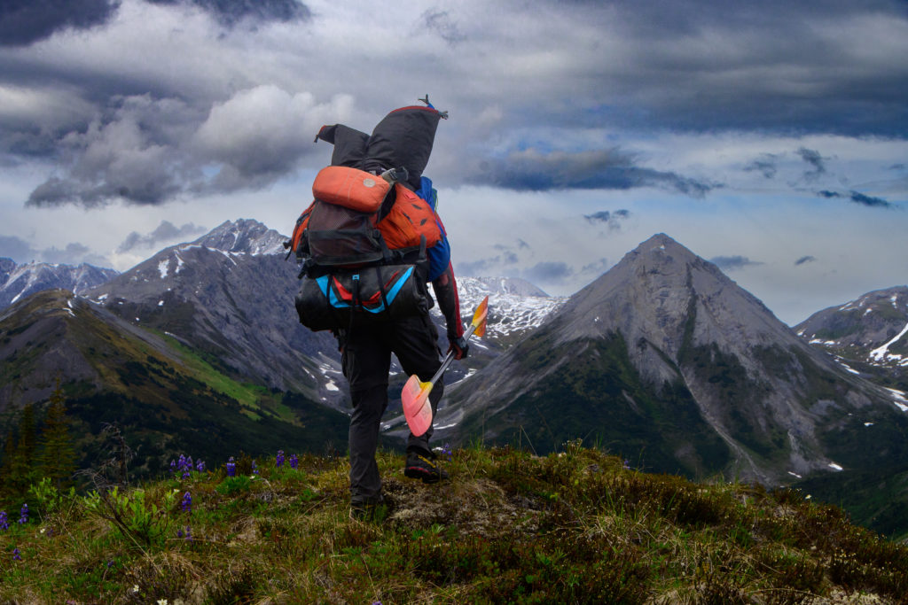
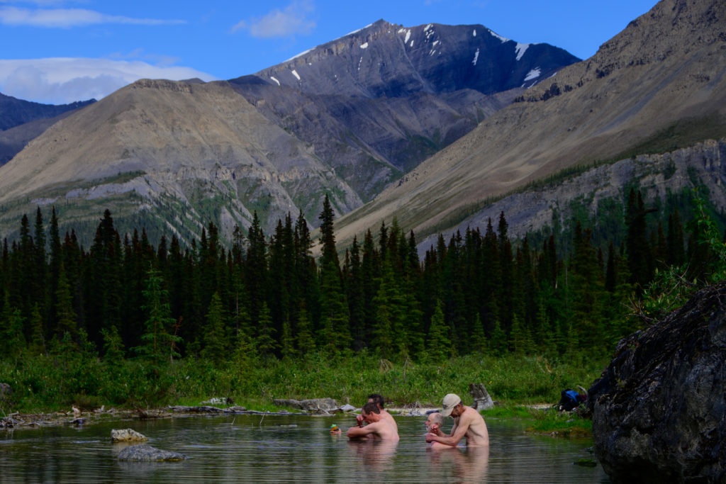
Broken Skull river trips typically begin with a flight into its source: Divide Lake. Greg’s research on the area indicated bare mountains and continuous ridgelines on the west side of the river, and the plan was to ascend the first ridge and then gallivant along it for as far as we could before dropping down to the river and floating back along the Broken Skull. Leaving the confluence with the Unnamed River we couldn’t quite see what this would entail, but in order to get past the short gorge above the confluence we had another steep climb and and over a relative nob before dropping back down to a flat, easy-traveling braided section of river. However, cresting the little nob gave us the full view of the ridge that Greg had in mind, and it was daunting; as he put it, “this is where Google Earth sometimes doesn’t tell the whole story!” We were looking at a 4000 foot climb up slopes that looked like they’d be great skiing to a barren ridge that we would be following for possibly up to 20 miles, there were no snow patches in sight, and with the previous hard climb/ridge hike still fresh in our minds, it was clear that part of the trip was not going to happen. But going up through the flat braided section meant getting to a hot spring, and – to really confirm that we didn’t want to haul our gear up there – hiking up one of the ridges as a day hike seemed like a good option. So a few easy miles later we dropped our packs at a nice riverside campsite,
bushwacked a mile to a beautiful and comfy hot spring
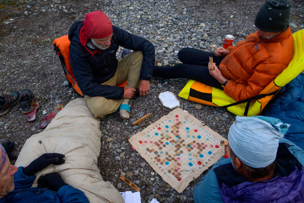
and after a pleasant night (that was another stage in the Nahannni Scrabble Tourney)
we scrambled most of the way – about 3000 feet – up the ridge, and all of us agreed that was challenging enough as it was carrying water bottles and snickers bars.
Part of the appeal of this trip was that there were lots of options for adventures, and by forsaking the Broken Skull upriver jaunt we were adding more time for other options that lay downstream, as well as whetting our appetites for a future, more “normal” trip down the Broken Skull.
But we still had plenty of miles to hike and paddle with lots of adventuring to do, so we carried on with this trip. To be continued….
Tinned oysters? That will teach you! Some valuable calories on the ground there! Love the part where Google Earth doesn’t quite “tell the whole story”. This is an amazing trip. Looking forward to next installment(s).
INCREDIBLE!!!! You are a tough group of hombres… impressive !!!!!! Fabulous pictures and story!!!!! Will
Beautiful country and trip! I do know the resistance feeling of trying to hike through the brush in those parts. [Also, I hope you didn’t harvest and eat a mushroom in the wild – a friend of mine (Peter Dayton) just died from eating false morels along the Green River (Utah)].
Dream trip! Awesome stuff. And love the pics and story. And I can’t wait for the rest.
So good. Amazing Tom. Thanks
[…] Here is the remainder of the tale of our Nahanni packraft adventure; part I is here. […]
I’ve done similar trips. Check out the Upper Coal. When I got back from that and described it to a friend he said”You call that a fuckin’ vacation?”
Wow! What an incredible adventure. Makes sailing seem civilized!
Thanks for passing along the link, Paul. The adventures continue!
Curious on the dates of the trip. Pretty interested in a trip in the Black Wolf or Flat diem and through Virgina Falls. Your flows look in the ballpark of what I’d want for the harder whitewater. Care to share?
hi David – you caught me at a good moment. our trip was from 6/11-27, on the black wolf 6/21-23 ish. we had what we thought was medium to low flows, but apparently right after we left a big rain event popped them up pretty big!
[…] year a crew of us were able to do what we felt was one of our “best trips ever” (mostly due to only having short term memories!) in the Nahanni region of northwestern […]