Like a lot of the Western states, Oregon has not only a lot of backcountry but also a lot of logging roads and trails criss-crossing its forests and mountains. It also has a vast desert in the rain-shadowed terrain east of the Cascade mountains, and in 2013, inspired by the Great Divide Route, Oregon bikepacking fans created the “Oregon Outback” trail that runs the length of the state on gravel roads (75%) and paved roads (24%) that has since enjoyed plenty of use. However, within a couple of years the organizers – inspired by more trail-oriented routes like the Colorado Trail and the Arizona Trail and the fact that people were actually riding a lot of singletrack with gear – decided to put in an ambitious route linking up not just remote backcountry roads but also rideable trails, and do so through the heart of the Cascades that run the length of the state. It took a few years and a lot of work by dedicated volunteers, but over the last couple of years the Oregon Timber Trail has already become an iconic route.
I grew up in verdant Portland, Oregon and my wife Ashley grew up in the arid wine, fruit, and hops country of Yakima, Washington, so we both have a penchant for the great Pacific Northwest, and have found ourselves there annually to not only visit family and friends but also ski the iconic volcanoes, paddle the cold, crystalline rivers, and ride tons of high quality singletrack. All of those singletrack rides were on day trips, but in the meantime we we did a lot of road and easy gravel touring in Utah and other states. Over time it started to sink in that our views of viable bicycle touring was changing along with the activity by doing more rugged desert backcountry tours and nibbling at a few singletrack trails with gear. Finally last fall we tackled a 300 mile section of the rugged and arid Arizona Trail that features a lot of challenging trails in full bikepacking style (basically, no racks/panniers and on “real” mountain bikes), and as another summer trip to the PNW loomed it was pretty much a given that we had to try a chunk of the comparable Oregon Timber Trail. Spearheaded by a mountain bike enthusiast bikepacker named Gabe Tiller who hails from the unlikely town of Mill City (profiled in the great podcast “Timber Wars”, about the long history of logging in the PNW) the nascent non-profit “Oregon Timber Trail Association” rallied a bunch of Gabe’s pals to create a route that is not only twice as long as the Oregon Outback at 680 miles that are 98% off-pavement, a full three-quarters of it is on trails, and it sports a quad-burning 70,000 feet of vertical! We had to give it a go.
The OTT is described as comprising four distinct tiers, with the first couple in the southern “basin and range” country east of the Cascades, and the northern tiers start in the middle of the state and for the “Mount Hood Tier” the trail transitions over the crest into the famous greenery of huge Douglas Fir forests. It was in this transition from high desert to sub-alpine that we decided to hook into, the route, so from Hood River we were able to find a shuttle guy (via the OTT website) who – for a couple hundred bucks – agreed to drive us from Hood River a few hours south to the endearing tourist town of Sisters, nestled in pine forests at the base of the Three Sisters peaks. Our shuttle driver was a chatty guy from Portland who just loves all things bicycle and bikepacking, and with his sprinter van he decided to do a shuttle business, which he said lately means “oh, two or maybe three trips a year!” We hoped he wasn’t counting on that to be his long term business plan. After he dropped us off we of course realized that we needed a bike shop for a couple of things, and fortunately even in small Sisters there are two very helpful shops.
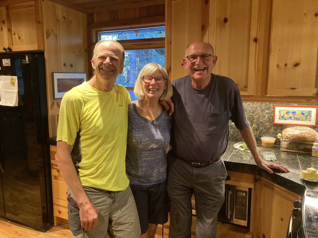
We were directed to great singletrack starting right on the edge of town by a shop employee who uses it as his daily commute, and the trail parallels the busy highway for about 15 miles to the lovely hamlet of Camp Sherman, where a great little store is quite near the banks of the opaline Metolius river where it burbles out of a small hillside, and more importantly is where my dear cousins the Hacketts have a lovely place literally on the banks of the Metolius:
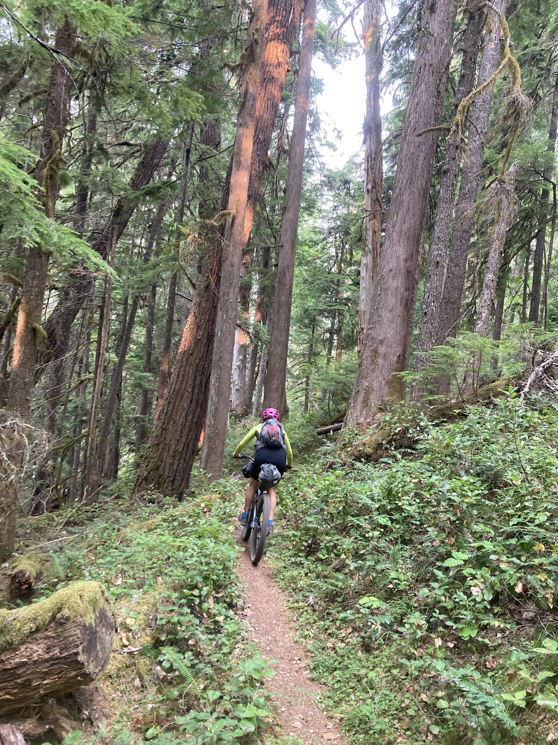
From Camp Sherman another trail paralleling the highway took us to the ever-popular Suttle Lake, where we joined the OTT proper. So far the trails we’d been on were pretty much flat, but that quickly changed at Suttle Lake when we joined the old Santiam Wagon road, which was the historical route over the Cascades in that area. We were prepared for climbing to get over the hills, but we weren’t very prepared for….sand? C’mon, Utah has sand, Arizona has sand, but….the Cascades? Sure enough, there’s sand in them thar hills, though unlike true desert sand it’s finely-ground volcanic pumice.
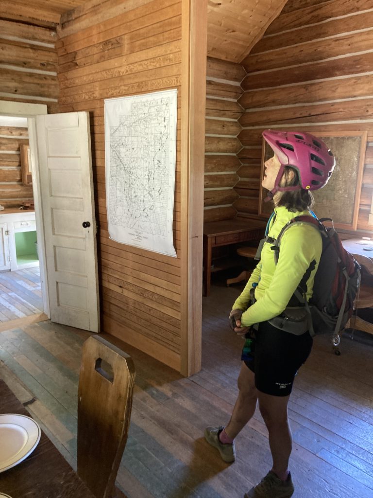
Regardless, it made for some challenging going, which resulted in the first of many pushes on this journey, but soon enough we had ground our way through the sand, the trees started changing from pines to firs, and the ground thankfully hardened up with good dirt. That said, the trail continued to be challenging; we saw a sign for the “Oregon Gravel Grinder” that we later discovered was a race that partially used our route, and it was sort of hard to believe that gravel bikes traveled on the rugged trail that we were on (we later talked to a friend who exclaimed “I was as scared on a bike as I’ve ever been trying to race that section on my gravel bike!”). After a long descent we found ourselves at the trailhead for the iconic McKenzie River trail, a 25 mile long singletrack alongside yet another beautiful river that is an alluring side trip, but we opted to continue on the OTT route the opposite direction, only to get sidetracked by the fascinating Fish Lake Depot; the historical stop for travelers going over the Santiam Wagon road. One of the beauties of bike touring – bikepacking? – is that it usually provides the flexibility and – more importantly – the opportunity to check out obscure little interesting side nuggets that we usually just blow past in the car. In the case of the Fish Lake Depot they had a fascinating history of horse and mule-drawn wagons going over the – sandy! – “road” that we had just ridden over, and there was an account of the first motor vehicle that – barely! – made it over, and a tale of the barracks that housed the firefighters that actually burned down while the firemen were away on forest fire. An enthusiastic volunteer was excited to see us and loved giving us the tour of the restored old buildings and historic equipment and clothes:
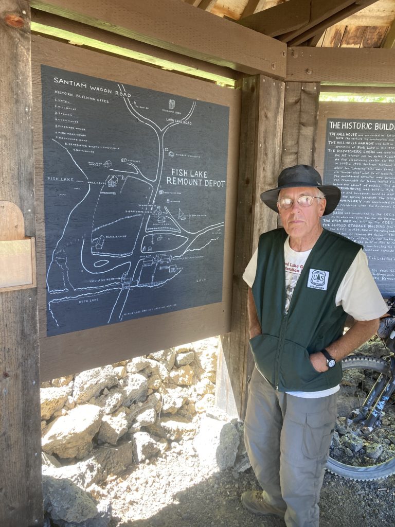
including a switchboard that was the terminus of the hard lines that were strung from the fire lookouts on buttes as many as 10 miles away through old growth forests.
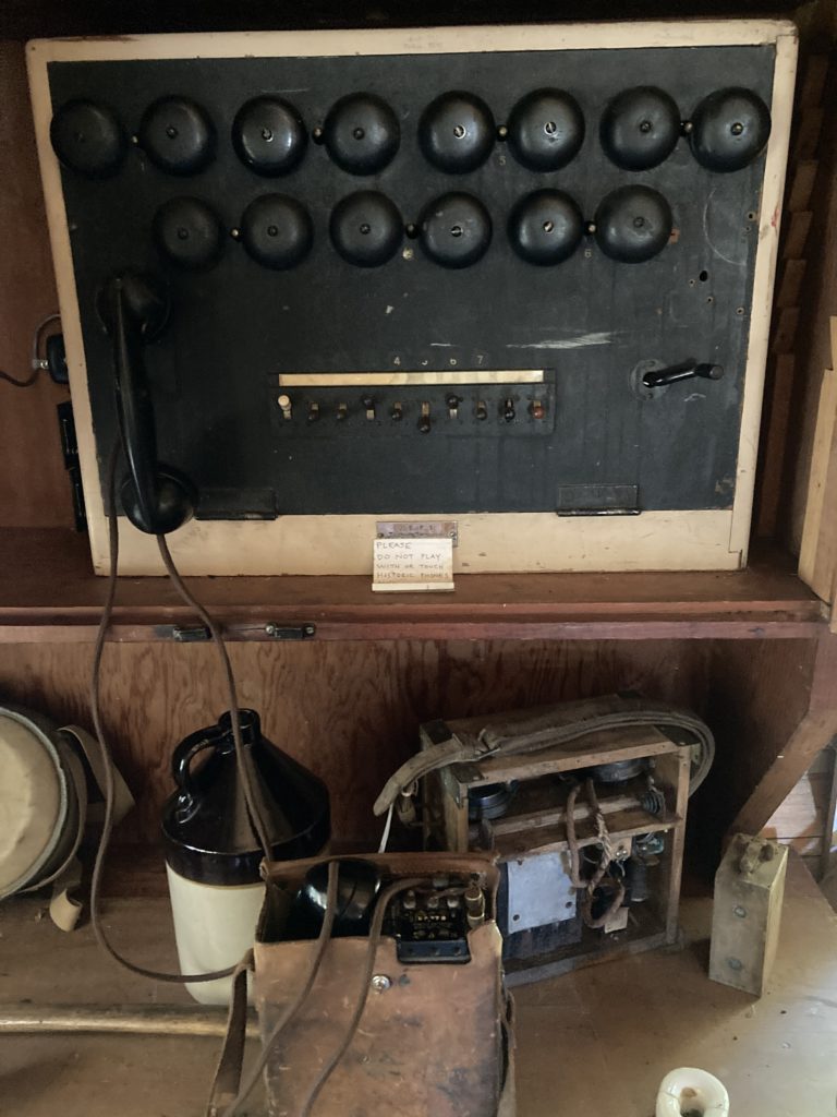
Those were some ambitious folks back in the day.
One of those buttes was Crescent Mountain, which veered off the gravel road on a singletrack that climbs a very respectable 2400 feet in just a few miles of singletrack and is a bit of a hot grinder, but then drops an equal amount and then some on more high quality singletrack that nearly brushes a few different wilderness areas over many miles.
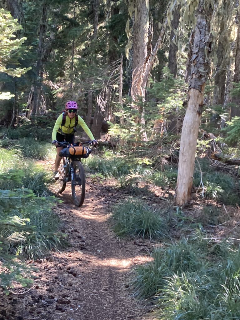
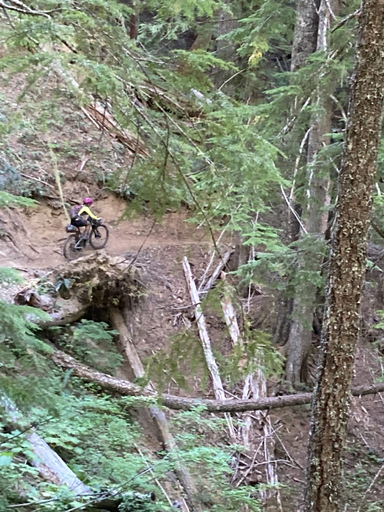
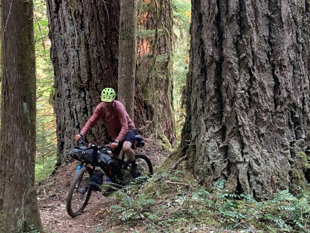
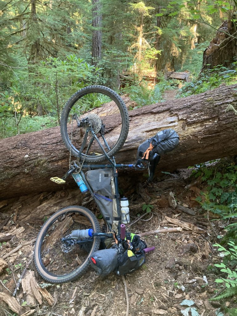
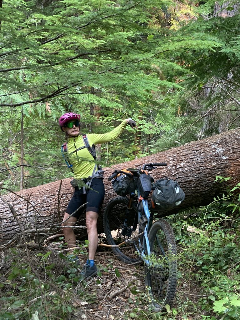
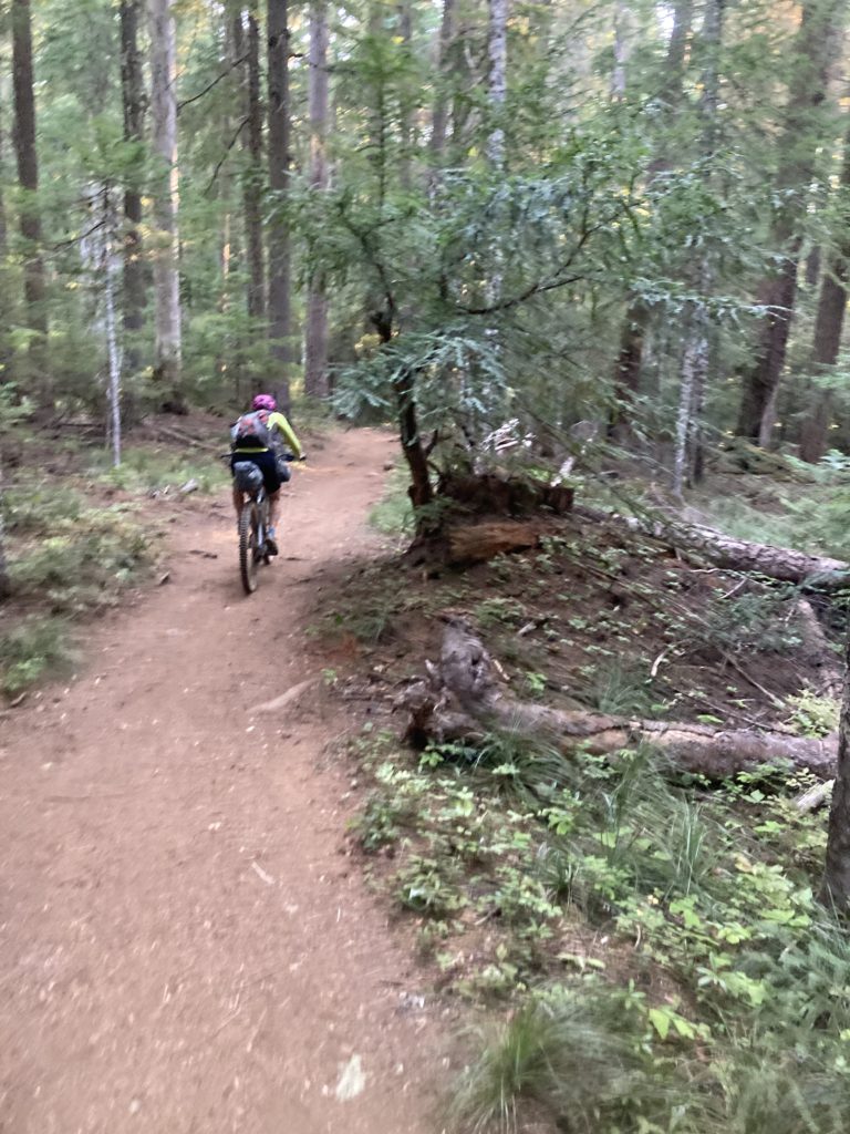
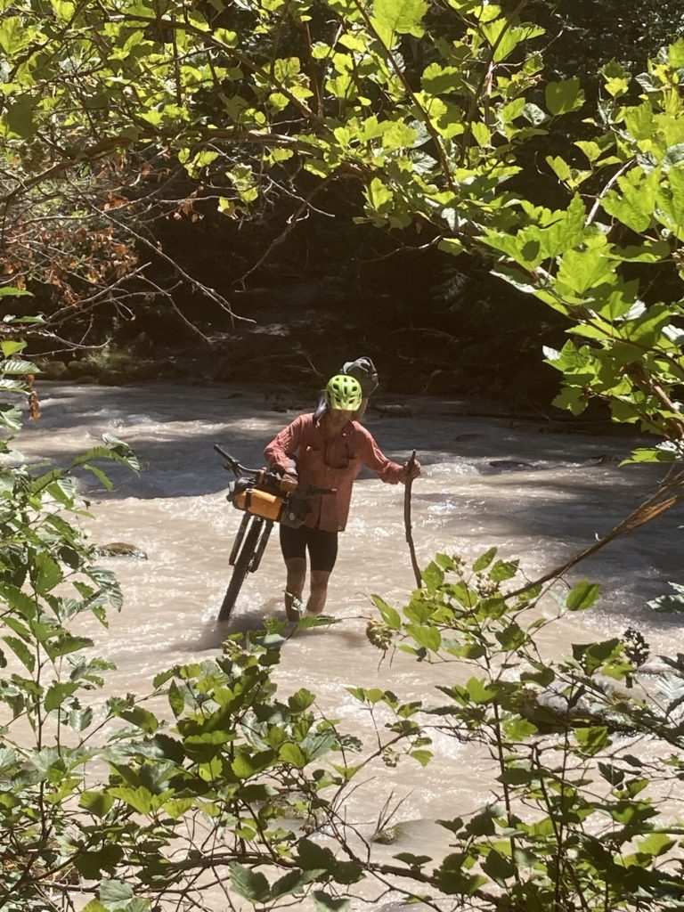
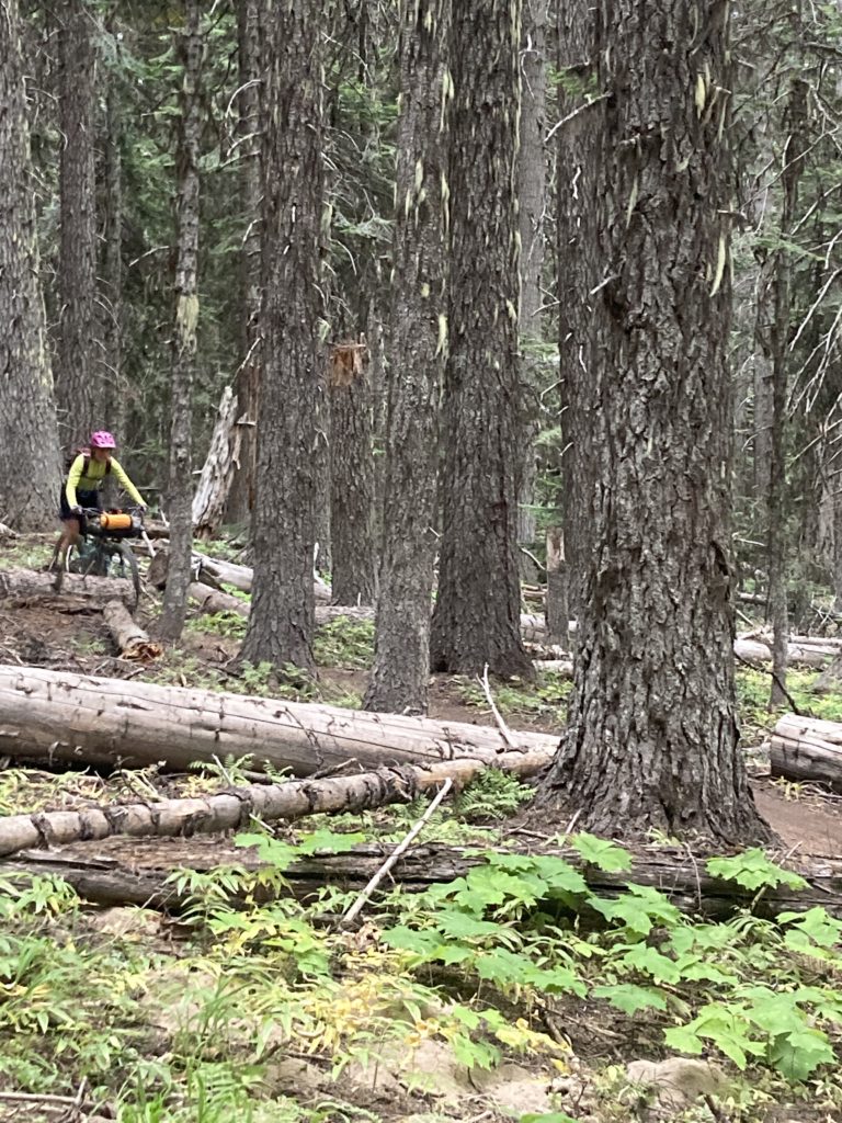
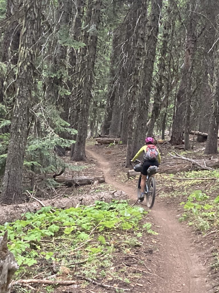
This section from the McKenzie River to the North Santiam River is known as the Cascade Crest, and it’s virtually 100% great singletrack, most of which is actually rideable! However, it feels remote, and while there were bike tracks on these trails and riders had taken saws in to clear the many moderate logs that had recently fallen, it’s clear that the Forest Service hadn’t gotten in there to get out the really big logs that the Northwest is famous for, so we had to engage in a few – but not too many – creative and challenging log-crossings.
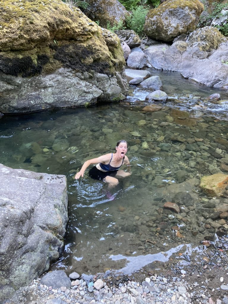
The Northwest – especially the west side – typically has very nice summer weather with little rain and moderate temps, and this summer had been no different with high temps running in the 70’s. However, a few days before arriving we glanced at a weather forecast and were surprised to see a dire warning: “heat wave!” I have had my share of meltdowns on bike tours; I’ve gotten heat exhaustion in a range of very nice hot places: Cuba, Vietnam, Ethiopia, Mexico, Korea, and yes of course southern Utah, and was fairly certain that I was going to add Oregon to that list as the heat blasted us. We descended to our low point for the trip in the little town of Detroit and it felt like an oven; indeed, the temp was over 100 degrees there. But for once I tried to be smart about hydrating and electrolyting, and even though my fingers and hands cramped while braking, my toes cramped inside my shoes, and my calf muscles were twitching like a Jack Russell terrier anticipating a big cramp, I – barely – was able to keep from a full quad/hamstring cramp meltdown throughout the trip. And a great aspect of the PNW is that there is actual water there in the form of rivers and lakes, so we were able to at least splash around in creeks and dive into lakes at the end of each day to wash the layers of salt crust off our bodies and rinse out our stiffened jerseys, and the depressions that hold those creeks and lakes are the coolest places around to camp in, so our nights were tolerably cool.
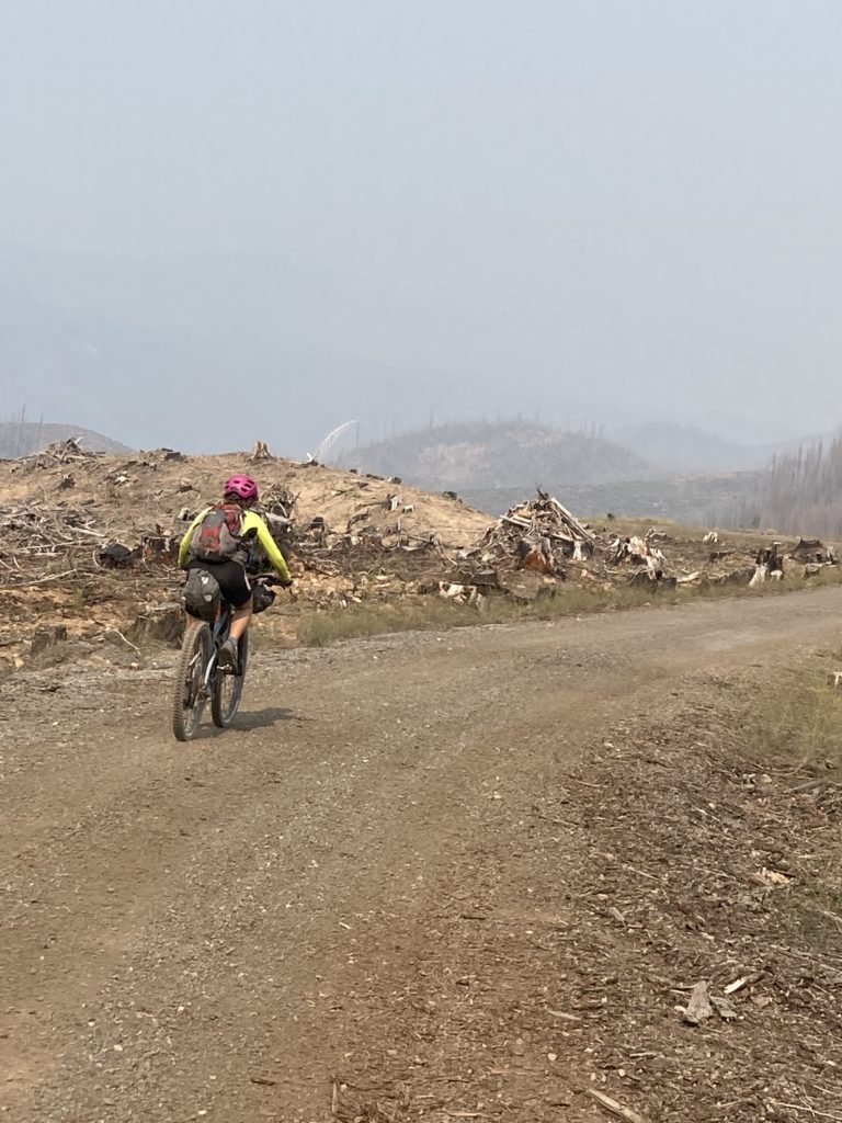
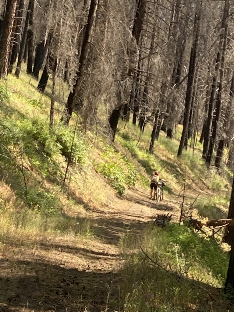
With the heat we had it was easy to understand that even a place as verdant as the Northwest could be so fire-prone, and indeed we had a good view of that; the 2020 fire in that area almost completely destroyed the town of Detroit when three fires converged and burned over million acres, which is over 1500 square miles, and we rode through its blistering moonscape aftermath for over a full day.

As it was, there was also a fire in the hills above the McKenzie river south of us that eventually blew smoke into us and as of early September – a month later – it is still burning.
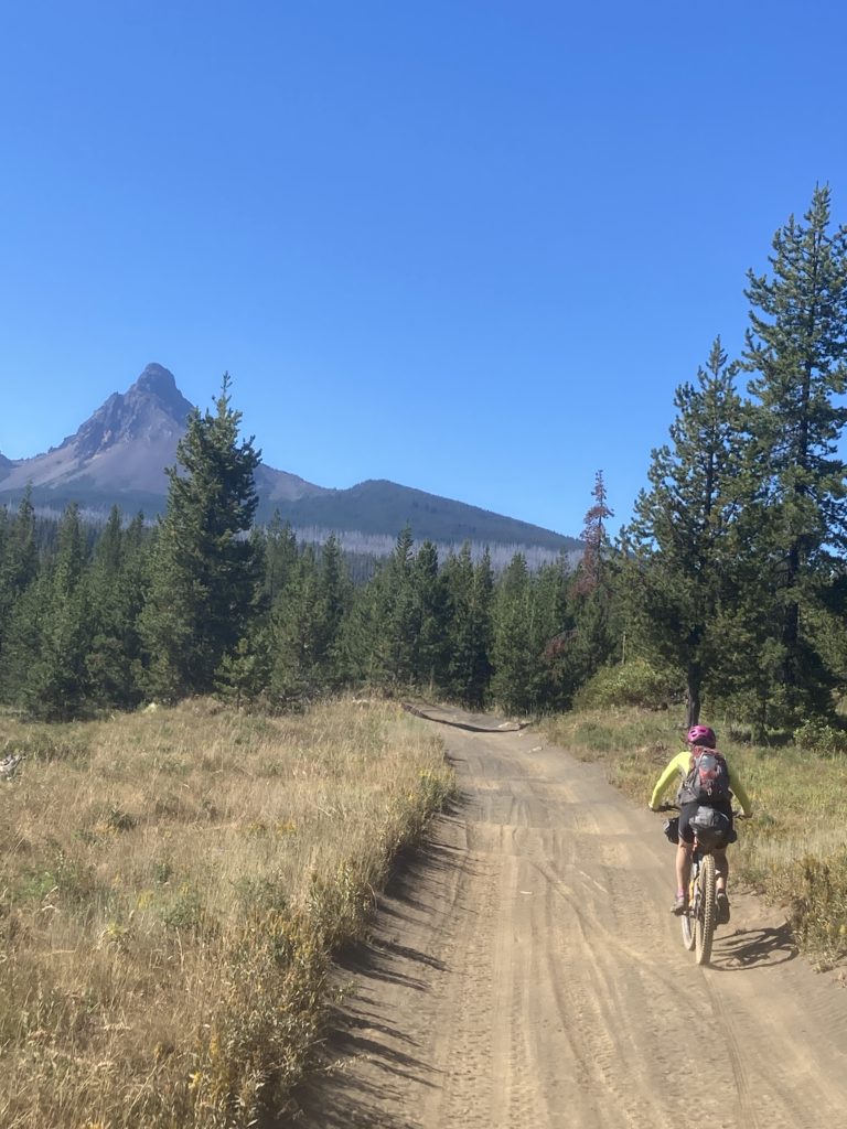
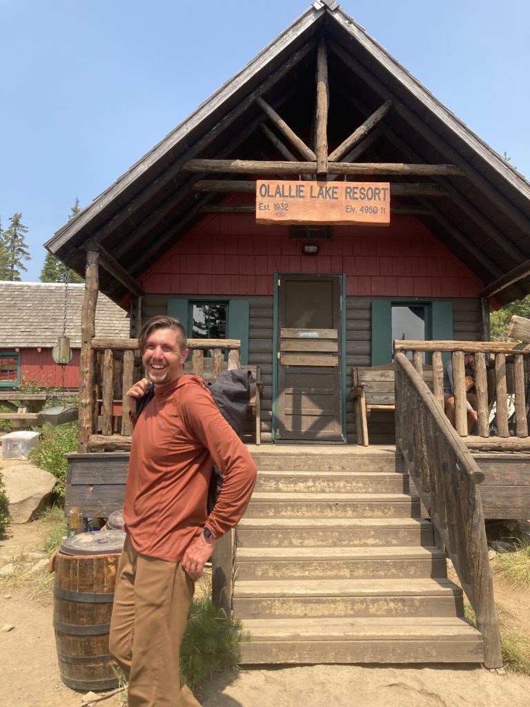
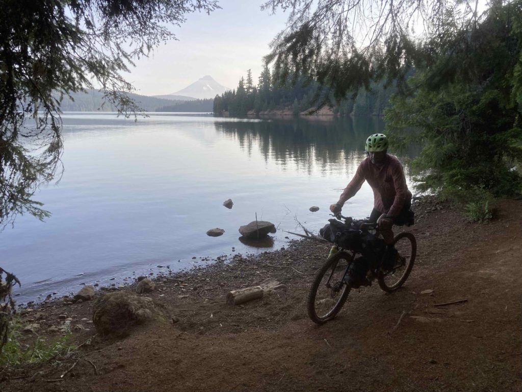
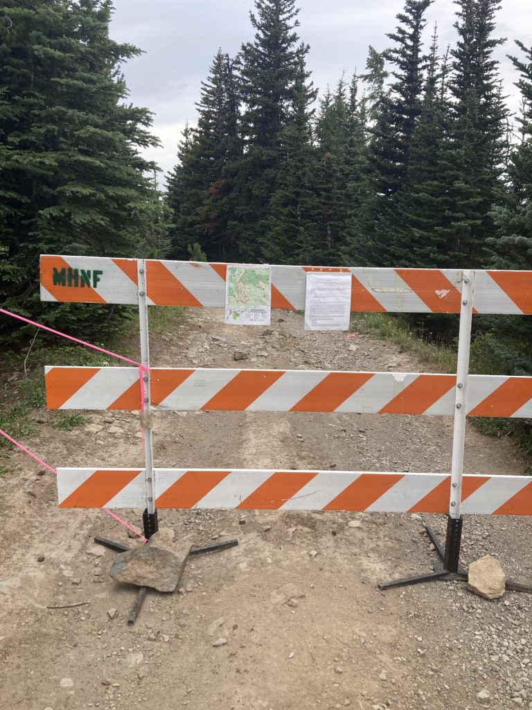
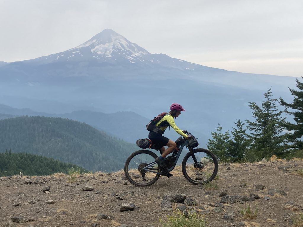
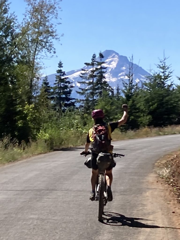
As we trundled along the Cascades we had spectacular views of Oregon’s iconic peaks: the Three Sisters, Mounts Washington and Jefferson, the spiky Three Fingered Jack, and soon enough, looming over our end point of Hood River was Mount Hood in the smoky distance. We were paralleling the Pacific Crest Trail, and eventually the two routes joined at Olallie Lake. Olallie was a little off our route, but in order to service the PCT through-hikers we knew that they had backpacker-type food and we were trying to keep our bike weights down to account for the hard riding so we weren’t carrying much food. However, it turns out that the lake and resupply was even farther out of the way than we anticipated; a critical trail cutting over from the gravel road we were on to Olallie over a low ridge had been completely fried by the fire (which was a bit of a surprise to us; virtually all of the other beta we had gleaned from the OTT facebook page was up to date).

So we had to go pretty far out of the way in terms of both miles and verties to indeed get our resupply. At the lakeside store they had a thermometer next to the store’s sign that indicated 4960 elevation, and the thermometer read 90 degrees. The PCT’ers – most of whom are going southbound this year due to the Sierra snowpack – were also hurting in the heat, which made the “no swimming” sign at the lakeshore all that much more painful!
From Ollalie lake it’s about 25 miles of gravel road to the popular Timothy Lake, which has something like five different campgrounds around its perimeter; it’s indeed busy, but again the lake provided a much-needed rinse and our fellow campers were gracious enough to provide us with some cold beverages. Timothy lake has a super fun singletrack encircling it, which of course the OTT takes advantage of:
and at the north end we veered off into the maze of forest roads that led us towards Mount Hood over high ridgelines and deep into river canyons.

As we got closer to Mt Hood, the new season in the Northwest – Fire Season – reared up. A fire was burning in a wilderness area adjacent to a ridgeline road that we had planned to take to access the famed singletrack of Surveyors Ridge
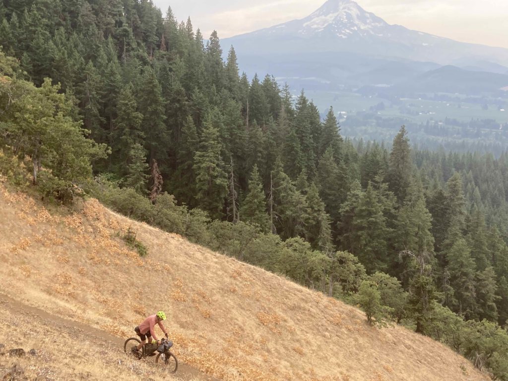
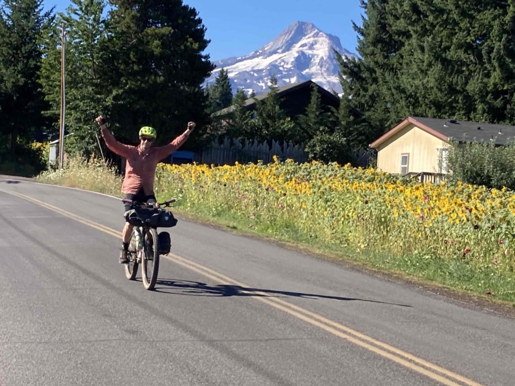
Again we dropped way down to a paved road to take us up and over to the combination of highways 26 and 35, which wrap around the south and east sides of the mountain. We lost a lot of vert cruising down highway 35 towards Hood River and could have continued our cruise and soaked in the cool Hood River itself, but that would have meant foregoing some legendary singletrack!
So we did the long climb up from the valley up the 44 road – well known to local mountain bikers – to the incredible network of brilliant singletrack on Surveyor’s Ridge:
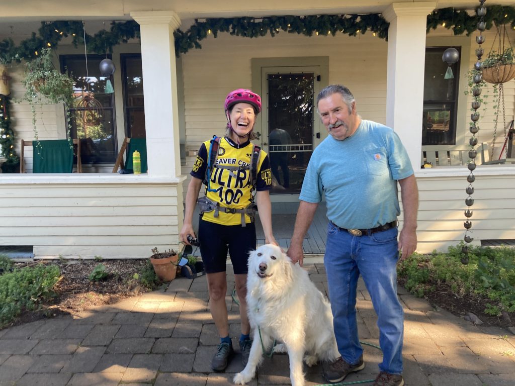
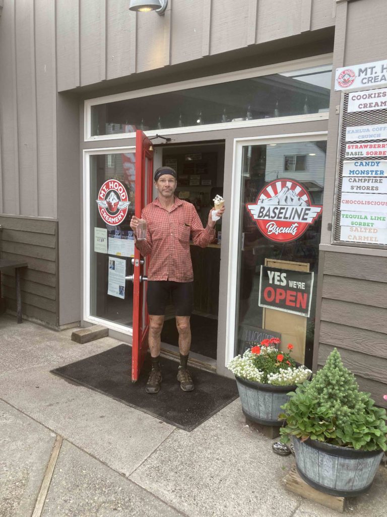
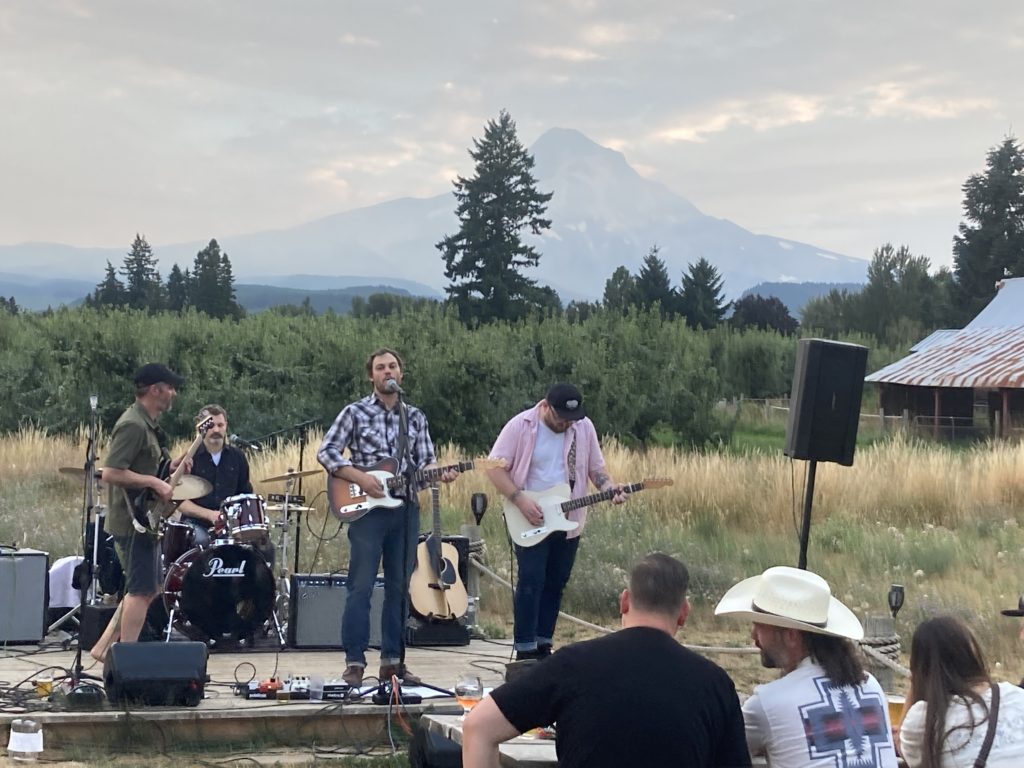
which ultimately spit us out into the pear-tree hamlet of Parkdale. We stumbled into a bed and breakfast that was not available for guests to formally stay at that night, but the kind owner let us camp in the yard, take a shower, and caffeine up in the morning, while the ribs place, breakfast cafe and afternoon ice cream shop was a block away, and the brew pub with live music was across the street. Bikepacking in the woods is great, but endearing little towns with just the right amenities en route can be just as great!
The final leg of our journey was a final 2500 foot climb up into the hills between Parkdale and Hood River, which put us into the upper reaches of Hood River’s amazing local network of killer singletrack in Post Canyon.
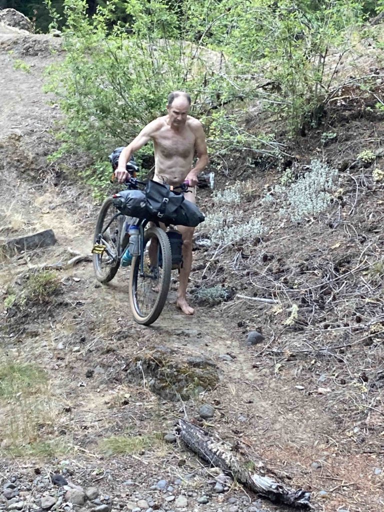
Near the bottom of the post canyon trails we bumped into this guy:
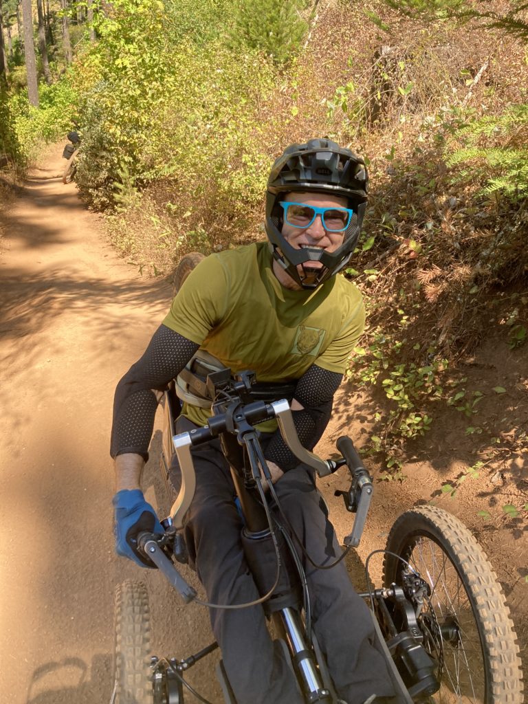
The one and only Greg Mallory, who was so excited about his new rig that is really the first ever legit singletrack-ripping adaptive bike. Greg’s story is an inspiring one that I’ll write about soon.
With its length and amount of great backcountry singletrack, it seems – from our experience on the northern tiers – that the Oregon Timber Trail is fast becoming a bikepacking classic route. The board of the OTT nonprofit clearly is proud of what they have accomplished and no doubt love fellow adventurous cyclists willing to give it a go, and we are looking forward to doing the southern half of it next summer (but not in a heat wave!).
[…] a bit nervous, because I have a bit of a history of melting in the heat, but last year we did the Oregon Timber Trail in a heat wave and I was pleased that I did okay, and being that this is the “end of summer” I […]