Our Paria adventure started as many adventures do: a text message came in asking “hey, you busy tomorrow?” For the first time in three years the Southwest monsoon cycles had been firing this summer, and they seemed to be making up for lost time and water, with more and bigger rain events than normal sweeping through all of Utah, Arizona, and New Mexico, and they were also stacking up on each other. This caused a lot of angst in some desert towns (Hanksville got hit really hard in a subsequent series of storms) but it did provide an unusual opportunity to possibly paddle some of the ephemeral rivers in the desert Southwest. So when I got the message from “professional packrafter” Jeff Creamer asking if I had anything going, I said “hmm, not really. Paria?”
The Paria is one of three major tributaries that come into the Grand Canyon below Glen Canyon dam (the Little Colorado and Kanab Creek are the other two) and over the last decade or so has proven to be the most important. Because the Colorado river water is released clear and cold from the bottom of the dam at the end of Reservoir Powell because all the silt from the rivers upstream has settled in the reservoir, there has been decades of perpetual beach erosion down in the canyon. The most obvious impact of this is that river runners have fewer and smaller beaches to camp on, but annual beach “recycling” over the millennia has created an environment that has relied on beaches. Our buddy Joe Hazel spent most of his career working on this, and the research that he and his colleagues did was the impetus for the prescribed floods that have happened periodically in the canyon; the idea is that a huge rush of water churns up sediment, hurtles it downriver, and as the current recedes, it creates new sandbars and beaches. And the key to creating new beaches is…. the Paria.
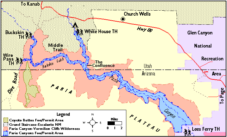
The Paria’s headwaters are in the Bryce Canyon area and flows down past highway 12 due south to where highway 89 crosses it, and in that distance it picks up pretty much all of the sand and clay and dust that lays dry and dormant for much of the year. So it picks up an extraordinary amount of sediment that rushes down to the Colorado just 15 miles below the dam at Lee’s Ferry, which is the start of the Grand Canyon, and mostly – because the damn keepers keep the flows perpetually low – the silt mostly settles out in the upper reaches of Marble Canyon, the first canyon of the Grand. But it’s a lot; according to that article referenced above: 1.9 million metric tons of sand in 2013 and 1.2 million metric tons of sand in 2014, compared to a median of 600,000 to 700,000 metric tons. One million metric tons of sand would fill a football field 44 stories high.” (I’m glad they didn’t make any reference to the size of Delaware; how am I supposed to know how big Delaware is?).
So Joe and co. had to wait for the Paria to flush its stuff into the Colorado before initiating the efforts associated with a high flow event (the max they can go is 45,000 cfs, which is only half of the annual peak flows happened pre-dam, and a small fraction of the historical highs that have been estimated at 300,000 cfs). I have been fortunate enough to have been on the Colorado in the Grand Canyon twice during these “high”(ish) flow events, and indeed I’ve seen that the river gets quite muddy, and indeed the sand bars and beaches are re-born.
But while I’ve been able to hike the Paria a couple of times doing the Buckskin/Paria loop and seen half of the wondrous sandstone gorge by foot, I hadn’t been able to paddle it yet. It’s a challenge to catch it with enough water; the summer monsoons are short and violent and the river literally flows for a few hours, and most times the spring snowmelt trickles off with only barely or non-boatable flows. Even the scientist and Soothsayer-Of-Flows Jeff Creamer has gotten skunked twice after carefully tracking rain events and watching the gauge and actually driving to the put in, only to find no water. His third attempt was successful, tho barely, with only butt-scraping flow.
So with – as Jeff put it – “a 1-2 inch rain forecast bullseye on the Paria headwaters for tonight, with three soaking events in the last 24 hours” the texts to confirm logistics starting pounding as well, and with the car in the garage loaded with a boat and its accouterments, some camping gear, and lots of fresh water to carry in the boat, I set the alarm for 2:30am to meet Jeff at the river by 8. Jeff checked the rain totals when he awoke in Durango and got mixed info about rain and flow, but I was already en route, so we’d see how we go.
A big problem with the desert rivers is that the water drains out of them as fast as it flushes down them, and we felt that we needed to put on at the peak and try to do all 42 miles of the river in one day, because if we spent the night we would run the risk of waking up to a riverbed full of unwalkable muddy good with no floatable water. Additionally, the silt-filled river pastes mud on everything it touches and raises havoc with the zippers on the boats that keep them inflated, and everything that did get wet – like dry tops, throw bags, the boats themselves – only would be wet but also muddy, so they got even heavier and wouldn’t dry out. Because the shuttle all the way to/through the town of Page, down and around to Lee’s Ferry would add some hours to an already-long day and jeopardize our need to blast all the way through, we decided to forego that shuttle and take out a few miles upstream and use an ancient cowboy access trail to escape the canyon and then walk through the desert back to the highway for a very short shuttle back to the put in.
Jeff had reminded me of the times that he’d gotten skunked and that there was – as he put it, in his own scientific way – “a non-zero chance” that it could happen again. However, when we got to the bridge we realized that……there was, um…plenty of water. We gaped at the surging chocolate mess charging under the bridge below us, and kinda gulped. I asked Jeff “and what kinda flow did you have last time?” answer: 120 cfs. What we were looking at was clearly many times that amount of water, but since it was so brown so we couldn’t see the bottom, and the riverbed is fairly wide at the put in bridge, it was really difficult to guess what the actual flow was. But our biggest concern – not enough water – was certainly alleviated, so we geared up and put on.
The first several miles are low gradient and wide open, and it was easy, fun floating, and was super fast; the campground is 4 miles down and we blew by it in less than half an hour. We could see the sandstone walls rising off in the distance, and as they got closer I tried to remember what the gradient of the river was in the canyon when Ashley and I hiked up it several years ago; I definitely remembered walking “up” a few micro “rapids” in the very narrow canyon, and thinking of this freight train of water hurtling down those while being compressed between narrow walls was a bit unsettling to me as we drifted inexorably towards the canyon.
It didn’t take long until we were in the canyon, where my question was about to get answered. While the whitewater (actually, brownwater) started out pretty easy, we were going so fast that we were getting a noticeable breeze on our faces from the river’s speed, and as desert canyons are wont to do, it was quite serpentine and we were literally blasting around blind corner to the next blind corner, and the smooth narrow walls created no eddies.
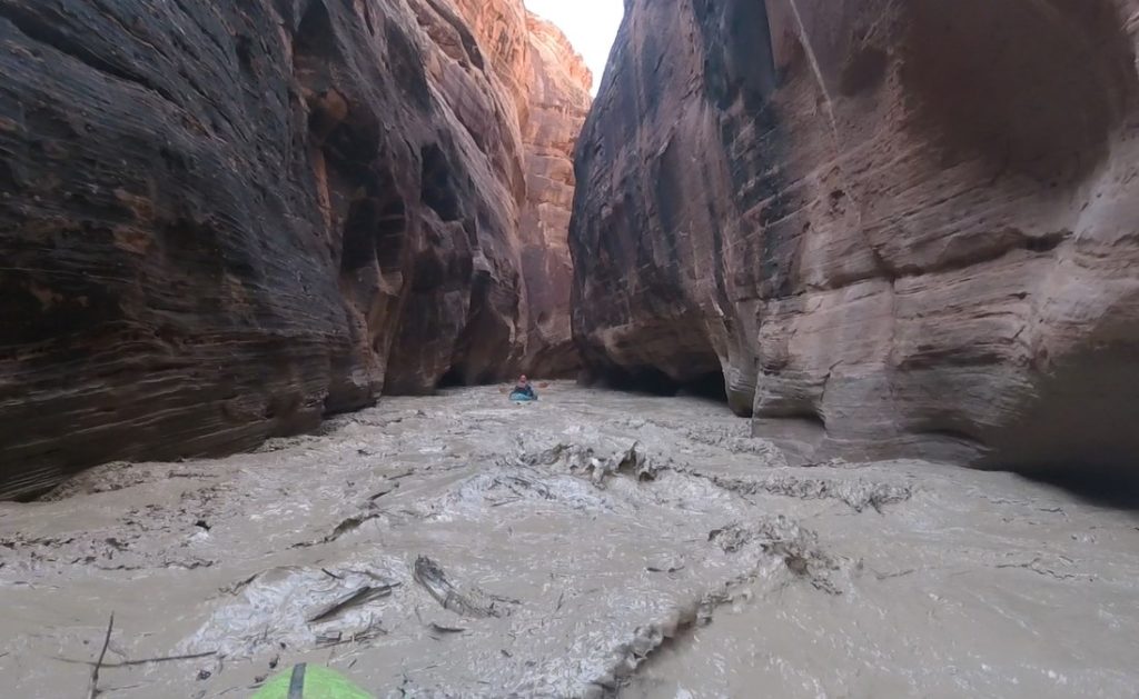
Much of the safety margin in kayaking is the ability to see what’s downstream and control your progress so that you don’t get overcommitted to something bad, but in this case not only could we not see downstream we were going so fast that we were constantly overcommitting. However, the paddling was indeed pretty easy, but – in one straightish section when Jeff and I could relax for a second and chat – I said “I’m not gonna lie, I’m REALLY nervous!” and he agreed. However, we discussed the fact that the gradient did stay pretty consistently low, there weren’t too many trees upstream that coulda died and fallen in the river, and we talked ourselves into the theory that the walls had been so nicely scoured smooth over the millennia that there were no “catches” for logs.
But with so much water flowing through such a narrow canyon, even normally-small rapids getting so compressed could end up big. And with it being so fast and continuous, a swim out of something big would be….bad.
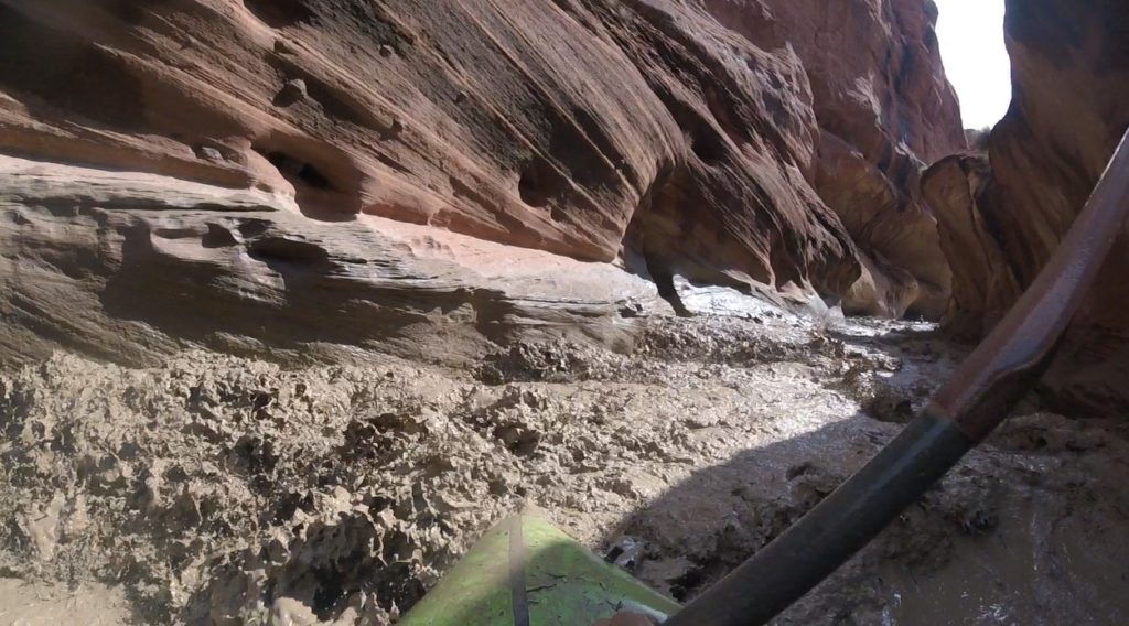
The other factor was vision; I thought wearing sunglasses would help with keeping my eyes from getting hammered by the silty water, and it seemed to be helping, until….I actually got a few drops of water on my glasses, and they went instantly opaque. I whipped them off and tried hard to keep turning my head and closing my eyes, which worked for a while…..
After blasting through umpteen corners with nothing too scary beyond each we felt that perhaps this was going to be the way it was going to go, until suddenly around one of those corners we faced what I feared: a straight corridor with a series of 4-5 huge breaking wave holes in tight succession, and Jeff barreling hard right into them.
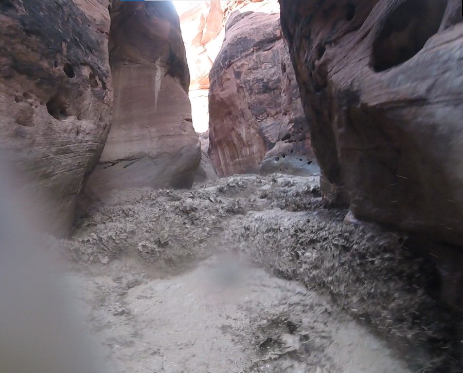
The only thing to do in that situation is to simply give’er, so I dug in hard for the 2-3 strokes that I had time for before crashing through the first one and tried to gauge and dig hard for the next, but in doing so I took a hit of “water” (liquid mud) on the side of my face and instantly it was if a sheet was pulled over my right eye. My left was okay – and fortunately it’s my “good” eye – but my depth perception went away and all I really saw in front of me was a brown maw.
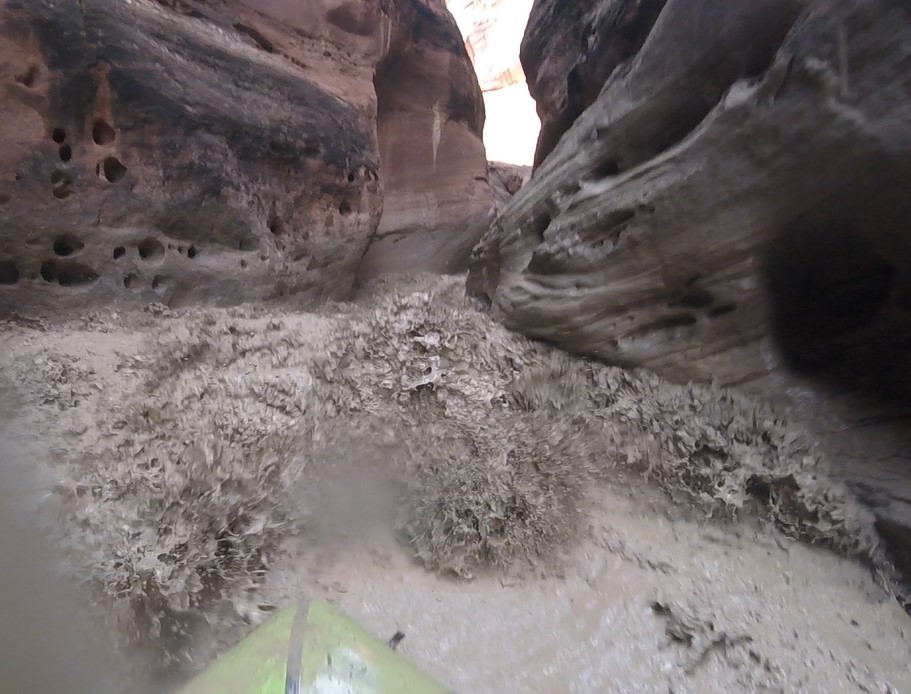
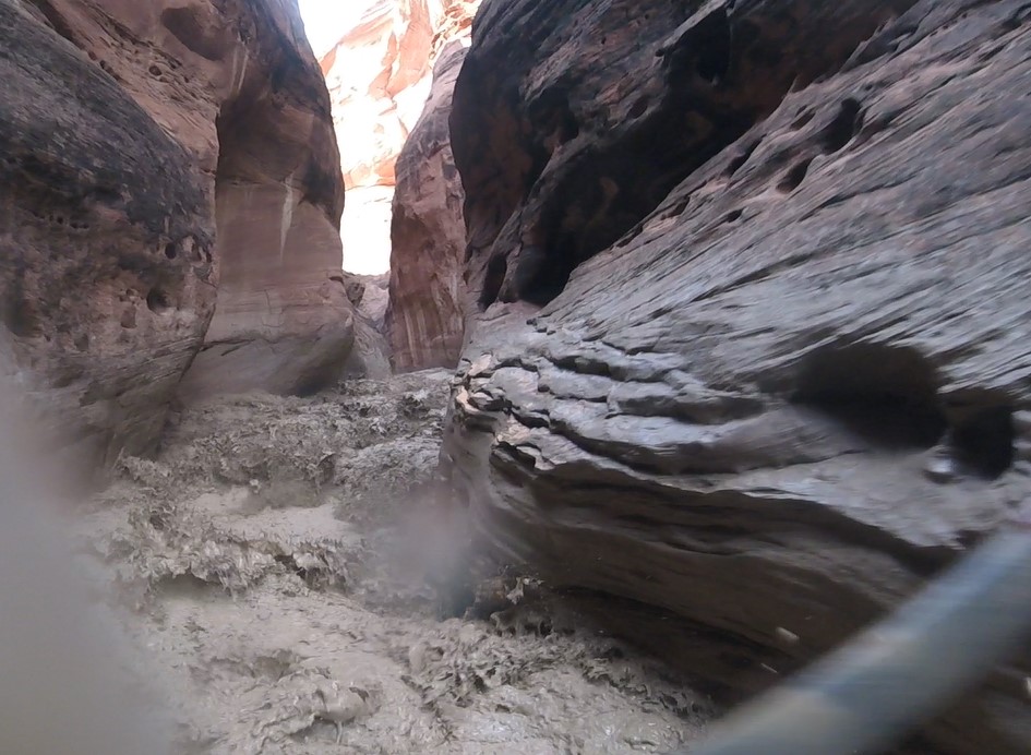
I just kept stroking hard, and with that momentum my boat just bobbed up and over these huge wave holes – as packrafts tend to do, fortunately – and didn’t get caught and “worked” in any of them. The river mercifully backed off a little just beyond, and Jeff and I were able to connect, both of us a bit shook.
More speedy and stressful twists and turns awaited us, but no more monster holes, and we had to keep reminding ourselves to look around and appreciate how dramatic and beautiful the canyon was!
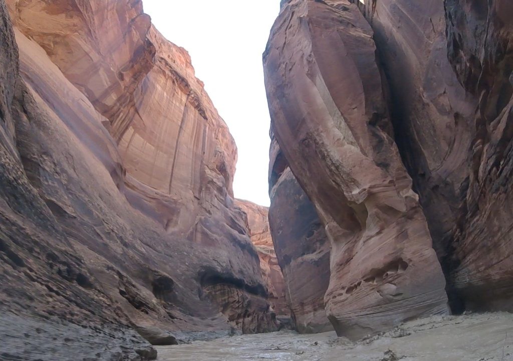
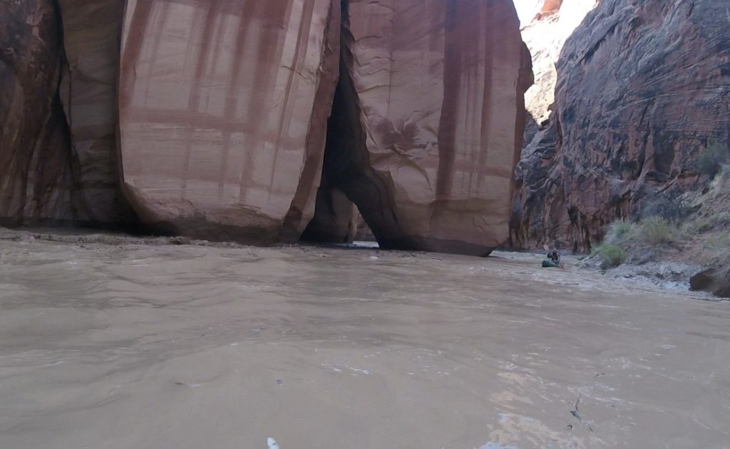
Jeff said that he thought we were through the narrowest section, but shortly after that we tore around yet another corner to see another corridor that was less than a boat length wide. However, this one was just small waves:
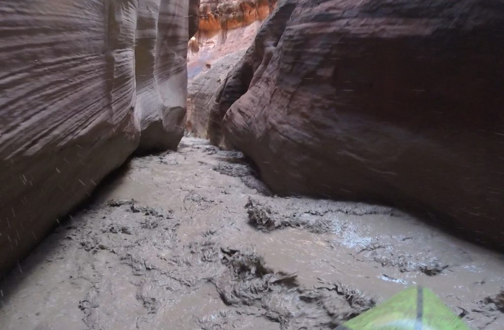
Just beyond that was Buckskin Gulch coming in from the West, and Jeff’s recollection of the canyon widening below Buckskin – complete with sandbars that had eddies behind them – was correct, and finally we could relax a bit.
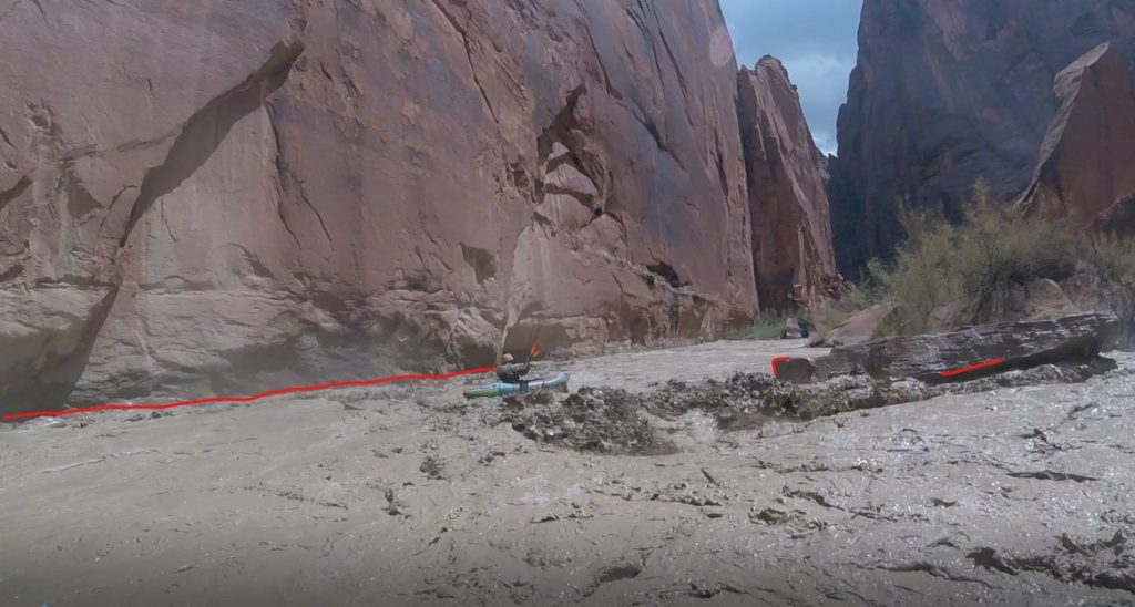
Usually when canyon walls fall away rivers lose a bit of their punch, but in the case of the Paria, as the walls move farther away from the riverbed not only does the gradient increase, but also huge boulders apparently have peeled off the walls and tumbled into the river, so the rapids increase in intensity.
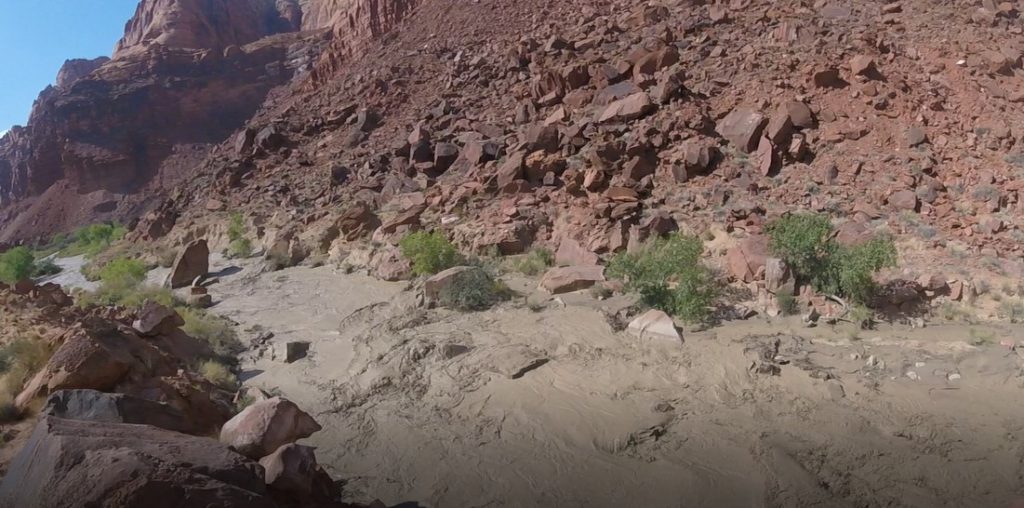
Even at low flows there were plenty of rapids and Jeff and his crew had portaged a few times, and even as we could see that the river was dropping since the boulders and walls were still lined with wet mud our pace slowed dramatically as we scouted extensively, and portaged a bit. We initially had thought that we weren’t really interested in trying to paddle too many rapids due to the potential for getting blinded by being splashed in the face by rogue waves or – eek! – going upside down in the roiling wet mud, but the section of rapids was long enough that we did paddle a lot of class 4, trying as hard as we could to protect our eyes.
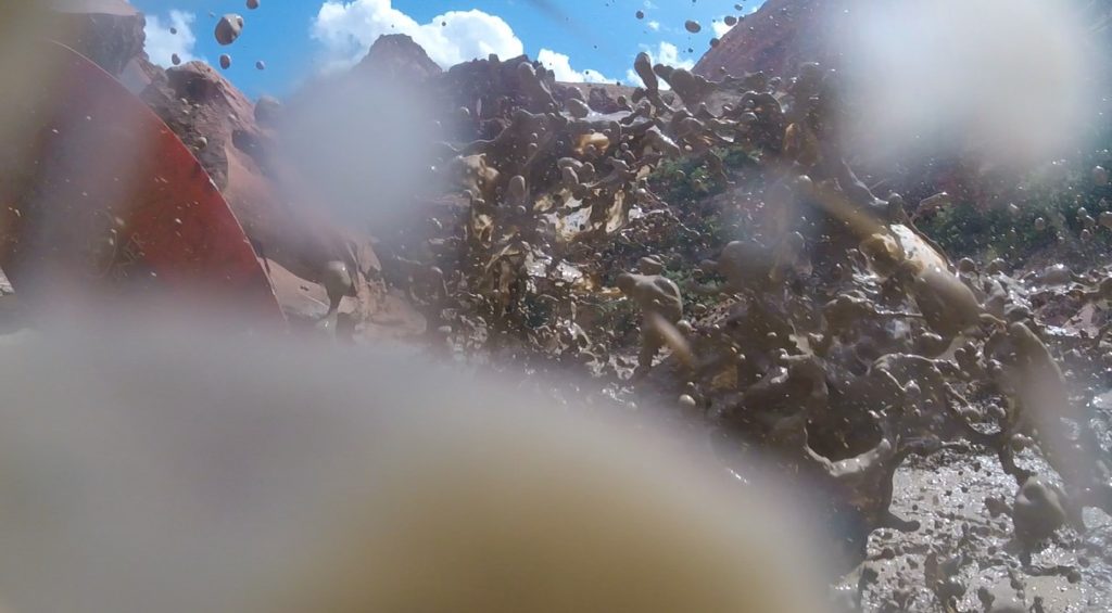
And oh the mud! We were so plastered with mud that I would glance back upstream to check on Jeff and not be able to see him, because he was simply another taupe-colored bump on the taupe-colored water near the taupe-colored boulders. The only color was the bright red of our eyeballs where they are normally white, from blinking furiously to clear the mud out, with our eyelids simultaneously acting as grit-wipers across our corneas!
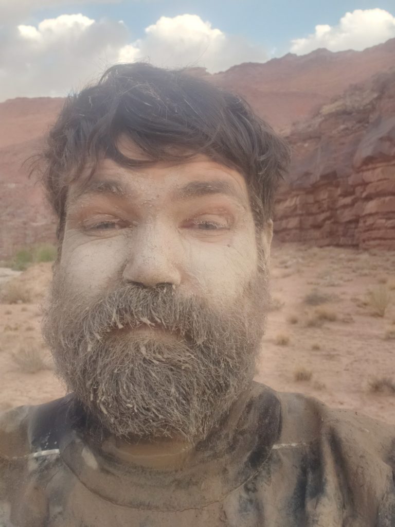
Grit in our teeth and trying to hang onto paddle shafts slickened with gooey water added to the challenge.
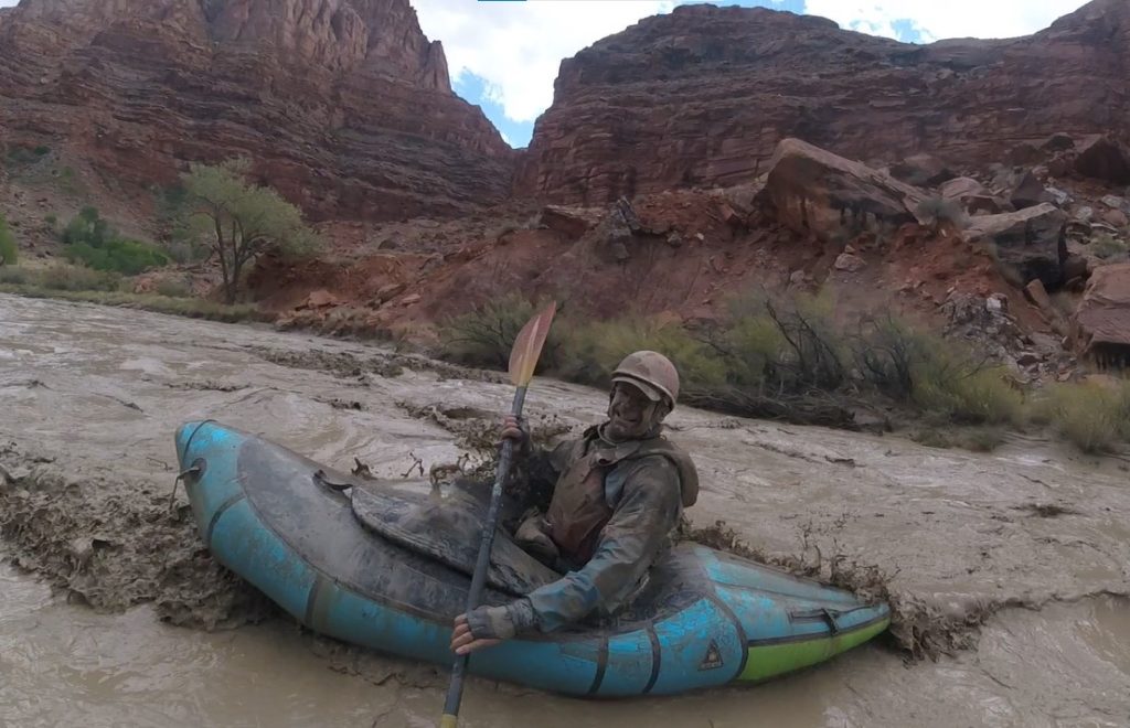
Finally the valley flattened out for good and we were able to drift for a bit, which is when we needed to start looking for the exit route, and finally, wearily we pulled our boats ashore for the last time after a long day.
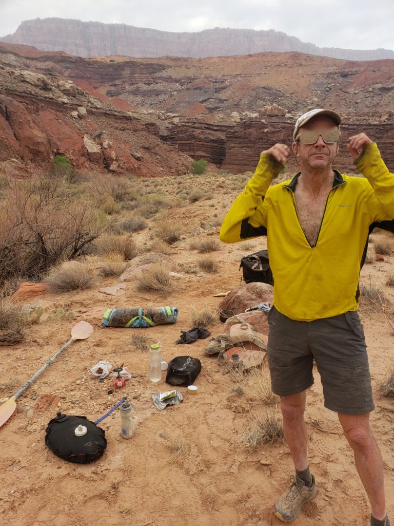
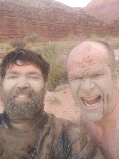
We awoke to a muddy riverbed that still had a bit of water, but was quite low; our strategy of riding the tidal wave down and avoid letting the river drop appeared to be correct. We tried to shake the now-dried dust from our gear and loaded up for the hike out. It was a good 2000-foot grind out of the canyon following an old cattle trail
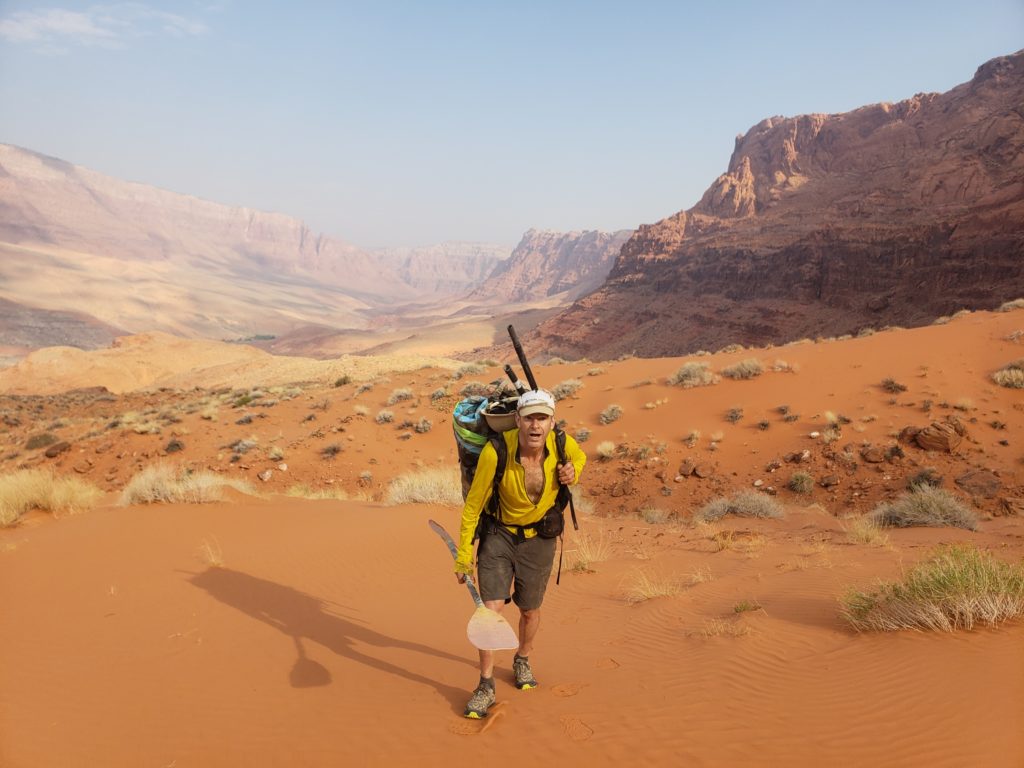
fortunately none of the rains upstream made it down to the lower Paria, because if that part of the desert was as wet as the upper, we’d not have been able to hike out on the greasy, gummy clay.
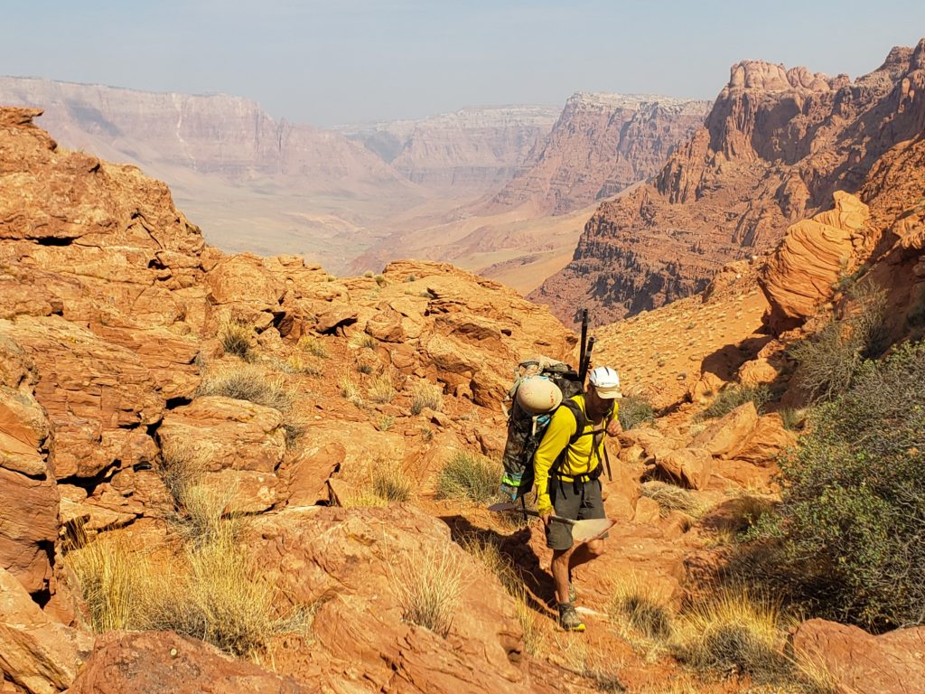
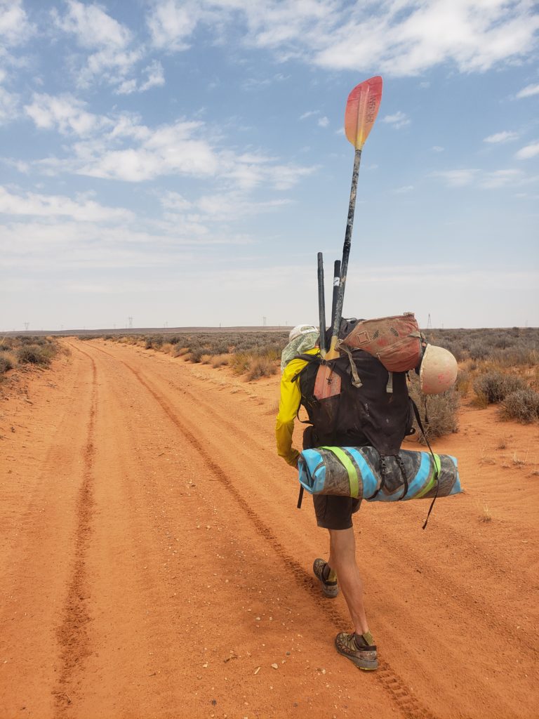
Upon reaching the crest of the canyon we were able to follow a drainage down to what eventually became an ATV track that led to a gravel road put in for the electrical lines heading north from Glen Canyon Dam.
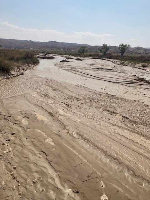
By the time we got back to our put-in bridge the wide, muddy bed had barely a trickle running down it; there was no way that it was boatable. We got a bit of cell coverage and were able to check the flow; it went from 100 cfs to….3300 cfs in 9 hours, and when we reached the gauge again it was down to 10 cfs.
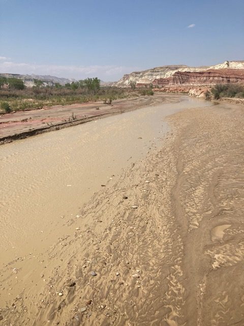
In the last decade it’s gotten bigger than that just a few other times. As Jeff put in his social media post: “Whenever you hike down a slot canyon you can’t help but wonder what it looks like at flood stage. As a paddler, you can’t help but wonder what it might be like to ride through one on a flash flood” We got our chance, and it was as exciting as we anticipated.
Thanks again to Jeff for his knowledge and efforts on monitoring the rains and flows, his paddling skills and steely resolve in some pretty tense situations, and generally good nature, as well as his willingness to bring a couple of cameras down that muddy mess after already ruining a very nice camera in a leaky dry bag in Alaska!
Jeff also put together a fun video clip (many of the pics above are screen grabs from his GoPro) using “Chatanooga Choo Choo” for the soundtrack, which is pretty fun and evocative of the freight train feeling of the river, but I might have been tempted to use Ozzy’s Crazy Train! And Jeff didn’t even mention to me that he got an article in Men’s Journal about his first Paria float from 2017: https://www.mensjournal.com/adventure/packraft-perfection-riding-a-flash-flood-through-utahs-paria-canyon/
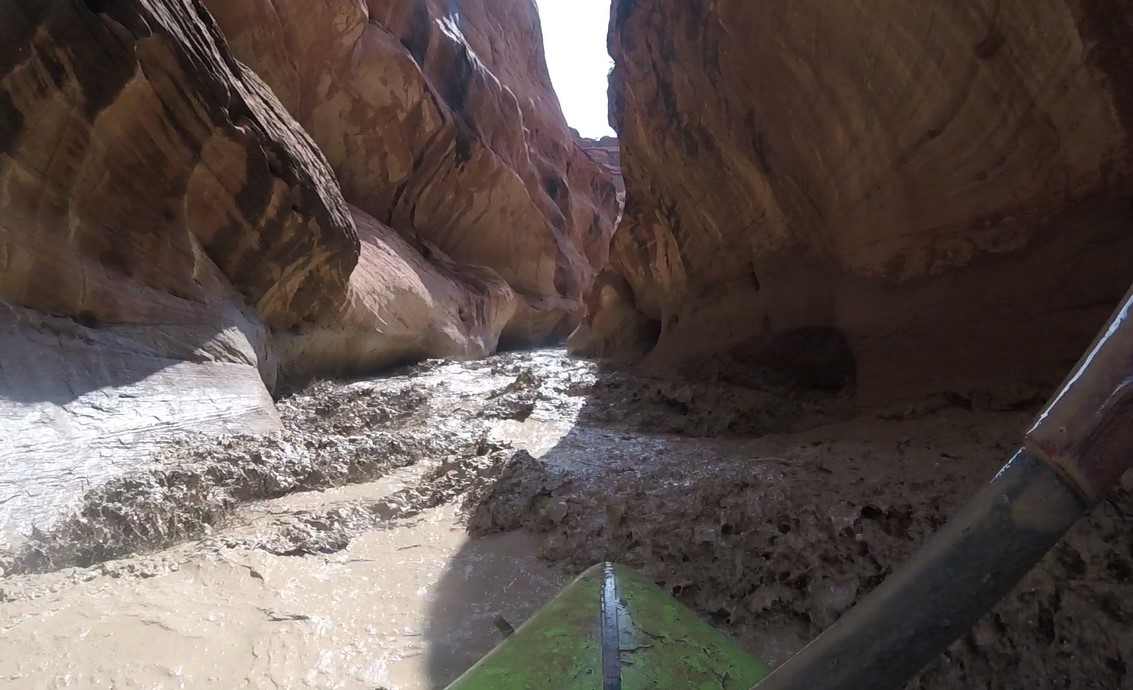
And the riders once again assumed the color of the landscape upon which they traveled.