Ashley’s birthday is in mid-November, which can be a challenging time of year; a bit early for good skiing, a bit late for summer-type activities, it can be pretty cold, and the nights are long for camping. This past weekend was no exception, but since we got shut down on another European bike tour this summer and the window was closing for viable bike tours until spring she decided that a southwestern Utah bike tour would be a good option, since it’s the lowest/warmest spot in the state. Thus after much poring over maps and potential route finding we headed south.
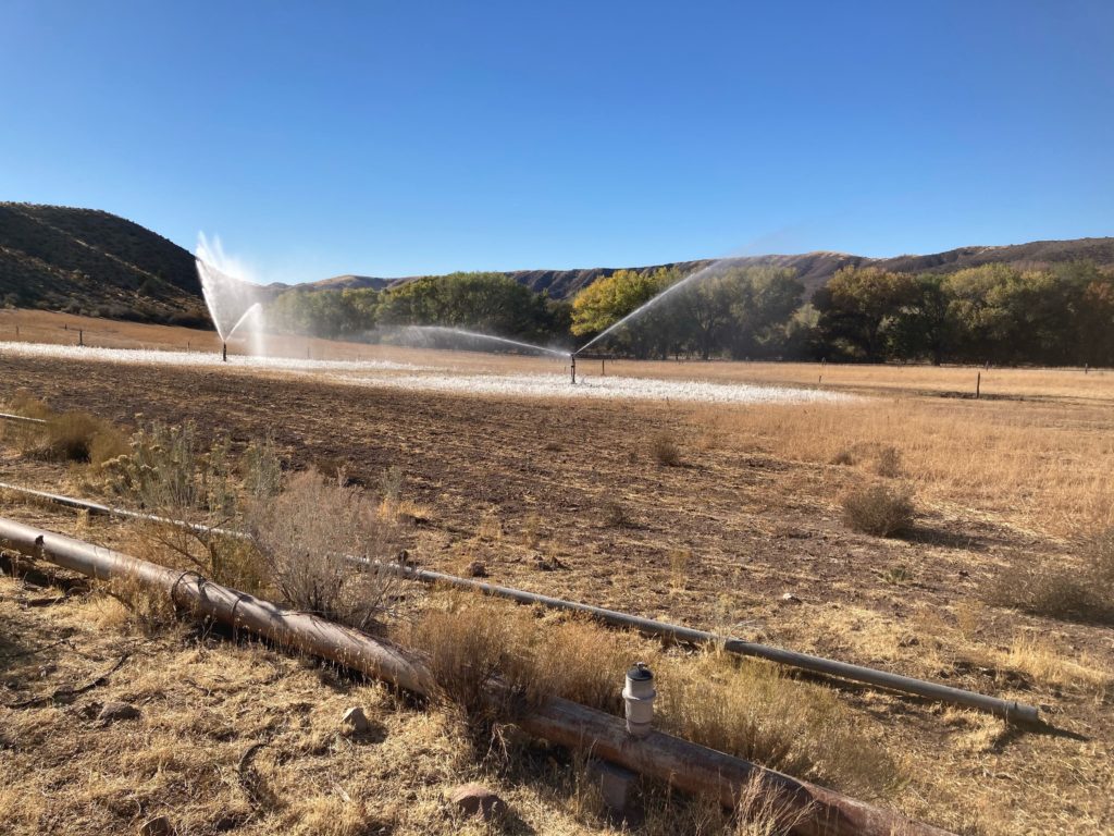
The idea was to start near St George, which at something like 2500 feet is always pretty warm, and head west towards and into Nevada before looping back.. While the route we chose had two passes that went over 6k, they were quick climbs/descents and we were confident that we’d be able to camp low. The route went through and around the Beaver Dam mountains, and into/beyond/back through the long Beaver Dam wash, a major “tributary” – if it ever had any water – of the Virgin river. Speaking of water, we were concerned that there was very little out there, so we made sure to have plenty of bottle cages on our bikes and knew that we’d have a high likelihood of being a bit dry.
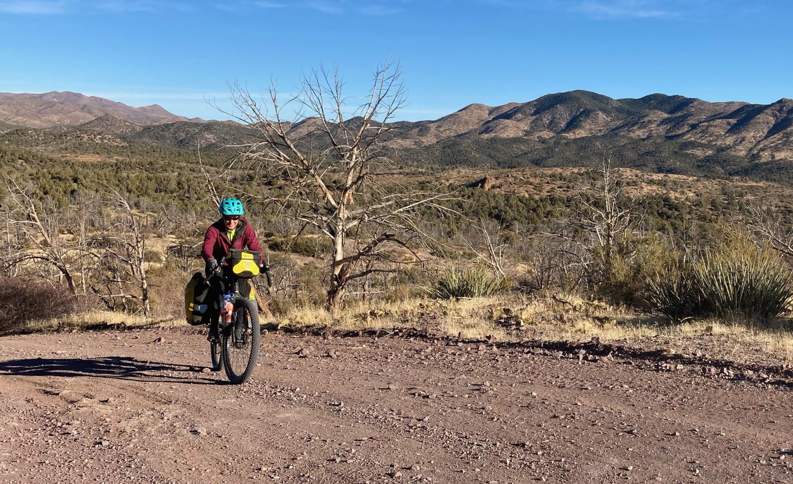
In lieu of starting in overdeveloped St. George we headed for the town of Veyo, about 30 miles north, on the backside of the Pine Valley Mountains that soar dramatically over I-15 as you approach Hurricane and St George. We got a bit of a late start due to leaving SLC in the morning, roared down the paved road towards Gunlock State Park, and as anticipated saw a big gravel road peeling off of the paved road; a quick check of the map on the phone indicated that was our route, and onward we went. It started out with a big climb, and we ground slowly up into the mountains. After an hour or so we stopped for a snack and I did the perfunctory check of the map and realized….we were “off route”. I put that in quotes because we had sort of arbitrarily come up with a good route, but one of the great aspects of bike touring is spontaneity and flexibility, so effectively our route suddenly changed. Yes, we coulda backtracked, but because of the aforementioned spontaneity and flexibility, we are fundamentally opposed to backtracking, and thus decided to let the adventure unfold.
There were a coupla problems with our newfound flexible plan, however. Our original idea of staying in the low elevations was clearly changing as we continued to grind up into the mountains, there was a bit of snow on the ground at the highest elevations, and the pass that we found ourselves going over went from south to north (our original route’s passes were more east-west) so the north side had some snow. Which was not a big deal:
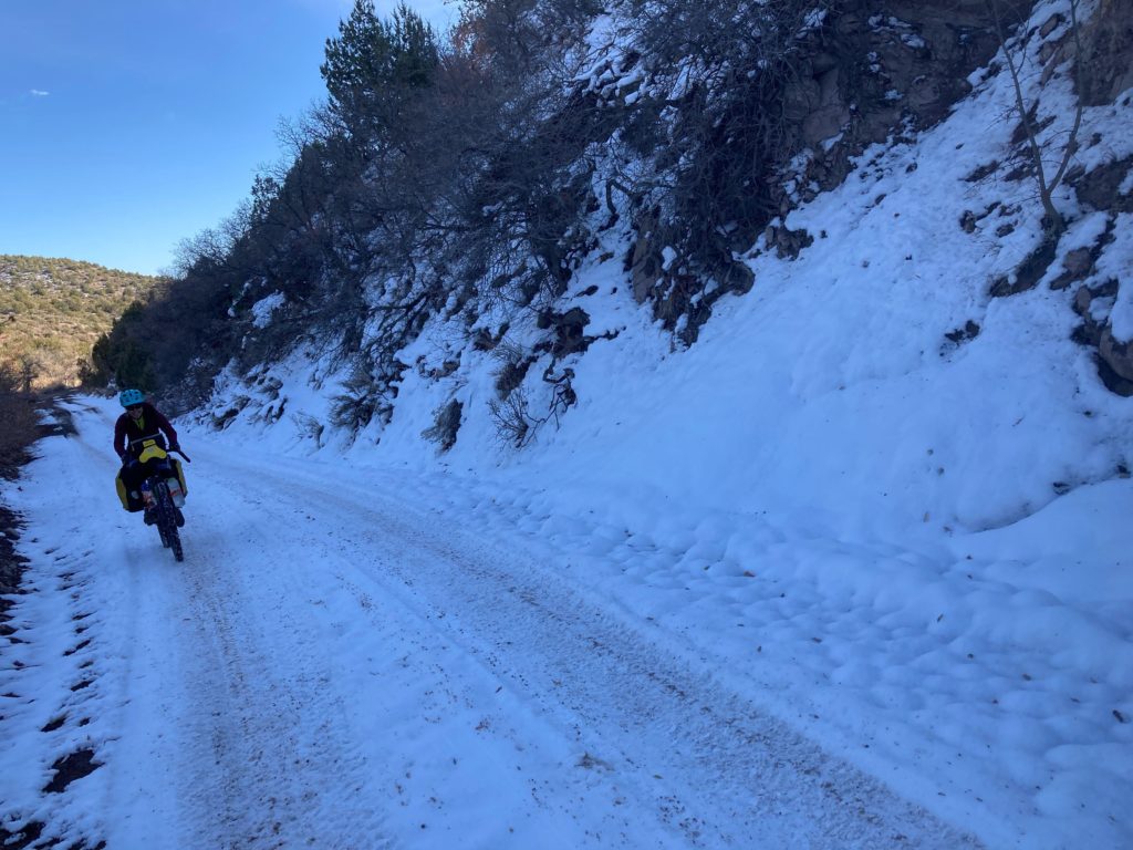
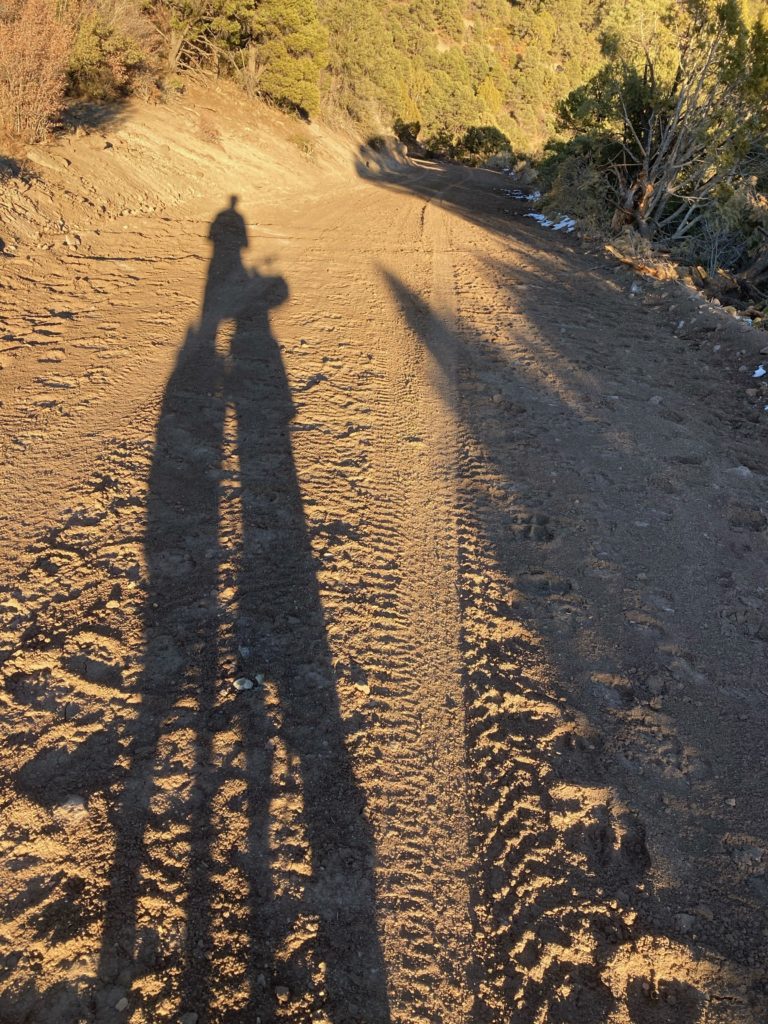
The snow was fine. But as we descended the north side the snow gave way to….mud. As anyone who has trundled around the Utah desert knows, desert mud is bad mud. We’ve been in worse mud – ie we weren’t quite having to carry the bikes because the wheels still turned, but it was still pretty bad. But as we continued to descend the mud dried on the bikes pretty quickly and we could kind of pry/chip it off at least our brakes, and it mostly flew off the chains, which were then dangerously dry. But we needed to clean the bikes and – as noted earlier – it’s a pretty dry zone.
The other problem was that in our zeal to do our original route we only downloaded maps for the zone south of us, so we were kind of riding blind. So our bikes were gooped up, and darkness was imminent, but at least we weren’t sure where we were or where we were going!
I knew that the small town of Enterprise, UT was not too far away, since we had driven past it on our way to Veyo, and we had to make the decision to camp high (and cold), or bust for town and see if the town had a motel or an Air BnB or somesuch. With a favorable wind blowing we opted for the latter, and with a nice sunset to watch we plunged forward to our fate.
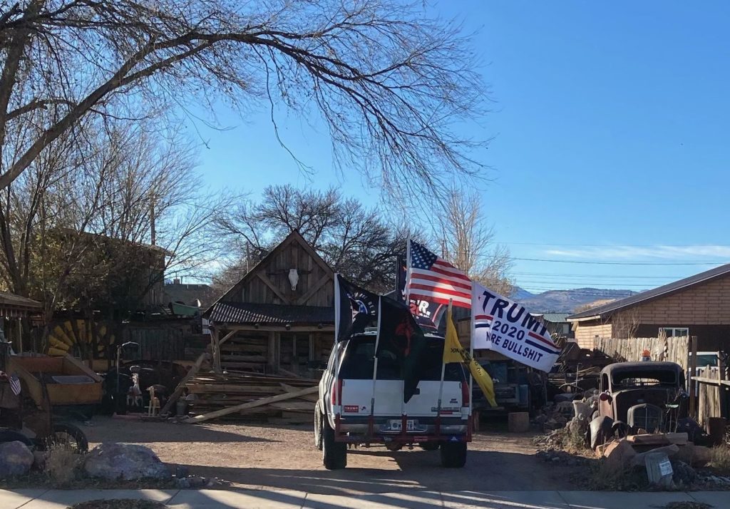
As the inevitable darkness fell we started passing some ranches, and they all had huge Trump flags flying.
On the way down there we had been listening to a newly-released podcast called “Facing West” by Mountain West News Bureau’s Nate Hegyi, which was his tale of doing a multi-week bike ride down the continental divide to slow down and really get a feel for the people who live in the rural west to better understand them and their perspectives. As we have found ourselves so many times over the years, Nate was correct in anticipating that being on a loaded bicycle at a casual pace erodes all the barriers between travelers and locals and he not only had some fascinating conversations, but also found that even in Trump Country people were very nice to him, invited him into their homes, and bought him meals, even though he was wearing spandex. Even if – as one person put it – their benevolence may have been predicated on “we just don’t want anyone to die out here” (because it’ll be too much of a PIA to deal with?) he found them to be kind, giving people.
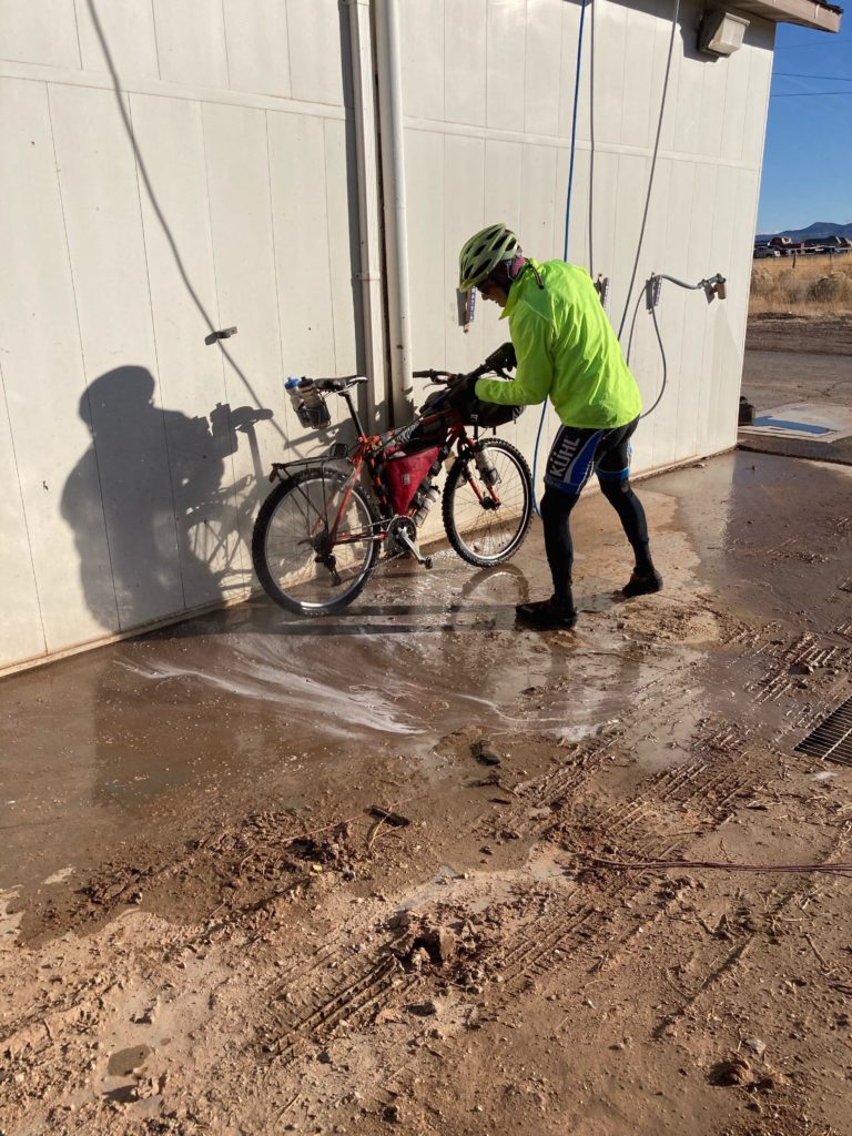
As we sped through the darkness heading for town we discussed the concept of testing Nate’s theory and knocking on the door of one of the ranches and asking if we could just camp in their yard on the lee side of the strong and cold wind and use their hose in the morning. An interesting thought, but….we didn’t do it. We rolled into Enterprise and I went into a divey burger joint – where there was nary a facemask in sight, as expected in rural Utah – looking for a motel, and indeed there was one. After a bit of clustering (there was no “office”, just a phone number to call to be let into the room) we found ourselves diving into a hot shower to get the mud off and the chill out.
The morning started with a quick trip to the bike wash place:
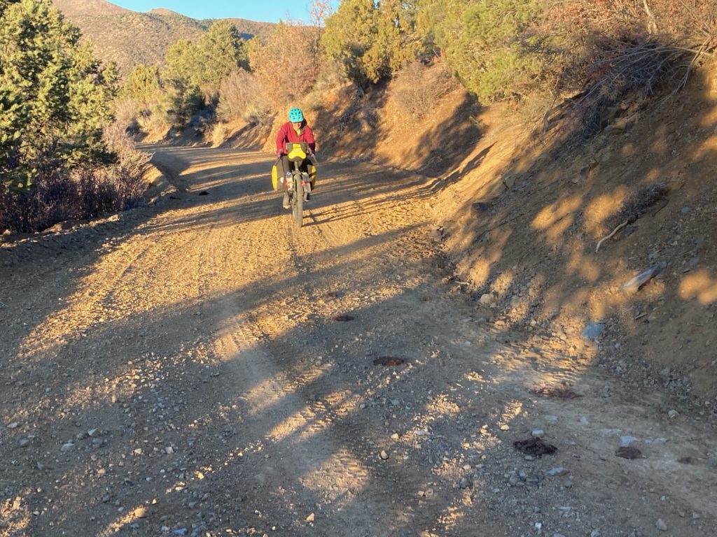
And we were back on the road
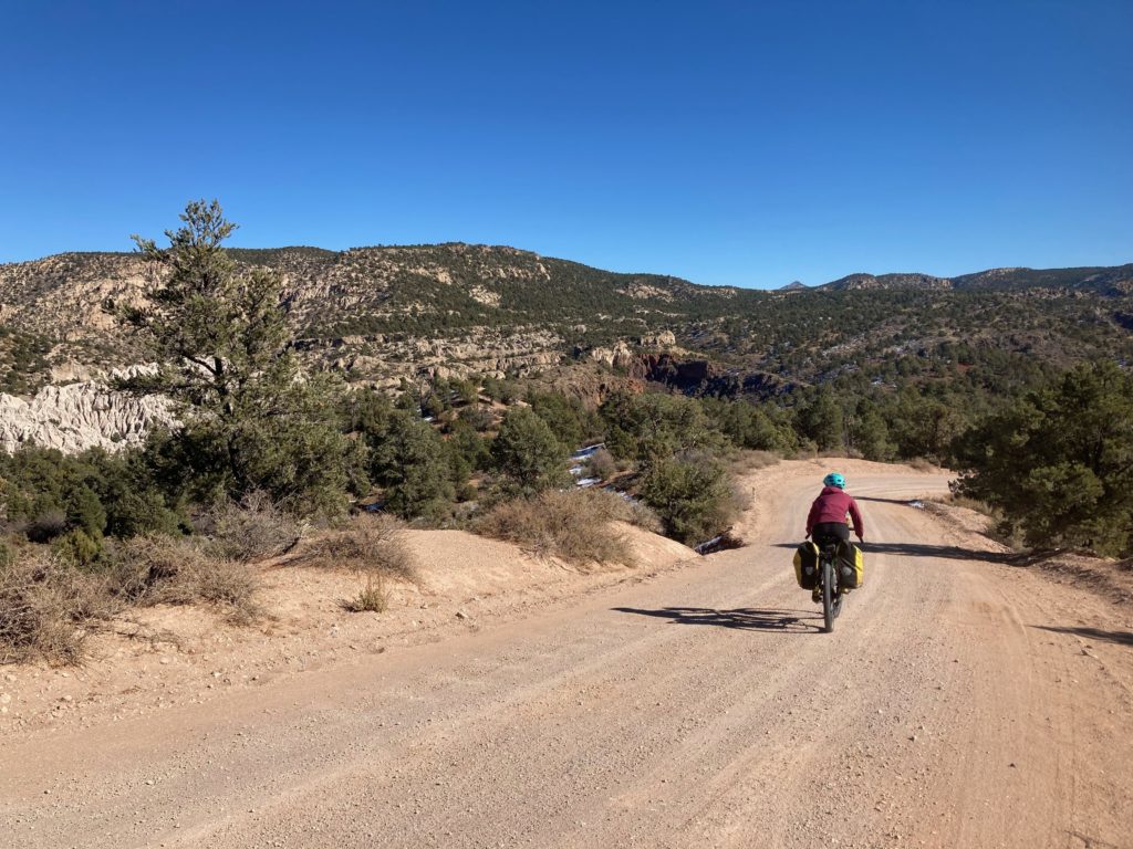
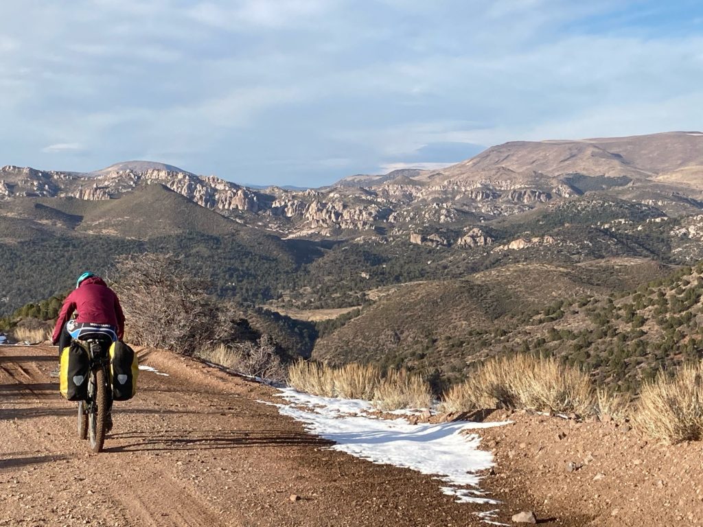
The other goal of going into town was that we figured that we’d find a wifi and would be able to download maps of where we were and where we might be heading, which indeed turned out to be the case. Our newly-formed route plan again took us up into the snow zone:
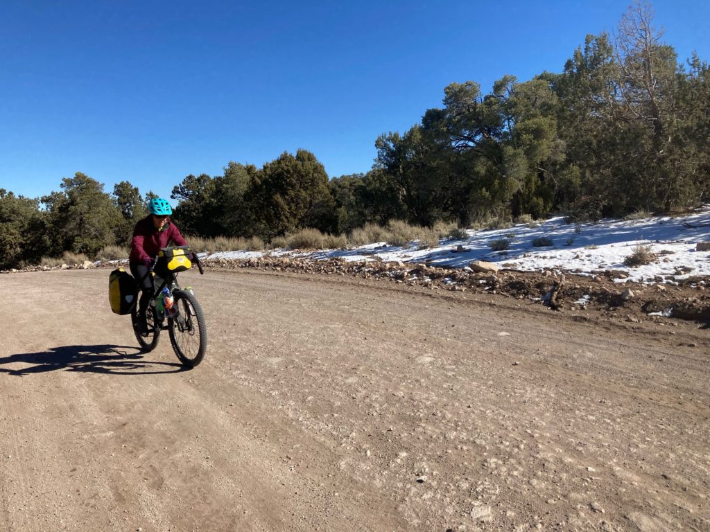
but between being more well-travelled, being flatter, and less north facing the dreaded melt-mud didn’t rear up at us, tho there were places where we were only a day or two away from that:
Despite uploading more mappage into my phone, we still managed to miss a couple of intended turns (they were pretty subtle) and found ourselves paralleling an active train track for a bit; we saw a couple of train workers who were stunned to see us: “what are you doing in the absolute middle of nowhere?!?” Not far from those guys was the railroad stop of Barclay, Nevada, which sported an intersection and a few homes, including one with a person outside of it, who was equally incredulous to see us, and he confirmed that we were tracking on our ever-evolving route. I confirmed the direction to our next potential destination of Motogua (I said “Mo-toe-qua” and he said “Moto-qua?” I said “we’re not from around here”, which was pretty self-evident!). As I rolled away I caught a glimpse of him shaking his head; he clearly thought we were idiots and weren’t going to make it, between potential mud, no water, and challenging roads.
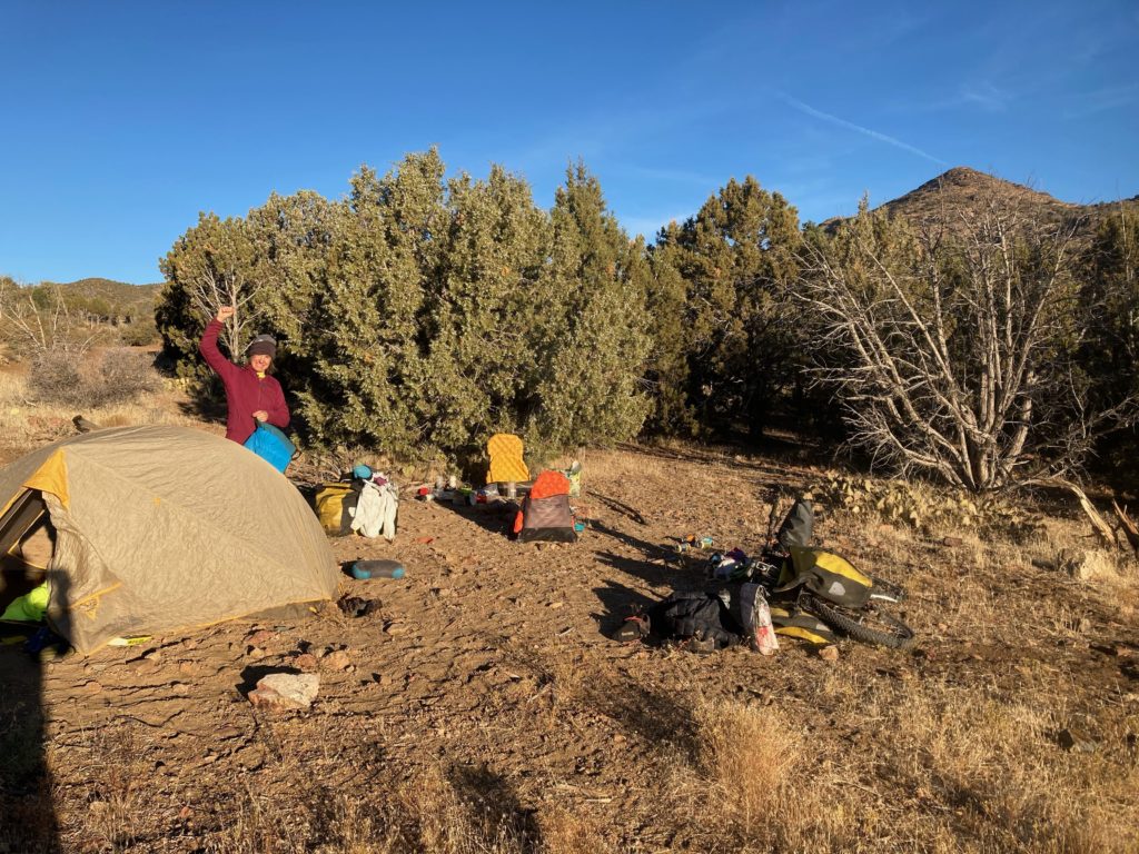
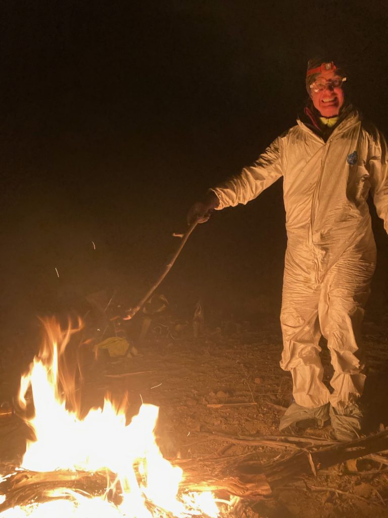
But we had enough water to camp dry, the roads were fine, there was no traffic, and we had great camping:
In the morning we rolled past Moto-qua, where we actually didn’t even see any buildings, but there was evidence of people:
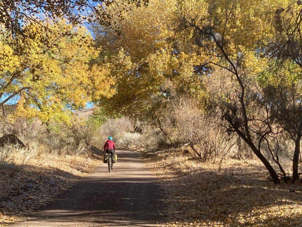
the Motoqua zone was in the Beaver Dam Wash, which sported plenty of our favorite trees: cottonwoods
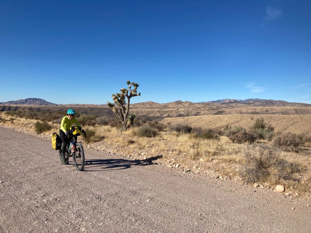
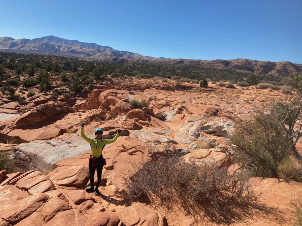
At this point we were now going eastward on what we had intended to be our original westward leg, and it was indeed low enough that we saw a few Joshua Trees:
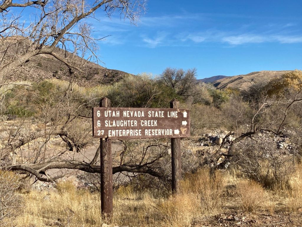
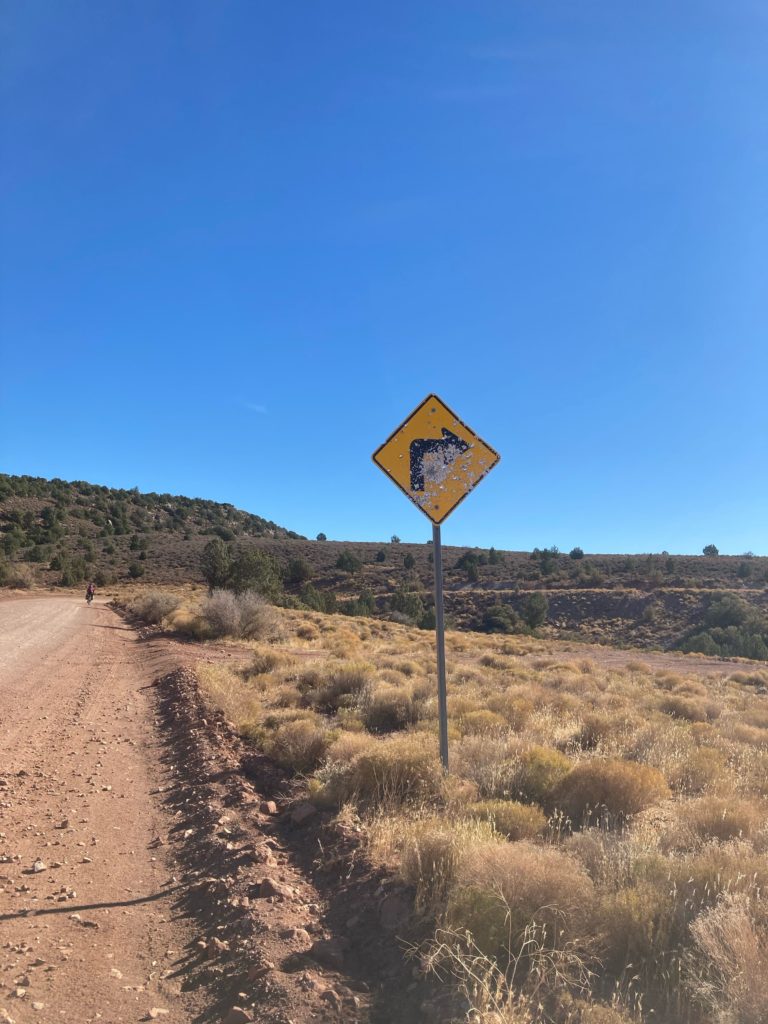
And we knew we were nearing civilization, such as it is, by the state of the road signs:
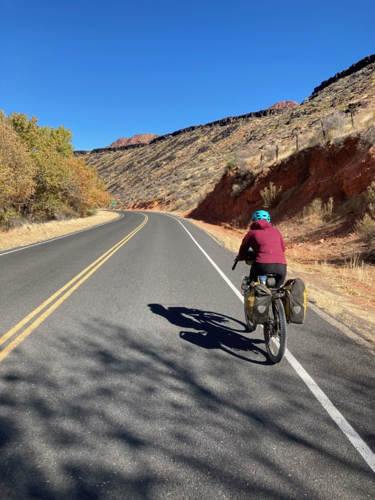
Soon enough we found ourselves back on pavement near Gunlock State Park:
Gunlock itself seemed to initially offer some potential:
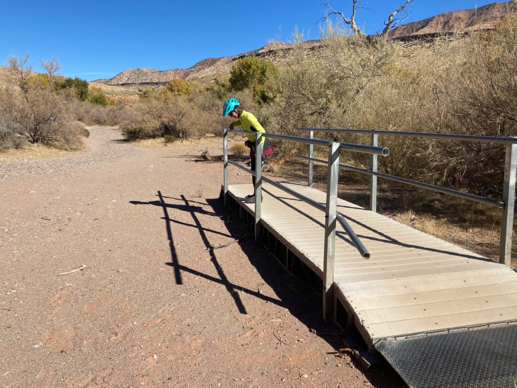
We rode past our initial turn off the pavement, and I noodled around trying to find our original destination, and even looking for it I missed it again! I realized it was a subtle double track just adjacent to a house/barn, so I didn’t feel too bad about missing it.
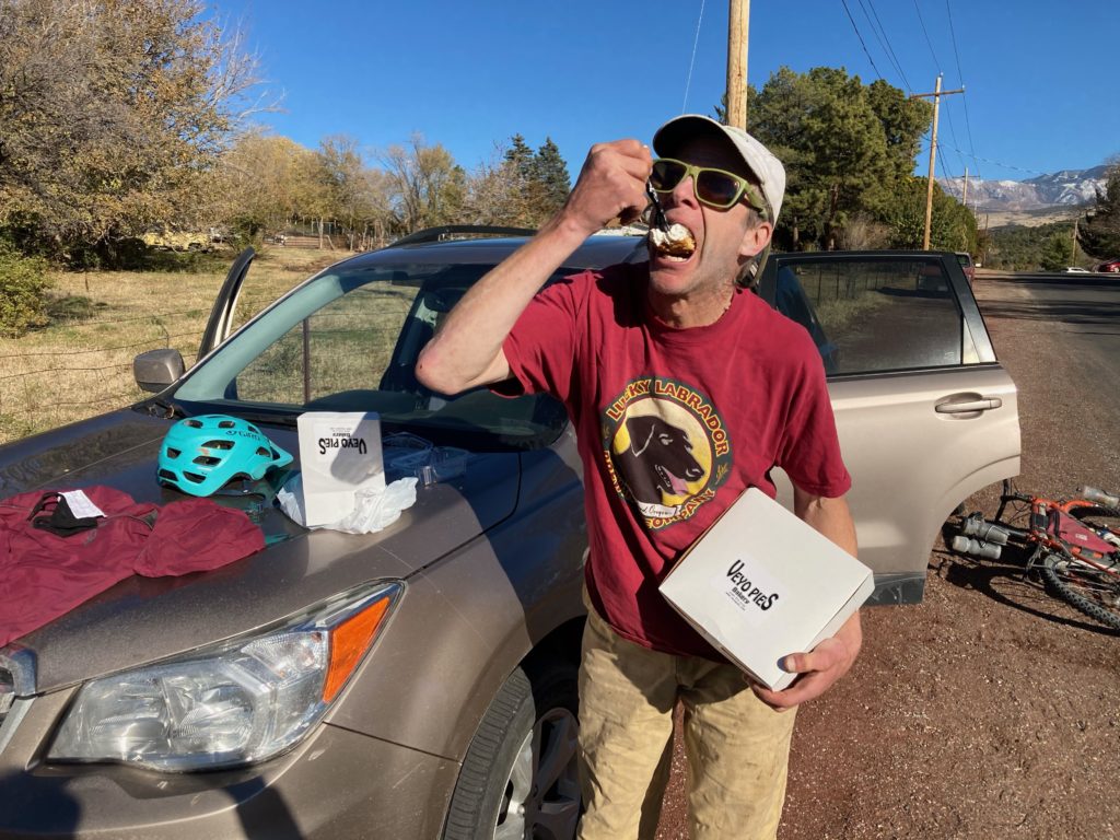
Soon enough we found ourselves back in Veyo, which is tiny, but does have an establishment that more communities should have (especially those on popular bike routes, which this one is as a road ride from St George): A pie place!
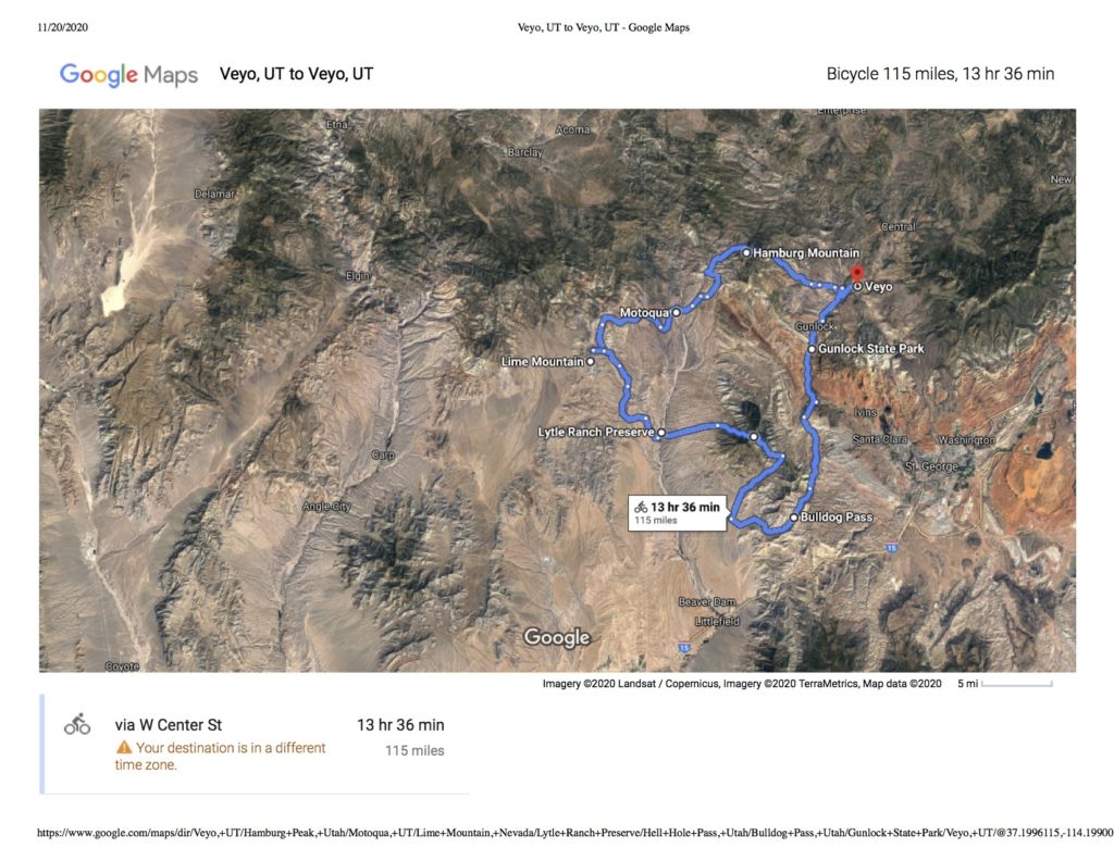
For what it’s worth, here is our intended route, which I think would be great and has some good peaks to hike up en route:
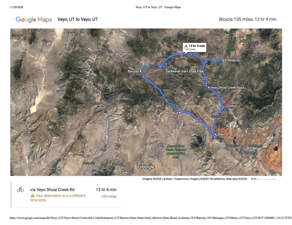
And this is our actual route:
Of course, it being a bike tour and all, we made the most of it, and now have another nice route to look forward to doing!
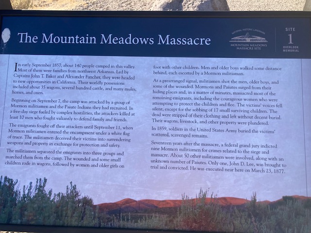
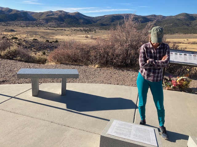
Of note, just north of Veyo is the site of the Mountain Meadows Massacre, which was the worst event of Americans killing Americans (aside from the Civil War) until the Oklahoma City bombing. A somber memorial to innocent travelers seeking a new life in California who were inexplicably besieged and then killed by Mormon settlers.
Glad modern Mormon militiamen are not prone to similar violence on unwary bikers. Very interesting and challenging ride it appears. I don’t doubt the few people you came across wondered at your sanity. If they only knew you…..
well, these daze it seems that our society could be regressing that direction!
The funny thing about the ride is that on a relative basis it’s not that far and doesn’t have a ton of vertical. A week prior Ashley did the White Rim in a day: 100mi, with something like 7k vert, and that gets done many times per year. As always, efforts and accomplishments are all relative….
happy birthday to ash! way to make the most of it!
Great birthday story!! Only the two of you would set out for one place and end up another and have a fascinating time along the way! The Mormon militiamen is a sad story; I’m sorry to say I didn’t know of it before. Doesn’t make me feel too kindly towards Mormons….